
Lost in longitude or confused by contour lines? Want to know all the tips and tricks for getting the most out of your atlas? Curious if paper towns still exist? "Ask a Cartographer" is your opportunity to get the facts straight from the source. Tom Vitacco, Rand McNally Publishing’s Director of GIS is here to answer your burning questions, and geek out over fascinating map lore – one exploration at a time.
This week, we're discussing how mapmaking has evolved with technology.
Question: How has technology changed the way maps are made?
Tom’s answer: Another fascinating question…thank you! I could spend hours discussing this topic, but I will try to keep this brief. I have been fortunate to have worked in both manual film-based and modern digital cartographic environments so I will comment on each and reflect on some of the ways technology has made it easier to make maps. Of course, my answer will relate specifically to my experience as a cartographer at Rand McNally Publishing, which might be quite different from others in the field.
Manual Cartography
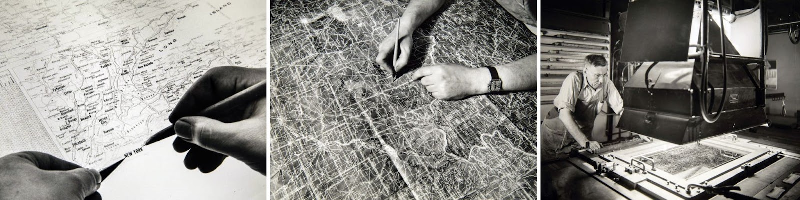
When I started as a Rand McNally cartographer back in 1986, we used film to create maps. The process involved multiple layers of film, each with a specific purpose and color related to the four colors used in printing (Cyan, Magenta, Yellow and Black). The film layers were punched with holes along one side and held together with metal pins to keep the layers aligned to one another. Some layers contained etched or “scribed” lines and open areas for solid colors or pattern fills while others displayed map labels that were attached to the film with hot wax and sharp knives. The film was labeled to ensure each piece was arranged in the proper order by color and then a large camera was used to create a set of final four-color composite film separates. The film was sent to the printer and converted into printing plates for the press. Overall, it was a lot of work to make a map in those days but the lessons I learned using film were valuable as my career progressed.
Digital Cartography
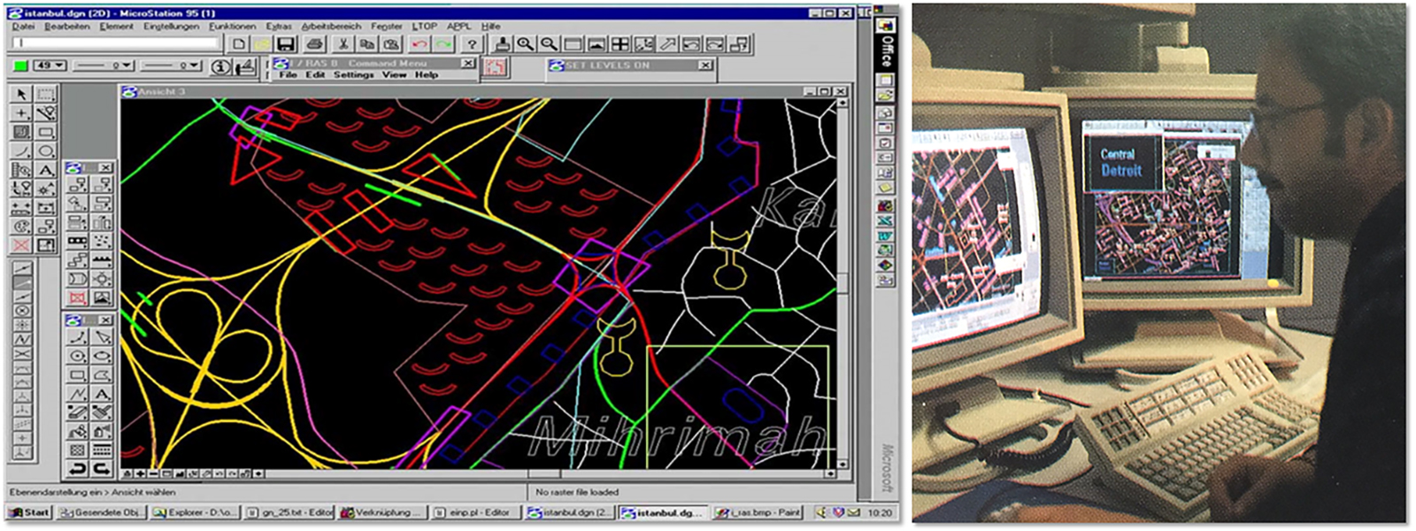
In the 90s, the transformation to digital cartography began at Rand McNally, and we have been using computers to make maps ever since. During this period, the film-based maps were scanned and converted into lines, polygons, and fonts to create the first digital map database for Rand McNally, referred to as the National Roads Database. For many years, our maps were made using a CAD software system which streamlined our cartographic processes. Using computers improved our efficiency to produce high-quality atlases and maps because it was faster to digitize or draw a line or polygon with the computer compared to using a scribe tool and mylar film.
Also, manipulating map labels was much easier on the computer and we could create the final four-color film composites directly, although the CAD environment required a separate system to output the map data and apply final map specifications. Overall, I can confidently state that productivity vastly improved when we moved to a digital cartographic environment.
Geographic Information System (GIS)
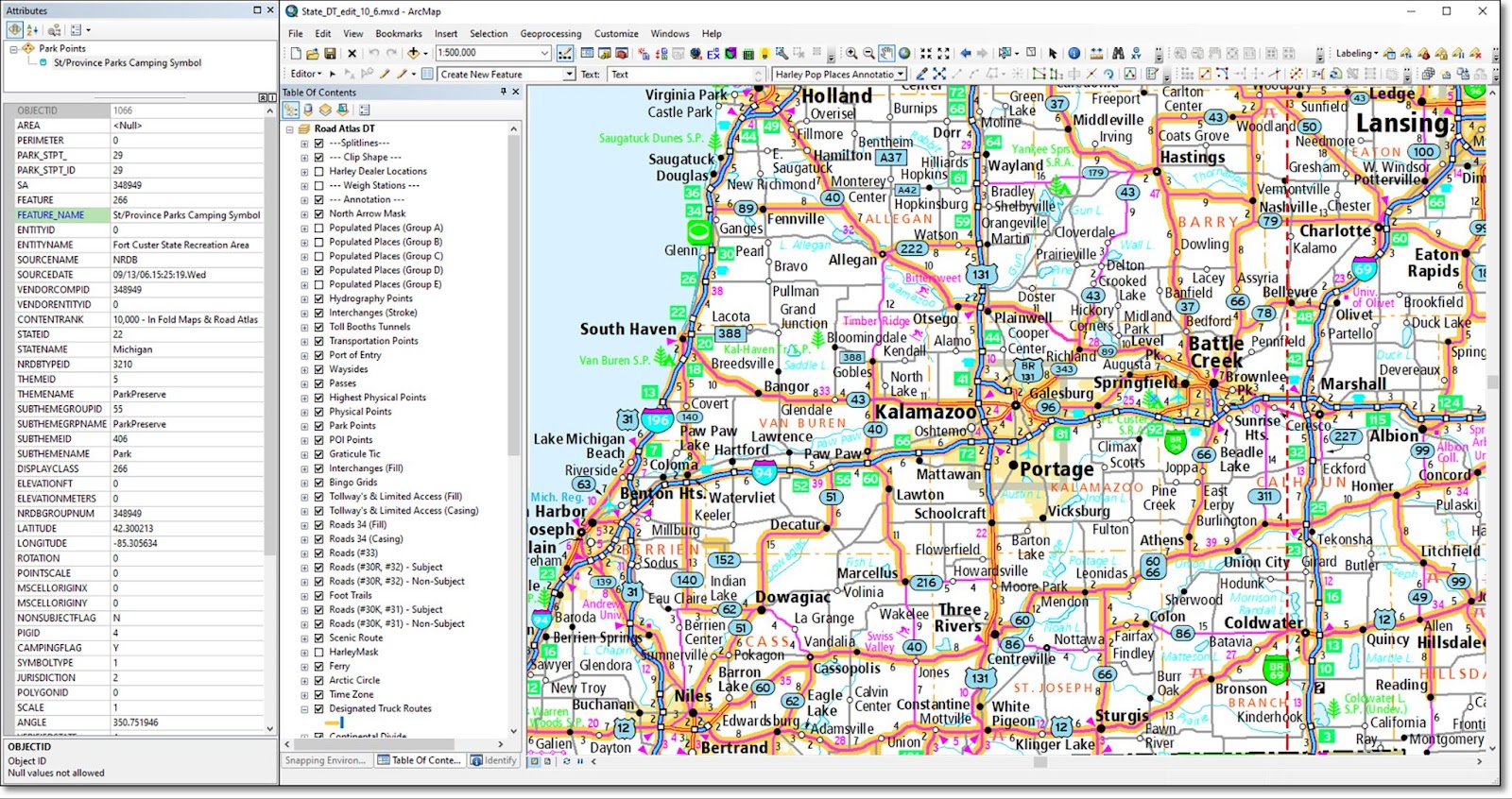
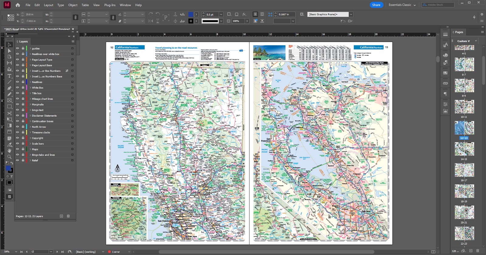
Rand McNally began using a Geographic Information System (GIS) around 2008, as we searched for a streamlined, yet powerful cartographic production environment to replace the CAD system. We experimented with different software and settled on a suite of GIS applications that we still use today. The new system is more visually appealing since the map data displays on screen very similar to how the map appears on a printed page. Plus, working with fonts and labels is much easier in a GIS environment than in the older CAD system since we utilize automated names placement algorithms and the tools for manipulating the labels are powerful and easy to use. By applying attribution to our data, we can use processing tools within the GIS to manipulate map data in ways not possible with film. Finally, we can export to print ready PDF files to send to the printer, and no longer need to produce film in-house.
Once a map is produced, it often needs to be assembled into a printed product such as an atlas or a state folded map. Putting together an atlas with film was a time-consuming and labor-intensive process, but with computers and software we can now assemble a full atlas in less time. Desktop publishing software was a game-changer for Rand McNally starting back in the 90s, and we were early users of software such as QuarkXPress and eventually Adobe InDesign to lay out and produce a variety of map and atlas products. Combined with GIS, page layout software allows us to build and export final products more efficiently than ever before.
Technology and Mapping
In the end, technology has revolutionized mapping in many ways. Working with film was a great experience, but the efficiency and flexibility offered with computers and a Geographic Information System helped automate and streamline our cartographic production workflows. If you are interested in seeing our cartographic products, please visit the Rand McNally Publishing website and check out some of the maps and atlases produced from our modern GIS environment.
Thanks again for the question! I hope I have provided some background related to how technology has changed the way we make maps as cartographers. Feel free to submit your map or cartography questions below and check back next Tuesday for another installment of "Ask a Cartographer".
Have a question for our cartographer? Email us at printproducts@randmcnally.com with “Ask a Cartographer” in the subject line and your question could be featured next.