Lost in longitude or confused by contour lines? Want to know all the tips and tricks for getting the most out of your atlas? Curious if paper towns still exist? "Ask a Cartographer" is your opportunity to get the facts straight from the source. Tom Vitacco, Rand McNally Publishing’s Director of GIS is here to answer your burning questions, and geek out over fascinating map lore – one exploration at a time.
This week, we are discussing vintage and historical maps…
Question: I would like to start collecting vintage and historical maps. Does Rand McNally sell any?
Tom’s answer: Thank you for the question about vintage or historical maps! The quick answer would be no, we do not sell vintage or historical maps. However, we do include many maps with historical content in a couple of our atlases. I am not a map collector myself, but I assume most collectors like to purchase printed or framed maps that are from the late 1800s through the 1960s or somewhere in between such as the Railroad Map shown below from 1883 for example.
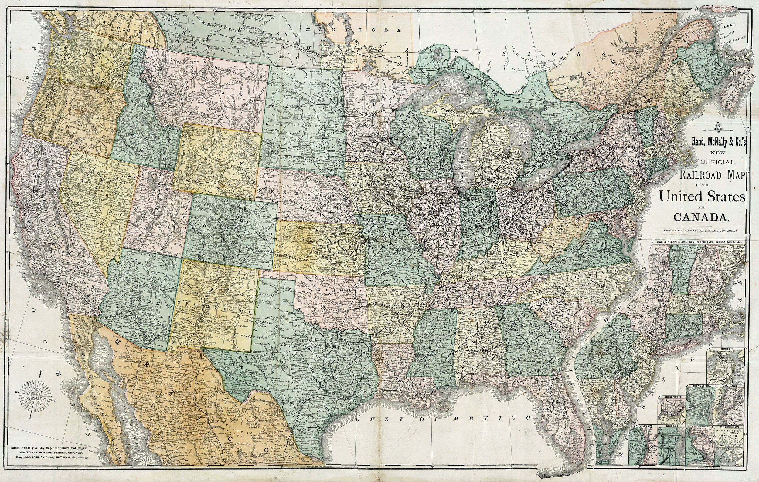
Pictured: Rand, McNally & Co., Map Publishers and Engravers, Railroad map from 1883.
Rand McNally has been producing maps for a long time, the first map was issued in 1872, and the early cartographers and engravers created some really cool vintage maps more than a century ago. While we do not sell those maps, I can point you to some places where you can view and even buy some of these collector items in this post. Most of the maps we produce these days that are historical in nature can be found in two products, the Atlas of American History or the Historical Atlas of the World. I will briefly introduce both titles below in case they are of interest.
Atlas of American History
The Atlas of American History is an atlas which covers different periods of United States history. The atlas is geared towards younger students, though, and includes more than 80 colorful maps showing key events such as the Westward Expansion in the early 1800s or North America from the late 1700s. The atlas also features chronological timelines, photos, charts, and tables of facts related to different states. While the atlas is an excellent resource for a student interested in the history of our country, the maps are not what I would consider collectible even though they are historical in nature.
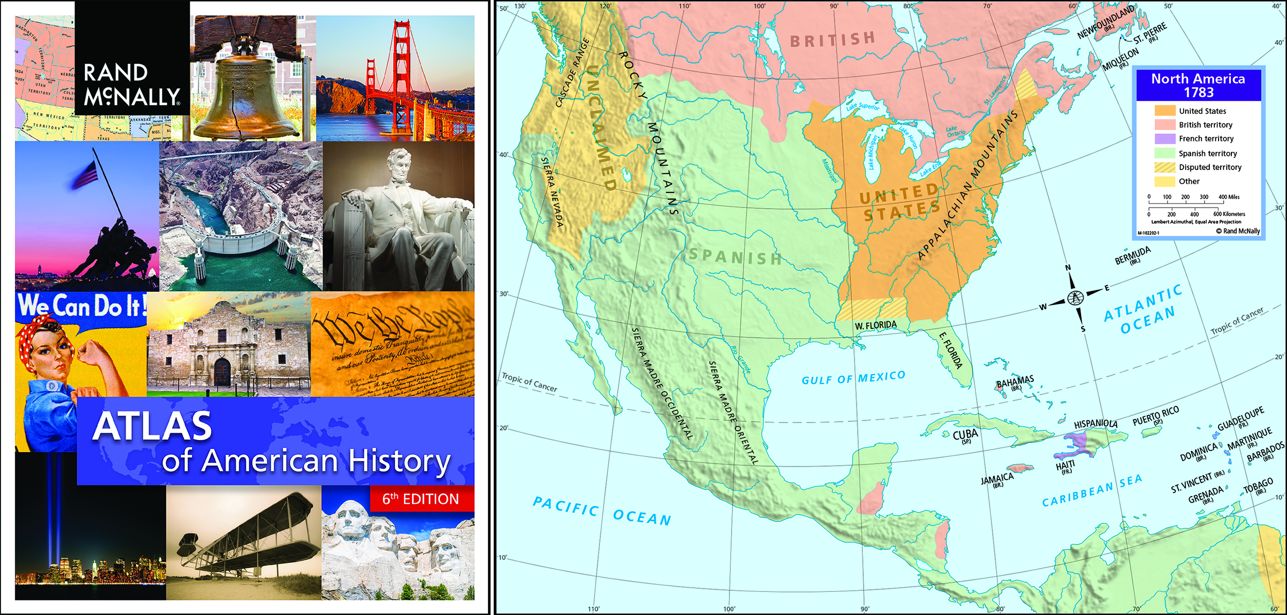
Pictured: The Atlas of American History and the North America in 1783 map.
Historical Atlas of the World
The Historical Atlas of the World covers many important periods in world history with more than 100 pages of historical and thematic maps. The atlas is also geared towards students, so please keep that in mind if you are interested in getting this atlas. The atlas presents important events from world history and the impact these events had on the places and regions where they occurred by using illustrative maps with themes such as culture, civilizations, literacy, language, and religion. As with the Atlas of American History, this atlas might not be considered collectible, but is another great reference atlas and an interesting gift for young students or teachers.
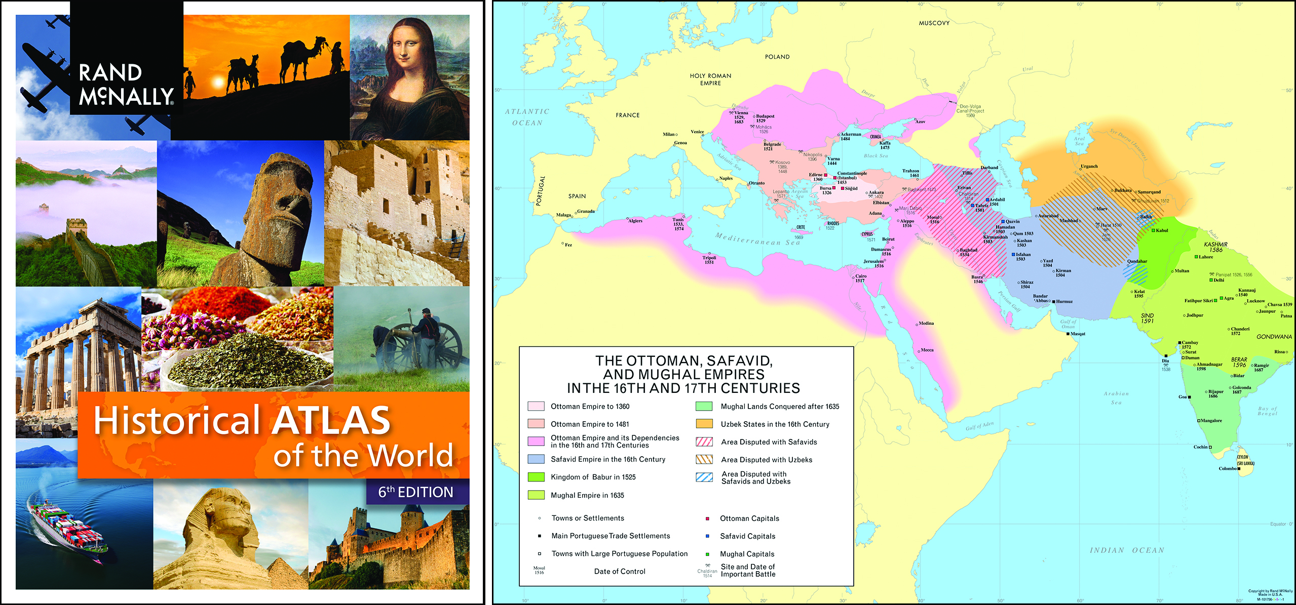
Pictured: The Historical Atlas of the World and one of the many maps included in the atlas.
Vintage Rand McNally Maps
Although we do not sell vintage maps today, there are different options if you would like to browse some of the wonderful old maps produced by Rand McNally or even purchase printed reproduction copies. The first resource is the Library of Congress website, which contains a decent collection of vintage Rand McNally maps and product images. One example would be this old map of our nation’s capital created in 1893 shown below. A couple of interesting cartographic items I will point out include the use of building shapes, which is something we still include on our “downtown” maps today, plus the inclusion of the large directional letters like NW or SE, which is not something we show on our modern maps except for within a compass rose graphic.
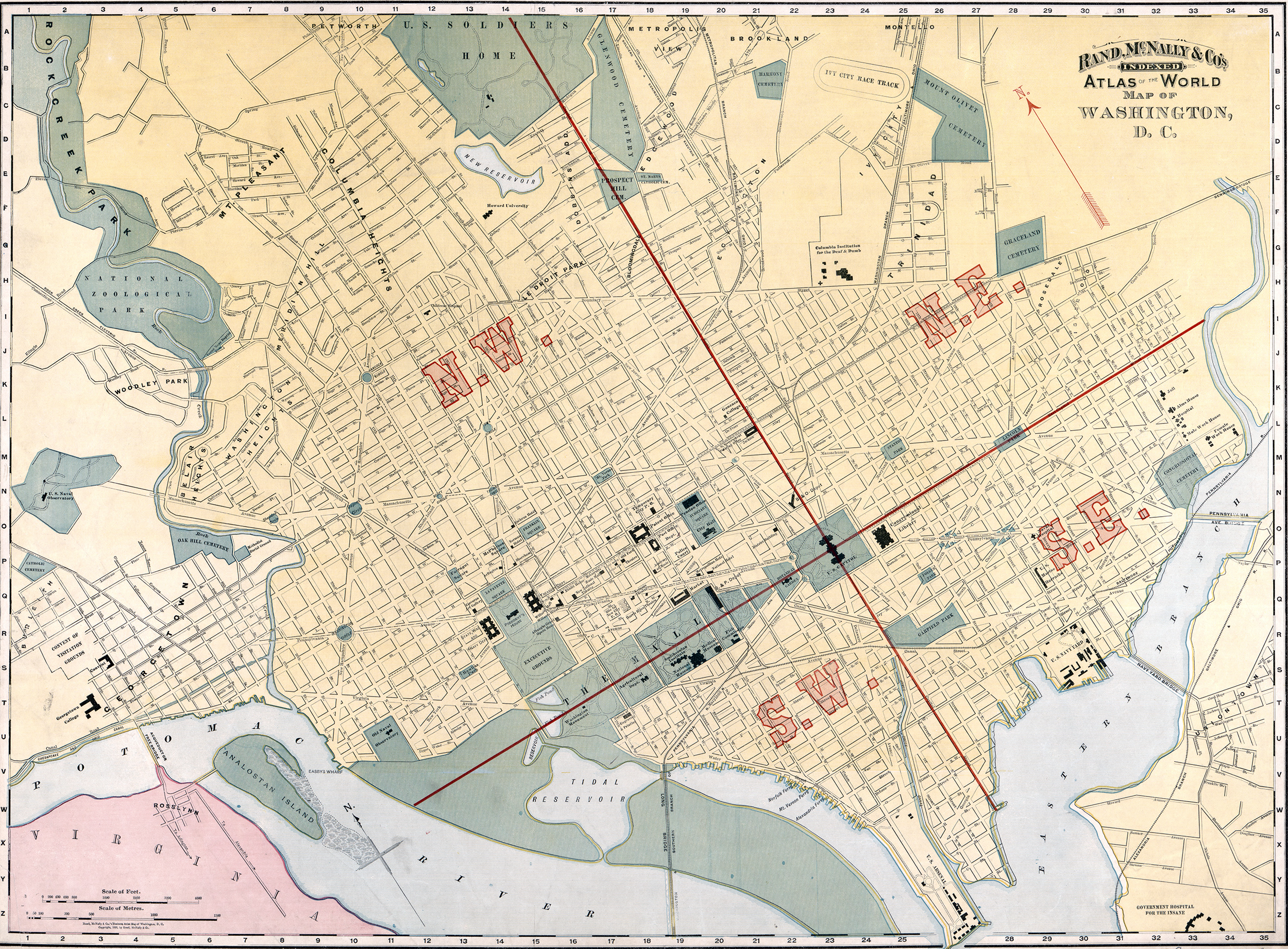
Pictured: A map of the Washington, D.C. area from 1893 from the Library of Congress, Geography and Map Division.
Many libraries have vintage or historical maps in their collections as well and you can often view these if you make the proper arrangements. The Newberry Library in Chicago is a good example, and their map collection is large and varied. In fact, Rand McNally has donated a considerable number of old maps and products to the library over the years, so the company has a good relationship with the library. Often libraries will require membership for access to detailed products or information so if you decide to use a library as a resource for viewing vintage map collections, please check with them for more information regarding access.
Finally, there are websites dedicated to older map collections such as the
David Rumsey Map Collection. I believe you can purchase prints at different sizes of some of the old map titles, although they will most likely be reproductions and not the original map. However, I am sure you can purchase originals from collectors or an auction site for higher price points if you desire. If you want to start collecting, this site might be an excellent resource to browse.
Our team has a Google alert set for "Rand McNally maps" and we recently discovered an auction of a Rand McNally map from the estate of musician Gordon Lightfoot. All his tour stops were marked on the map with push pins. So setting a Google alert for the type of maps you're interested in collecting may be a good start too.
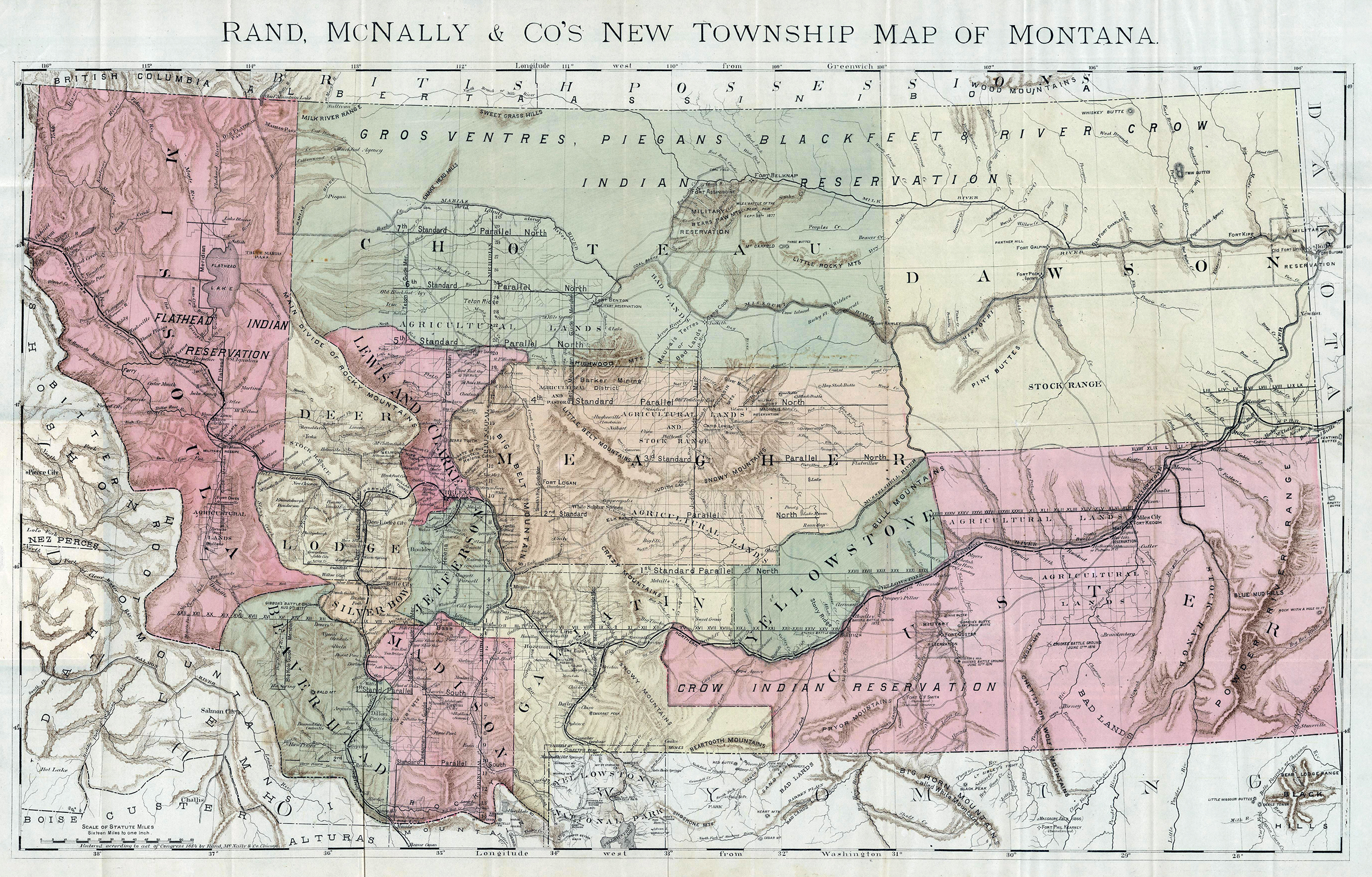
Pictured: A Rand McNally map of Montana from 1884.
Cartography on Vintage Maps
I am amazed at the level of detail on some of these older maps and the skill sets needed to create maps like the ones I have included are astounding to me. Here is an old 1877 Rand McNally map from the Library of Congress which displays the route to Texas that was used by “colonists and emigrants” as the title implies.
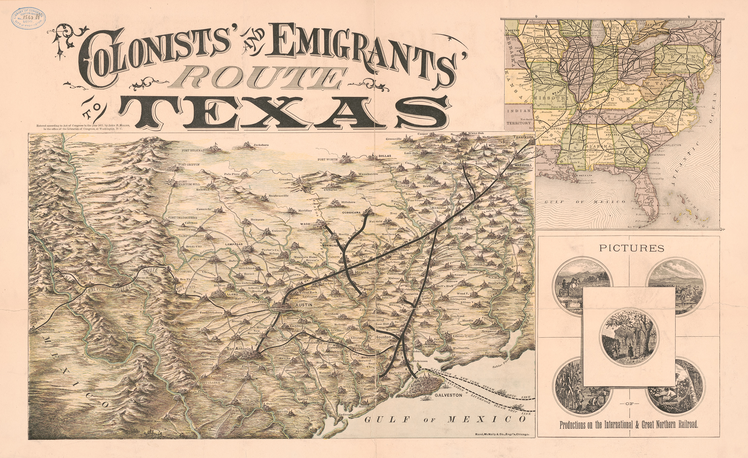
I have never seen this map before and thought it was a good map to point out the details and the skill level required to make a map back in the 1800s. In the “zoomed in” image below that I cropped from the main map, you can see the topology shown through hatching methods to depict slight elevation changes as well as small “sketches” of cities and towns connected by a handful of roads and rivers. To me, the detail is incredible and knowing it was all done by hand is even more remarkable.
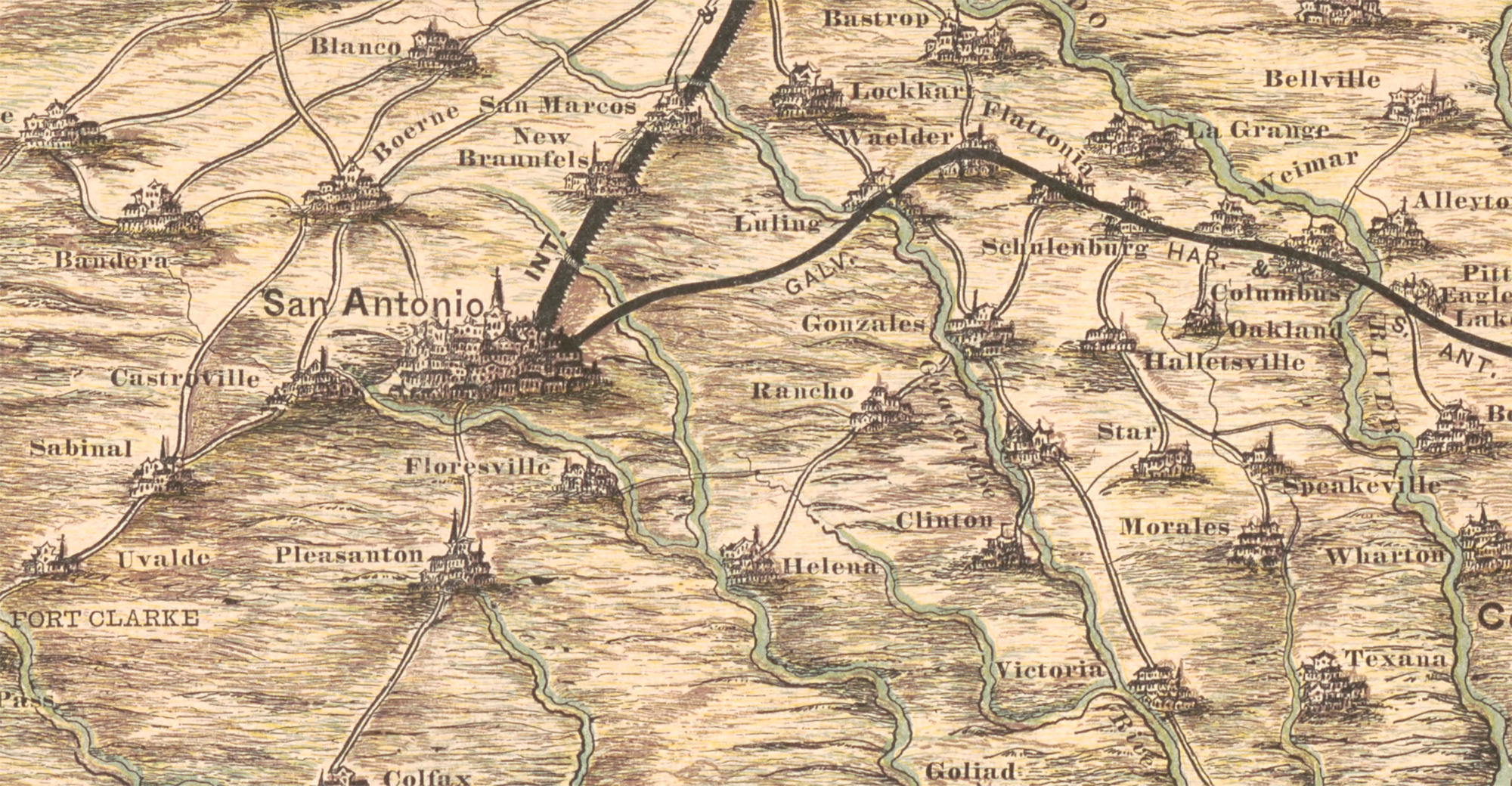
I also did not realize we used to include Rand, McNally & Co., Engr’s, Chicago on the maps back then since I never made the connection that the company most likely employed both cartographers and engravers during that time. Or maybe the team back then was really made up of skilled engravers and the cartographers came on board later. I am not sure, but I thought it was worth mentioning because these were true artists with outstanding skill sets.
Thanks again for the question and I hope I have offered some decent suggestions about vintage and historical maps for you to consider. If you do start collecting, I am sure you will soon discover how intricate and detailed older maps were and come to appreciate the skills required to produce what really is a piece of art!
Feel free to submit your map or cartography questions below and check back next Tuesday for another installment of "Ask a Cartographer".
Have a question for our cartographer? Email us at printproducts@randmcnally.com with “Ask a Cartographer” in the subject line and your question could be featured next.


