
Lost in longitude or confused by contour lines? Want to know all the tips and tricks for getting the most out of your atlas? Curious if paper towns still exist? "Ask a Cartographer" is your opportunity to get the facts straight from the source. Tom Vitacco, Rand McNally Publishing’s Director of GIS is here to answer your burning questions, and geek out over fascinating map lore – one exploration at a time.
This week, we are discussing whether a north arrow is actually required on a map…
Question: Is a north arrow or compass rose really needed on a map?
Tom’s answer: Ah, the infamous north arrow question that I figured would eventually be asked. The question of whether a north arrow or compass rose is needed on a map has been discussed in the “carto community” for a long time. Honestly, the correct answer is subject to debate and there is no right or wrong answer to this question in my opinion. With that in mind, I will offer a few thoughts on the topic then provide a retrospective on the large variety of north arrow and compass rose graphics used during Rand McNally’s long cartographic history.
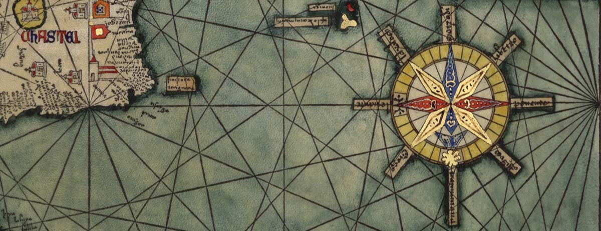
Pictured: An early compass rose graphic from Atlas Catalan de 1375 courtesy of the Library of Congress.
When I was in college training to become a future cartographer, my professors insisted we include a north arrow on our map projects, along with the usual elements like a title, legend, and scale bar. In fact, our grade would be lowered if we did not include these elements on every map! After working in the field for a few years, however, I quickly learned that while a north arrow can be an important part of the map, good cartographers know when not to use it as well.
To quickly answer the question, my personal feeling is that a north arrow or compass rose is not required on a map, unless it is necessary for orientation or clarity. I mentioned north arrows in a recent blog post about reading a map, which included a crop of the South Carolina map from the Road Atlas. I used red arrows to highlight the different north arrows on this map because they help with orientation for the city inset maps versus the state map which is oriented with north up (see image below).
So, in the case above, north arrows are extremely helpful. Many compass rose graphics are decorative and ornate, almost like mini pieces of art in a sense, and if they enhance the look or style of your map then I am all for including them. In general, as cartographers at Rand McNally Publishing, we tend to include north arrows because they usually help clarify the orientation of our maps which are often rotated to fit the paper.
North Arrow versus Compass Rose
Usually, a north arrow will include a line or graphic element with an “N” labeled to indicate north (left on image below), while a compass rose might look more like a star and frequently shows other cardinal directions such as north, south, east, and west (right on image below). Compass rose graphics are typically more ornate in appearance while north arrows can be overly simplistic in nature.
![]()
I looked at many Rand McNally maps from the past to see what types of north arrows or compass rose graphics were used by the early cartographic teams and I was surprised at what I found. I will try to highlight the huge variety of styles used below.
The first thing I noticed was the lack of a north arrow on the early maps, which surprised me to be honest, but I also found quite a variety of styles and shapes that are interesting.
Here are some examples of early north arrow and compass rose graphics from the following maps (left to right within the image below):
- Atchison Topeka and Santa Fe Railroad (1881)
- Burlington and Missouri River Railroad Route (1882)
- Pacific Railroads (1883)
- Brevard County, Florida (1889)
- Manila Harbor, Philippines (1898)
- Air Trails Map (1929)
![]() For the most part, I find these early graphics very intricate for the time and I continue to be amazed at the artistic skill level of the early Rand McNally cartographic teams.
For the most part, I find these early graphics very intricate for the time and I continue to be amazed at the artistic skill level of the early Rand McNally cartographic teams.
Corporate Partners
Rand McNally has fostered good working relationships with larger corporations, states, and municipalities for a long time and has produced custom maps for companies such as State Farm, Walmart, Camping World, Mobil, Reader’s Digest to name a few. This legacy has continued for over a century, and I wanted to share some of the interesting north arrow and compass rose graphics from some of the custom maps Rand McNally made for companies and even some states, larger cities, and National Parks.
Here are examples with dates from the following maps (left to right within the image below):
- Brooklyn, NY (1917)
- Baja California (1922)
- New York City (1929)
- Pure Oil Company (1934)
- Trans World Airlines (1939)
- City of St. Louis (1940)
- Sun Oil Company (1941)
- Pictorial Map of the United States (1944)
- Union Oil Company (1949)
- Sinclair Oil Company (1953)
- State of Illinois (1953)
- Grand Canyon National Park (1975)
![]() Rand McNally worked with a lot of oil companies back in the day and usually worked their name or logo onto the graphic. The first two images are more traditional north arrows from early maps, and the cartographers seemed to create more complex and compelling graphics as the years went on.
Rand McNally worked with a lot of oil companies back in the day and usually worked their name or logo onto the graphic. The first two images are more traditional north arrows from early maps, and the cartographers seemed to create more complex and compelling graphics as the years went on.
Road Atlas
The iconic Road Atlas has been the essential, trusted tool for road travelers for more than 100 years and it has always included north arrow graphics on the maps.
Here are examples with dates from the following products (left to right within the image below):
- Road Atlas (1927)
- Junior Road Map of the United States (1934)
- State Farm Road Atlas (1939)
- Florida Road Map (1948)
- Road Atlas (1972)
- Road Atlas (2010)
- Road Atlas (2024)
- Kids Road Atlas (2025)
![]() One of the immediate things I noticed when putting this image together is how the north arrow has been simplified over the years, from the early complex graphics, followed by the inclusion of a globe which is still indirectly used today. The north arrow from the 1972 atlas is particularly intriguing and a radical departure from our usual graphic style. I believe this graphic was used for quite a few years.
One of the immediate things I noticed when putting this image together is how the north arrow has been simplified over the years, from the early complex graphics, followed by the inclusion of a globe which is still indirectly used today. The north arrow from the 1972 atlas is particularly intriguing and a radical departure from our usual graphic style. I believe this graphic was used for quite a few years.
Modern Deco
In recent years, Rand McNally has included some decorative graphics on our maps often created by the design team. These compass rose graphics incorporated the colors and style from the main map into the ornate design shown in the examples below (left to right):
- Signature World Wall Map
- Classic World Wall Map
- Kids Illustrated Wall Map
- Kids United States Fold Map
![]() George Washington
George Washington
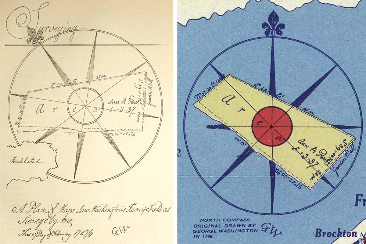
Finally, here is an interesting story I stumbled upon when researching this topic. George Washington, the first president of the United States, was involved with surveying and cartography from an early age and benefitted from his knowledge of maps throughout his life. In the 1740s, he created different maps and on one survey map of a turnip patch, he included a unique compass rose type of graphic (left side of image below). In 1934, Rand McNally recreated the original George Washington graphic on a map (right side of image below) and included a note stating, “North Compass originally drawn by George Washington in 1748.” I found this colorful tribute graphic to be unique and fascinating and thought it was a fitting way to end this post about north arrows and compass rose graphics!
Thanks again for the question! Hopefully, you found the variety of north arrow and compass rose graphics presented here to be as fascinating as I did while researching this topic. Rand McNally cartographers truly had a creative side as demonstrated through the artistic and functional graphics they produced to complement their excellent map skills.
Feel free to submit your map or cartography questions below and check back soon for another installment of "Ask a Cartographer".
Have a question for our cartographer? Email us at printproducts@randmcnally.com with “Ask a Cartographer” in the subject line and your question could be featured next!