
Lost in longitude or confused by contour lines? Want to know all the tips and tricks for getting the most out of your atlas? Curious if paper towns still exist? "Ask a Cartographer" is your opportunity to get the facts straight from the source. Tom Vitacco, Rand McNally Publishing’s Director of GIS is here to answer your burning questions, and geek out over fascinating map lore – one exploration at a time.
This time, we are discussing common cartographic misconceptions…
Question: What are some of the most common misconceptions about cartography?
Tom’s answer: Good question! There are many possible paths to follow with this question. Are we thinking of misconceptions related to the art and science of mapmaking, or about the perceptions of cartographers in society, or even how maps can distort reality? Since I am not entirely sure, I will try to touch on all three concepts.
I have been a cartographer for almost four decades now and cartography has changed a lot over the years, although I honestly believe it is mostly the tools, equipment and technologies that have changed more than the principles and the discipline itself. The answer to the question could be very subjective as well, so I will share my thoughts and opinions on these topics based on my personal experiences, but others might have different opinions on the misconceptions about cartography.
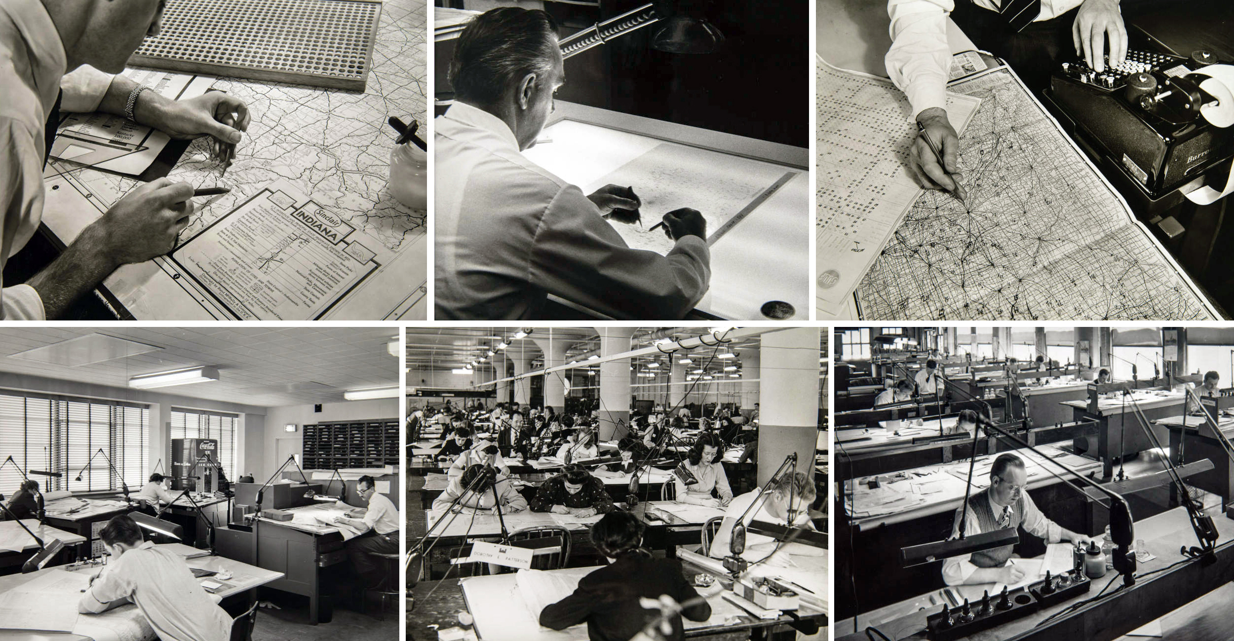
Pictured: Cartographers working at Rand McNally in the late 1930s.
Misconceptions about mapmaking
1. The computer does all the work
One of the biggest misconceptions in my experience as a professional cartographer working for a large commercial publisher is the idea that the “computer does all the work.” Sure, the computer handles a lot of the processing and data manipulation that would take a long time using traditional workflows, and I know first-hand the differences between manual and digital cartography having used both during my career. However, when it comes to cartography and creating a map, I feel technology only gets you so far and the decisions, attention to detail, and creative input applied by the cartographer is what translates into an aesthetically pleasing and effective final product.
The company might decide to create a new state map showing the Great Lakes region of the United States for example. We would use our GIS and proprietary map database, which includes a large selection of lines, polygons and point features, to develop a base map for the desired area. The cartographer would decide, based on the map scale and layout, which features to include by using attribution stored within the features of the database. So, the computer stores the data, but our cartographic staff is still making decisions on how to apply attribution to the map content to achieve the goal of producing a new regional state map in this example.
Once the base map is ready, map labels need to be added, and the cartographer chooses the fonts, sizes and styles for the specific map we are building. The computer will run automated label placement algorithms, but again the automated placement is just a start. The cartographer visually rearranges many of the automatically placed labels to produce a final map with clear labels that are legible while using appropriate styles, like the section of Michigan shown below. The labels were placed automatically, then manually cleaned up by the cartographer to produce a more visually appealing final product. Computers in general have revolutionized the mapping industry, but the decisions made by the cartographer, not the computer, are the key to creating a high-quality map in my humble opinion.
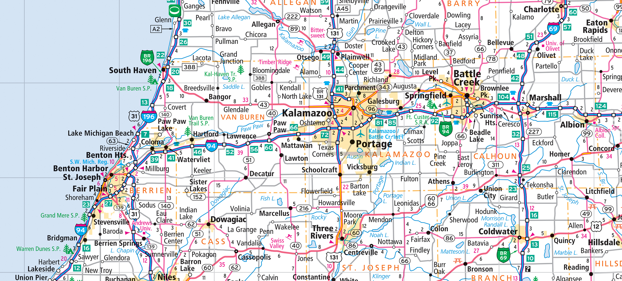
Pictured: A section of the Michigan state map showing final label placement.
2. Cartographers are obsolete
Another common misconception I have come across is the concept that the “world has already been mapped” so why do we need cartographers in the future? Fair enough question, but I do not agree with the sentiment, and we should always remember the world is ever-changing. Sure, huge companies such as Google and Apple and even the U.S. government, offer maps built from complex map databases that many people use daily, but they also employ cartographers to build and maintain the databases.
The same holds true, albeit at a smaller scale, for the GIS team at Rand McNally Publishing. We built a map database for state, provincial and city maps, but new roads are constantly under construction, while parks and points of interest open, close and even change names often. Our GIS team continually maintains and updates the map database because of the numerous changes that occur annually.
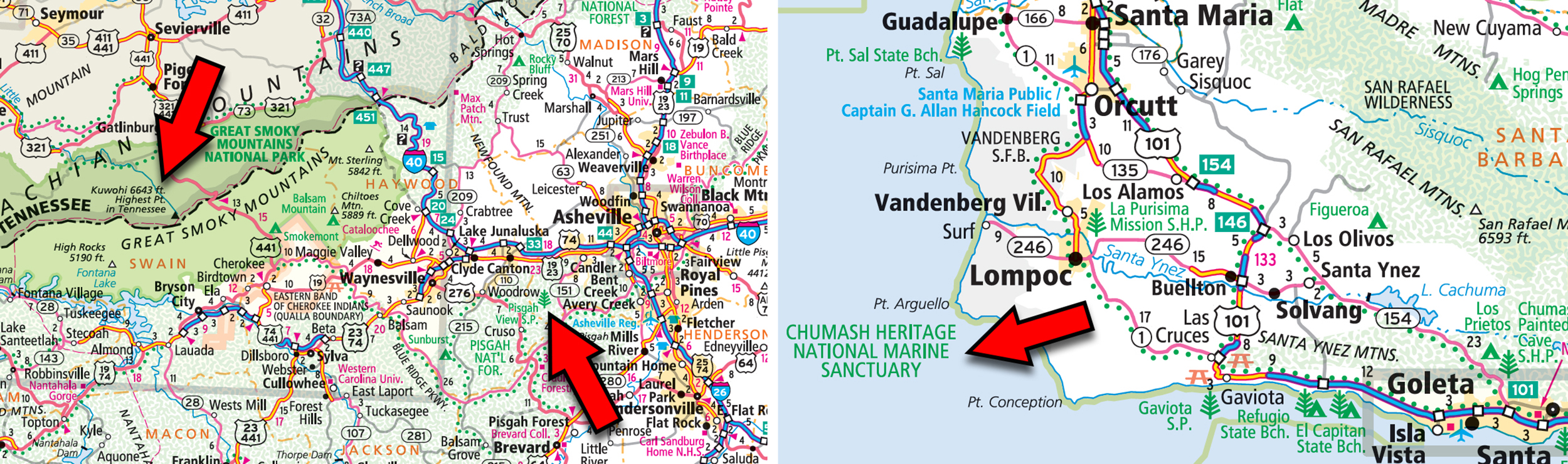
Some examples of recent additions or changes to our map database are shown in the image below, including Pisgah View State Park and the mountain name change from Clingman’s Dome to Kuwohi in North Carolina, as well as the Chumash Heritage National Marine Sanctuary off the coast of California. These updates will be reflected in the new editions of the Road Atlas and the appropriate state maps.
Plus, think about how maps are so prevalent in society today. You might see a map in a meeting or at a conference while viewing a presentation, or watching the news, or tracking a flight, and even the obvious example while navigating across town. Maps help people gain a better understanding of the world around them and even though the tools are now accessible for anyone to create maps, many novice cartographers quickly understand there is more to making an effective map than most realize. Cartography and cartographic principles are more important than ever with all the data and information available today.
Map misconceptions that distort reality
Finally, you will often read about cartographic misconceptions related to how maps and map projections can distort reality, so I want to cover a few common ones here. To start, many believe North and South America are situated above one another but in reality South America is farther east than many maps will show, especially the eastern section of Brazil. Plus, Africa is commonly thought to be part of the Southern Hemisphere, but most of it is north of the equator.
The Mercator projection is often a leading culprit in terms of misleading geographic information. The size of Greenland is one of the more common examples of distortion versus reality, since the Mercator projection makes it seem like Greenland is almost as large as Africa, yet it is much smaller in square miles.
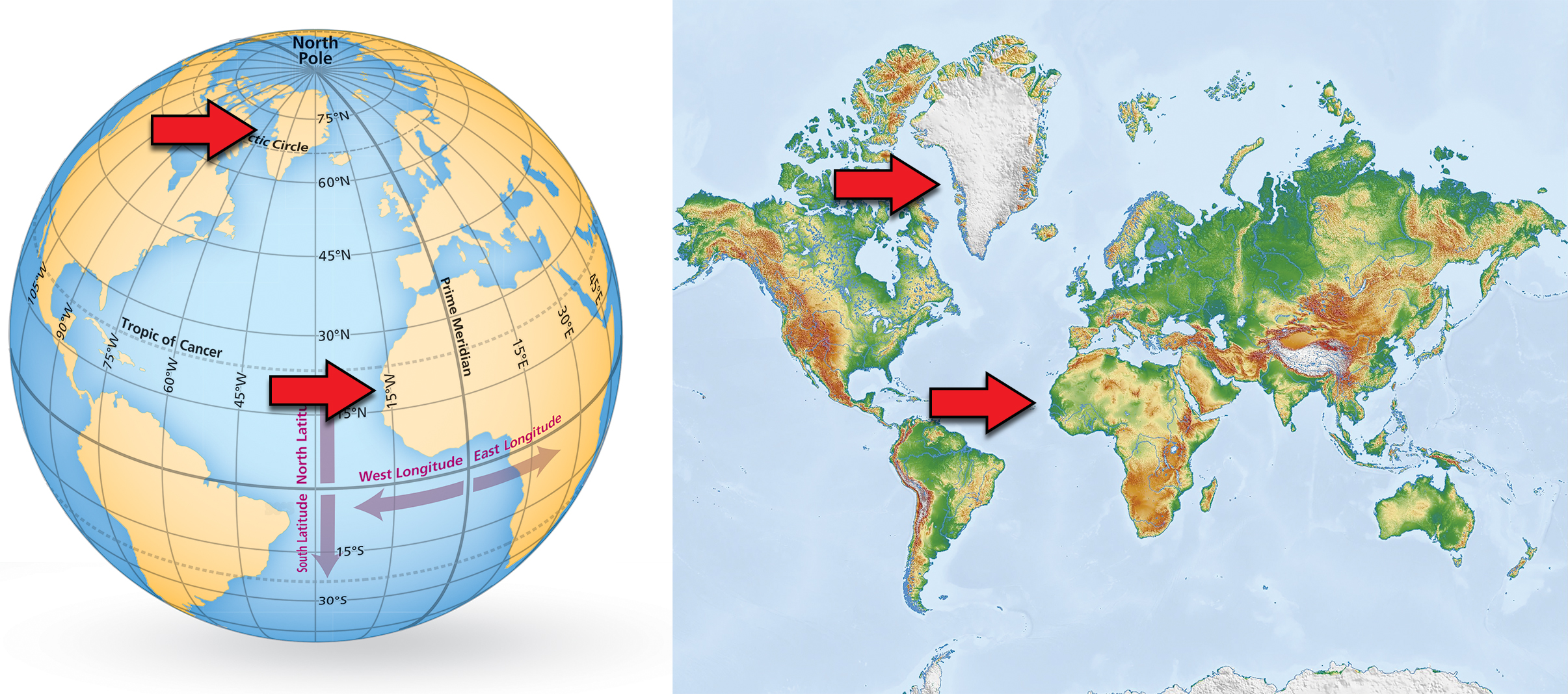
Pictured: A more accurate representation for the size of Greenland compared to Africa on the left versus the distorted perception caused by the Mercator map projection.
Even Europe, which some consider due east of the United States, is farther north than many believe and cities like Venice, Italy, are as far north as Minneapolis, Minnesota. There are hundreds of other map-related misconceptions out there so if you are interested you can easily find more with some simple searches online.
Thanks again for the question! Misconceptions about cartography is an interesting topic and I hope I successfully answered your question and provided a few examples related to the concepts I highlighted at the beginning of the blog.
Feel free to submit your map or cartography questions below and check back soon for another installment of "Ask a Cartographer".
Have a question for our cartographer? Email us at printproducts@randmcnally.com with “Ask a Cartographer” in the subject line and your question could be featured next!