
Lost in longitude or confused by contour lines? Want to know all the tips and tricks for getting the most out of your atlas? Curious if paper towns still exist? "Ask a Cartographer" is your opportunity to get the facts straight from the source. Tom Vitacco, Rand McNally Publishing’s Director of GIS, is here to answer your burning questions, and geek out over fascinating map lore – one exploration at a time.
This week, we are discussing some of Tom's favorite projects during his time at Rand McNally.
Question: What are some of the most fun projects you have worked on?
Tom’s answer: Wow, what a great but hard to answer question as I have worked on a lot of fun projects over my career as a Rand McNally cartographer. I think the best way to answer would be to briefly talk about one or two fun projects from each decade of my career.
The Early Days
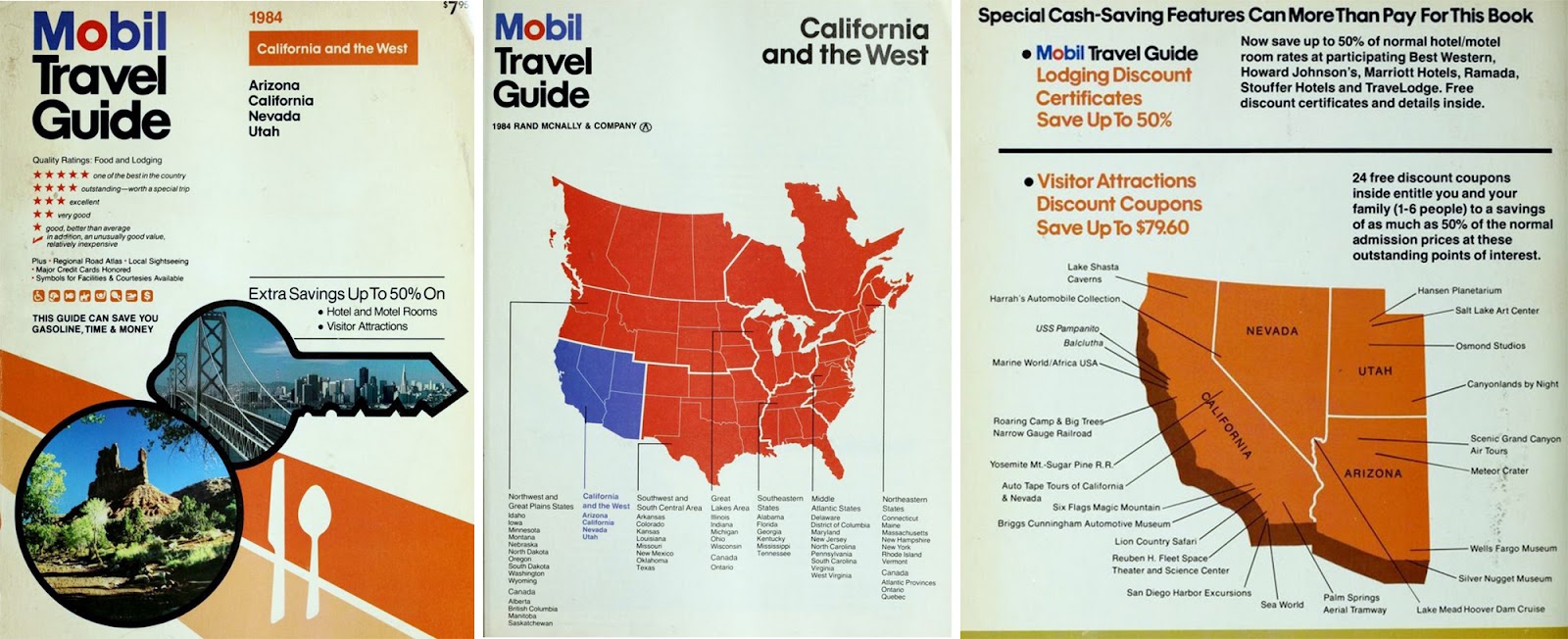
I began my career at Rand McNally in 1986 and the first real project I worked on was the old Mobil Travel Guides (now called the Forbes Travel Guides). I recall this was a fun project because it was the first time I was able to use my college training to “scribe or etch” the film used to create the maps. The cartographic team produced simple outline maps for the different guides (see image below) which were broken into geographic regions of the country. I will always have fond memories of working on the Mobil Travel Guides because it was the first time I truly felt like a professional cartographer.
The 1990s
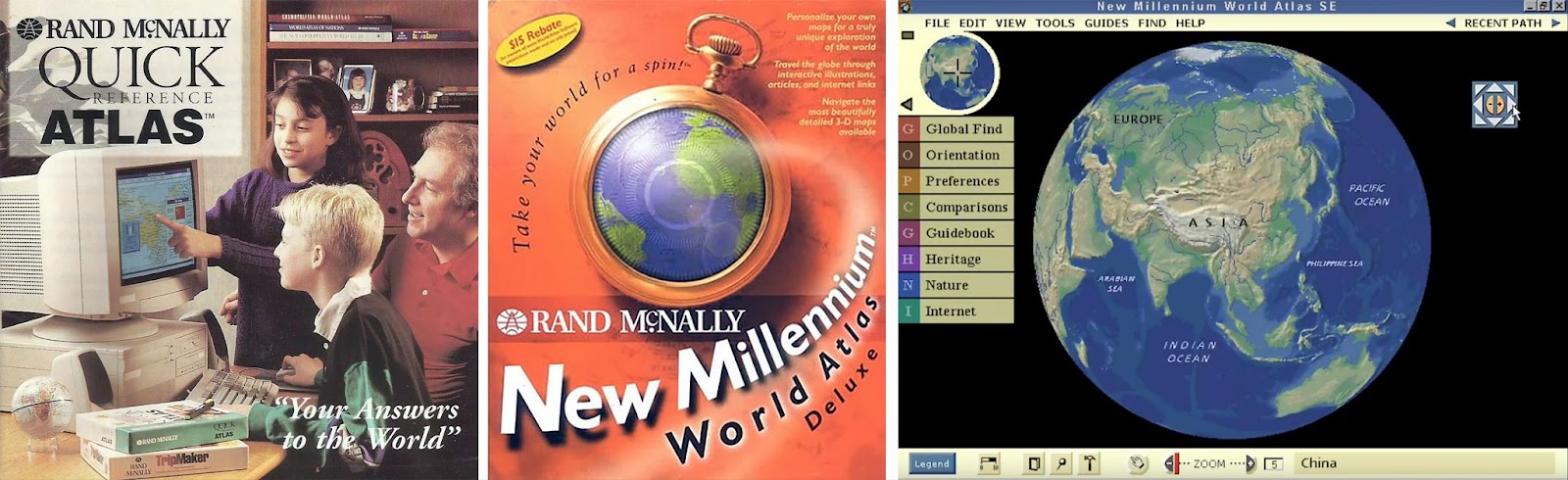
Digital cartography took off at Rand McNally during the '90s and we launched the first set of digital maps on CD called The Quick Reference Atlas around 1996. I was the lead cartographer on this project and led the effort to create all of the individual country and thematic maps for the release, and I really enjoyed working on the maps in a digital format. A few years later, Rand McNally released the New Millennium World Atlas on CD as well, an interactive world map (technically a globe you could manipulate before Google Maps was even out) with detailed maps covering the entire globe, plus thematic maps, videos, photos and editorial stories. Both software products were very exciting to work on at the time and the cartographic team embraced using all the new technology that was available.
Turn of the Century
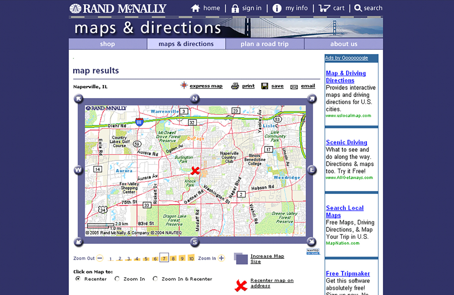
Around 2001, I was working as part of Rand McNally’s new internet team as their lead cartographer and we released our version of a web-based “maps and directions” product, albeit slightly behind MapQuest who was the leader in routing and online mapping at the time. Although we had less users, our web maps were rated higher than MapQuest because we had better map data and more human explication—meaning the directions you would get for your route sounded more human. In fact, we imported some of our own map databases into the online map engine which nobody was doing at the time. The routing and map display engine were built from scratch, and I had a great time working with the team that released this groundbreaking online map engine.
Road Trip Era
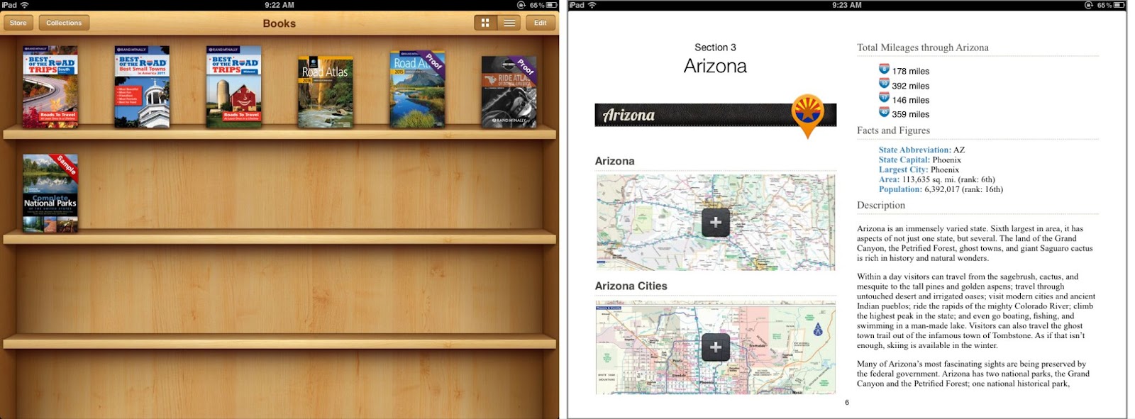
From 2010 to 2016 the company focused more on travel and “Best of the Road” trips, and I was part of the team who created a handful of eBooks which combined maps, photos, and editorial copy into electronic books and atlases. Building eBooks and a digital version of the Road Atlas (no longer available) was a lot of fun because it was a totally new concept for Rand McNally, and it forced us to rethink how we could produce simple but informative maps for this electronic format. We released numerous eBooks with user-generated content highlighting top 10 places to visit in regional locations and created custom maps designed to work well on digital readers like the Kindle and Nook.
Modern Times
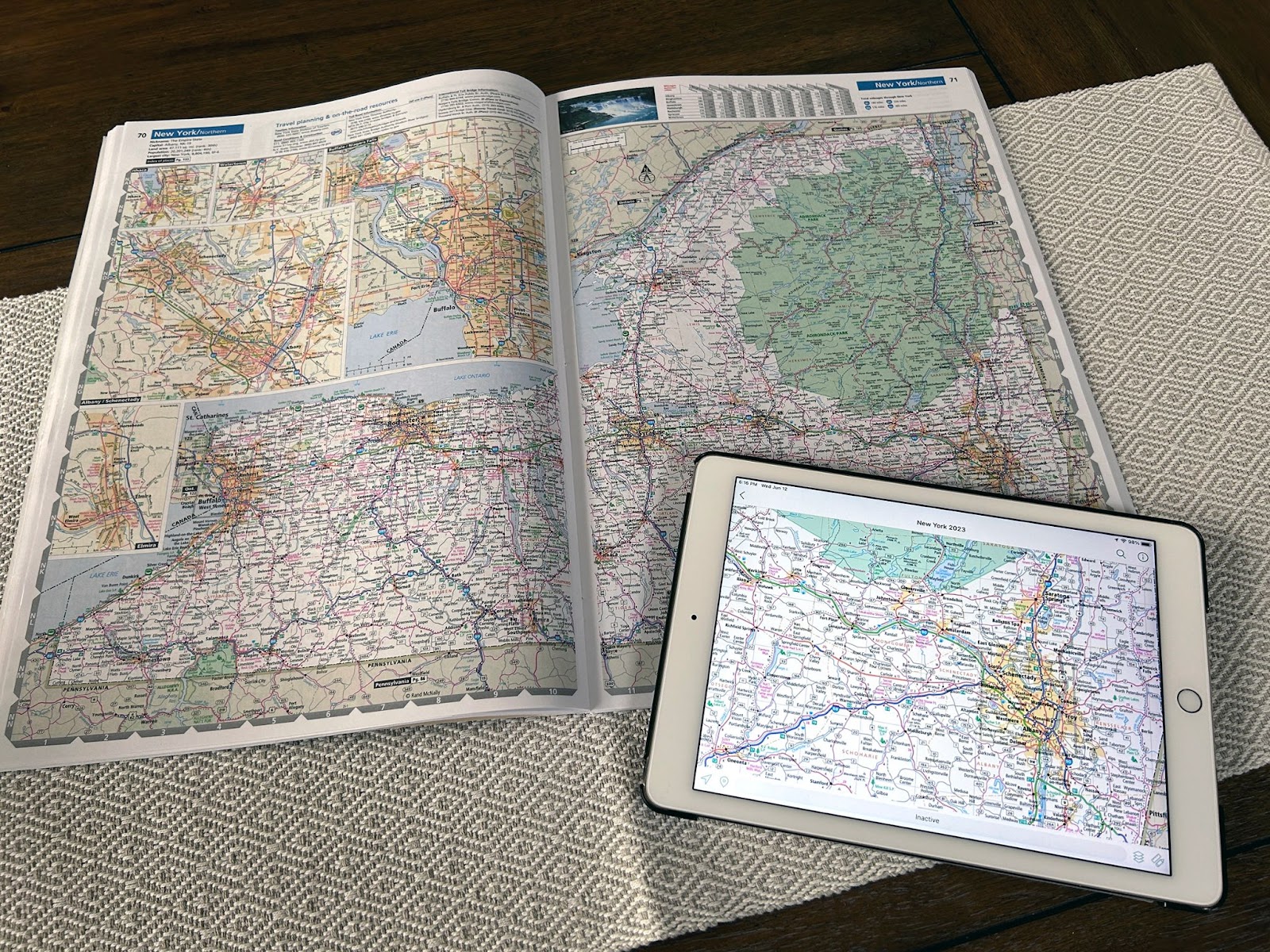
In 2024, we created new georeferenced digital state maps which are available on the Avenza map app, and this project was very interesting and fun for me personally because I learned new processes to generate maps that work on tablets and phones. I have always enjoyed learning new processes and this project was a perfect way to do just that.
Thanks again for the question and allowing me to take a brief trip down memory lane! If you are interested in any of our maps or atlases, please check out the Rand McNally Publishing website.
Have a question for our cartographer? Email us at printproducts@randmcnally.com with “Ask a Cartographer” in the subject line and your question could be featured next!