Lost in longitude or confused by contour lines? Want to know all the tips and tricks for getting the most out of your atlas? Curious if paper towns still exist? "Ask a Cartographer" is your opportunity to get the facts straight from the source. Tom Vitacco, Rand McNally Publishing’s Director of GIS is here to answer your burning questions, and geek out over fascinating map lore – one exploration at a time.
This week, we are discussing some interesting company stories from the past…
Question: Rand McNally has been around for a long time. What are your favorite stories from Rand McNally’s history? (Part 3)
Tom’s answer: As I mentioned in the last two blog posts, Rand McNally has an exciting history, filled with interesting stories and anecdotes that we hope are informative and educational for our readers. This week, we will continue with Part 3 of the original question submitted last month related to some of my favorite stories from Rand McNally’s past. Today, I will focus on a fascinating product released in the early 1900s, plus share some information about a popular event that Rand McNally participated in for many years.
Rand McNally Photo-Auto Guides
About three years ago, the television news show CBS Sunday Morning did a story on mapping and Rand McNally, and I was part of the presentation team. While we were collecting research materials for the story, we came across an old product called the Rand McNally Photo-Auto Guides. Although the Guides were not mentioned in the news story, I found the product intriguing and thought I would share more information about these cool guides with you today.
In the early 1900s, road conditions were generally poor and for the few people with automobiles, traveling on these roads was a risky endeavor. Most roads were just dirt or gravel and had no markings or signs along the route. Paved roads were uncommon so getting around was a challenge, yet most automobile owners were adventurous and wanted to travel with their new machines. Automobile associations began to form, and the demand for better roads increased, so new governmental agencies were created, and more money was allocated for road construction. As the transportation network vastly improved, Rand McNally saw the need to offer products that would assist travelers along their journey. One of those products was the Photo-Auto Guide.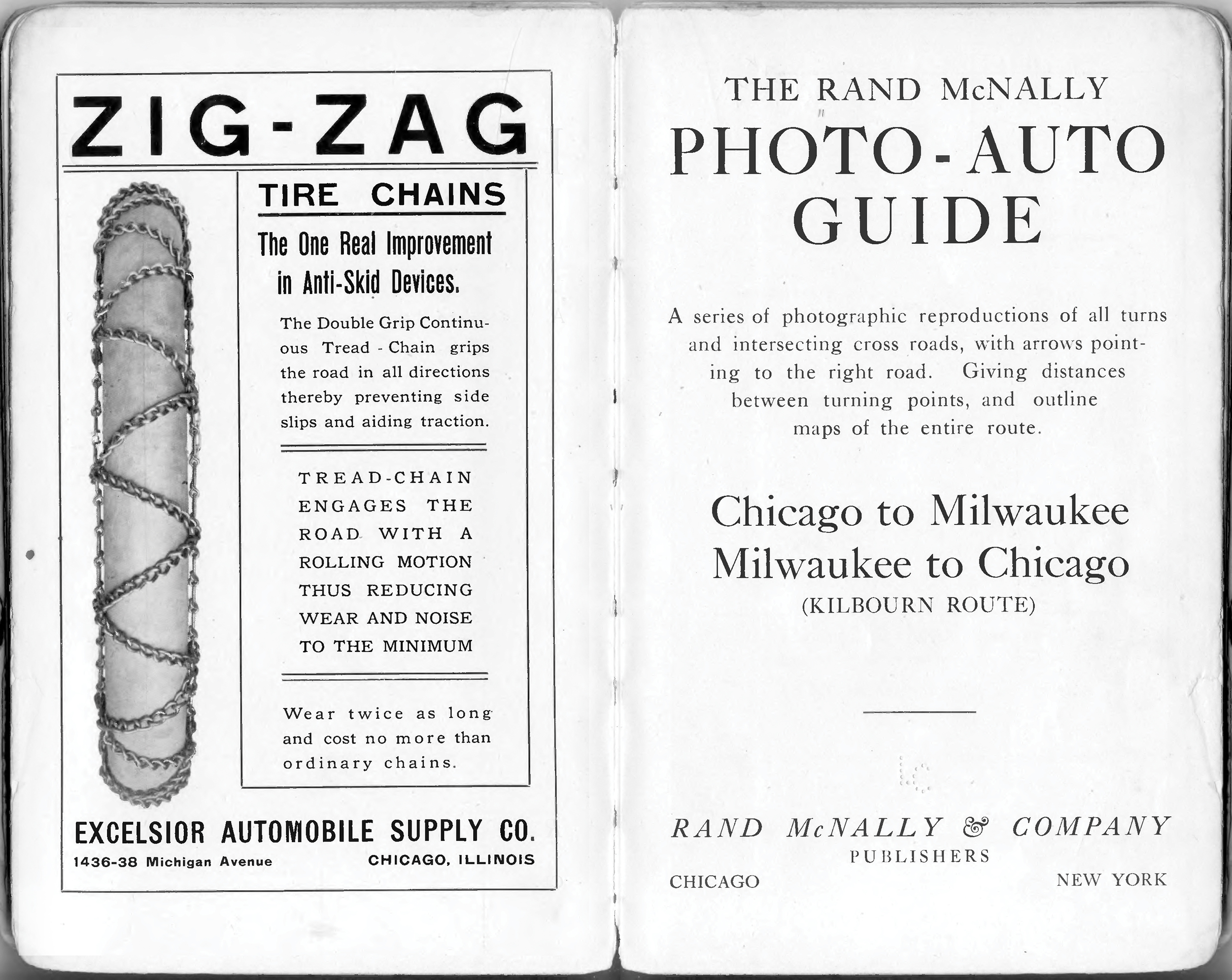
Pictured: sample pages from the Chicago to Milwaukee Photo-Auto Guide including an ad for tire chains.
The concept of the Photo-Auto Guide was to provide a detailed description of the route between two cities or places and include photographs, hand-drawn maps, turn-by-turn directions, travel distance charts, an index, a place for notes, and many advertisements. Topographic features were highlighted, such as railroad crossings, bridges, schools, and other easily identifiable landmarks. Since paved roads were few and far between, these guides also showed different routes for wet or dry weather. These guides could be considered a precursor to the AAA TripTik and were produced before road maps really became a viable product.
The original Photo-Auto Guides were published by Chicago-based G.S. Chapin around 1905 and mostly included trips between places on the east coast. In 1907, Rand McNally purchased the rights from G. S. Chapin to publish the guides and also acquired the rights and patent for the Photographic Automobile Maps from H. Sargent Michaels. During the next few years, Rand McNally published many guides, as you can see in the table shown on the left of the image below. There was a large price difference between the guides, mostly because the page counts varied greatly as some of the guides were around 300 pages in total.
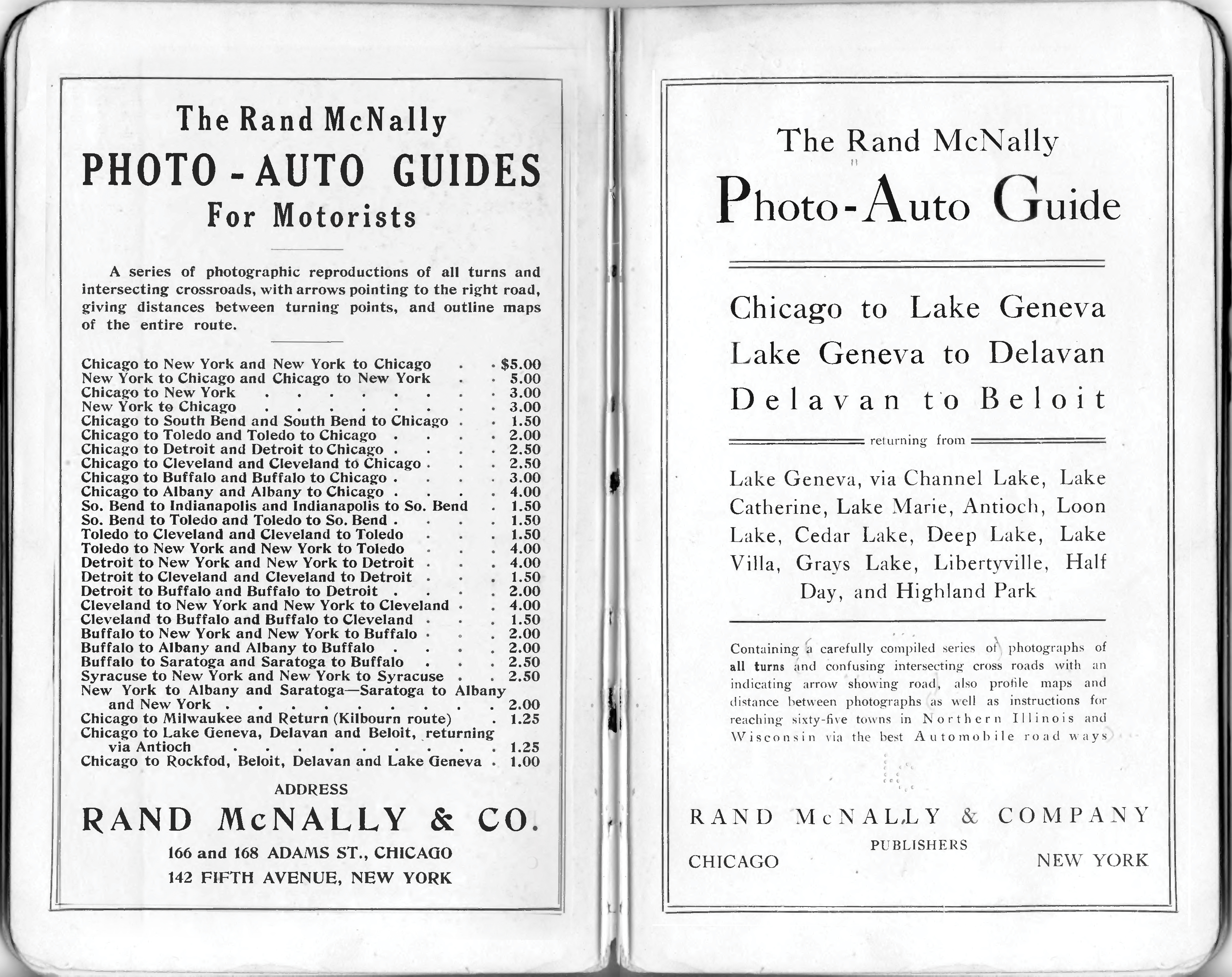
Pictured: the list of available Photo-Auto Guides at the time is shown on the left page.
There are a few reasons these guides appeal to me. First, they were basically early versions of GPS and the type of route navigation that we all take for granted today, albeit 90 years before MapQuest and eventually Google and Apple maps or even Garmin devices. Additionally, the way the directions are displayed using not only turn-by-turn information but also landmarks and visual data, is exactly how I used to create directions for family and friends, who often asked since I was a cartographer. I would include images of road signs and use landmarks in my written directions, like “turn left on Main St…you will see a church on the corner” and I would draw arrows as well because I always felt the extra content was helpful. Seeing the unique content of these guides struck a chord with me.
Chicago to Lake Geneva
I wanted to provide more details about these innovative products using the Chicago to Lake Geneva guide as an example. The image below, provided by the Library of Congress, shows two pages from the guide and you will notice some interesting things. First, two of the photos show signs or landmarks like the hotel, which I am sure was an effective and visual way to guide motorists at the time, as long as daylight was available! The other two photos highlight directions and turns and include arrows added on top of the photograph. I like how the directions mention things like “cross bridge” or “cream colored house with olive green trimming on right after you have made turn,” although if the owner painted the house I guess the guide would be outdated.
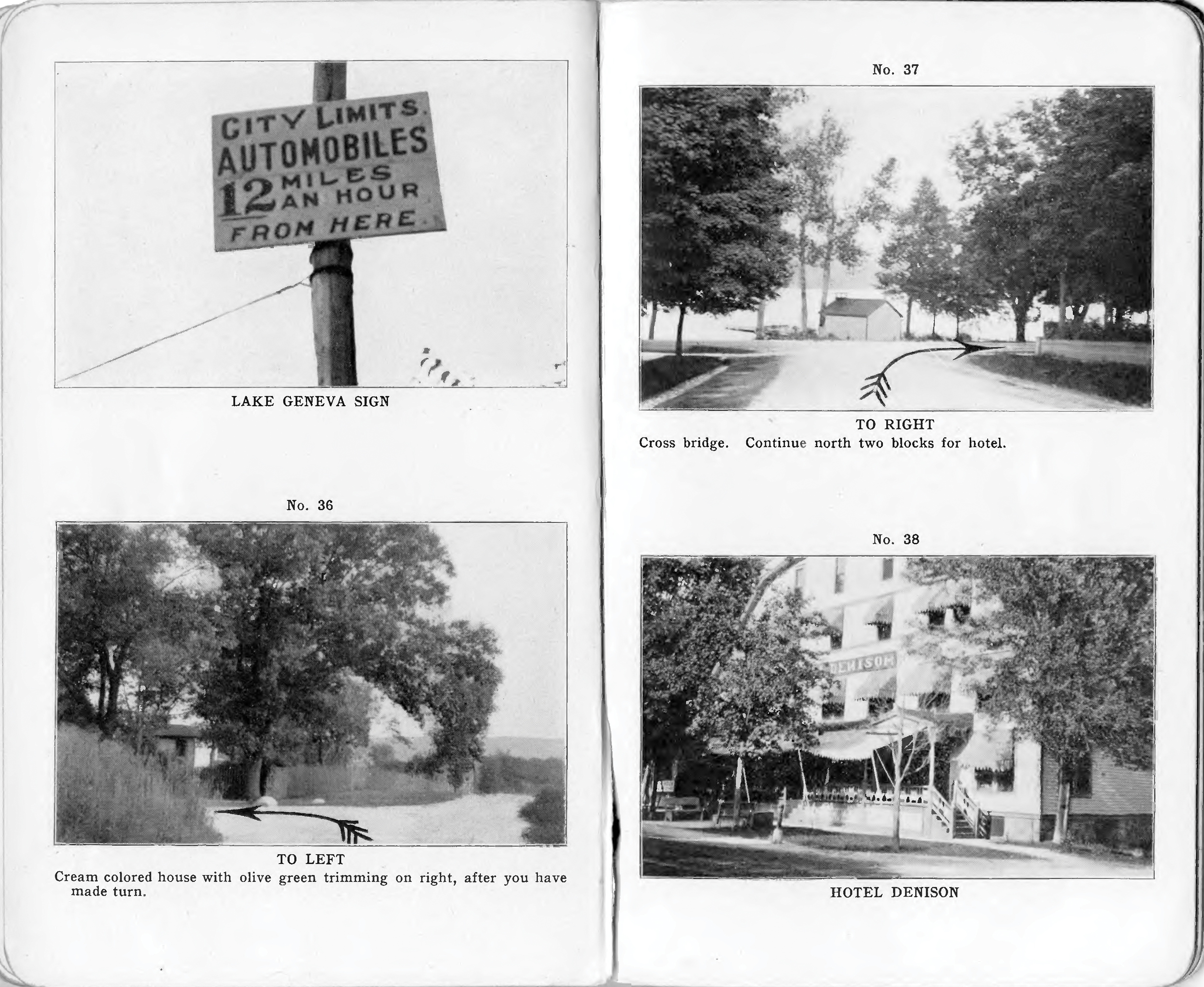
Pictured: examples of photographs with directions, arrows, and landmarks/signs from the Chicago to Lake Geneva guide.
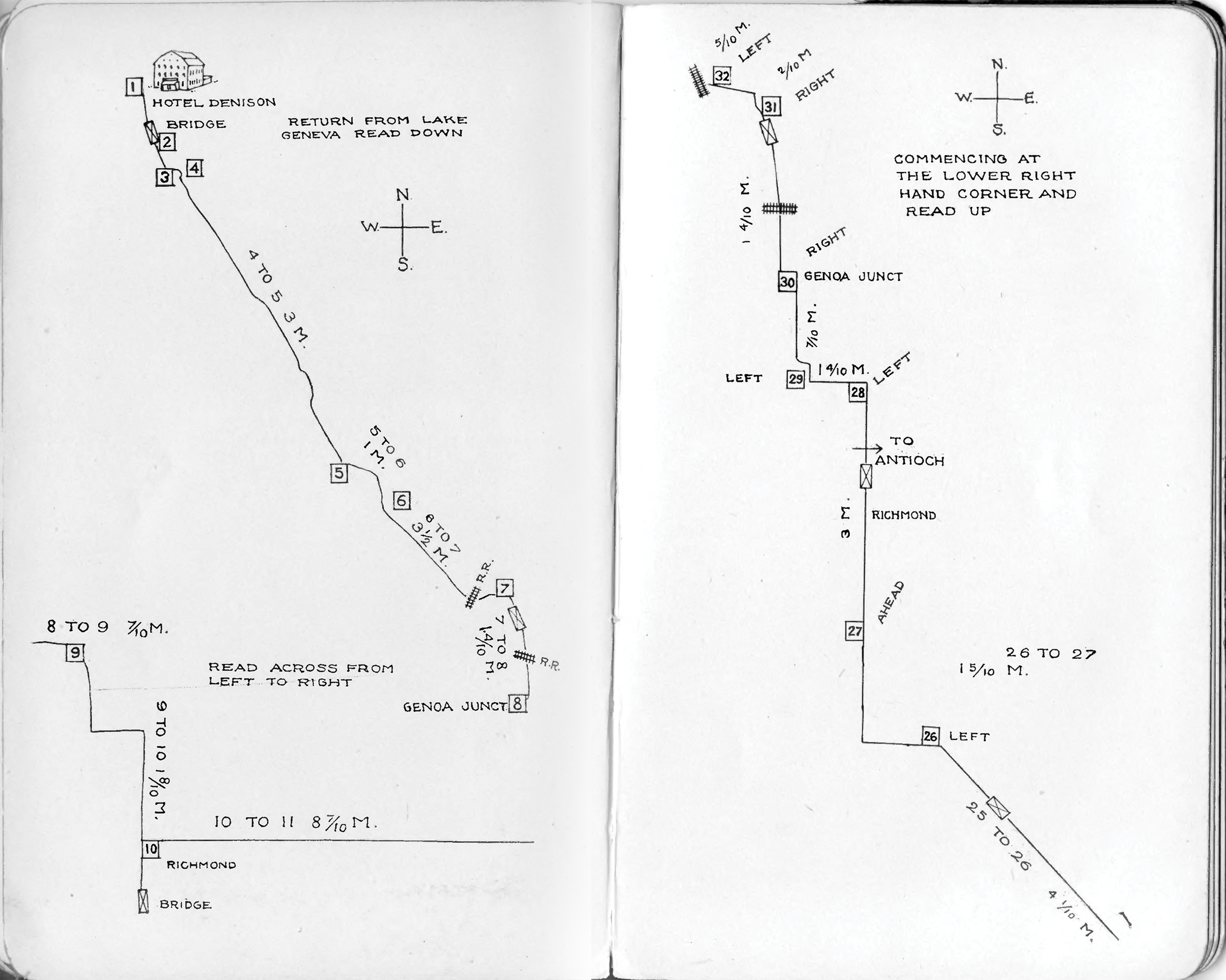
Hand-drawn maps and sketches were also part of the guide, with mileages, notes and even small drawings of landmarks like the hotel, as shown in the image below. Although simple in nature, the maps look to be fairly accurate and contain useful information for someone travelling along the route.
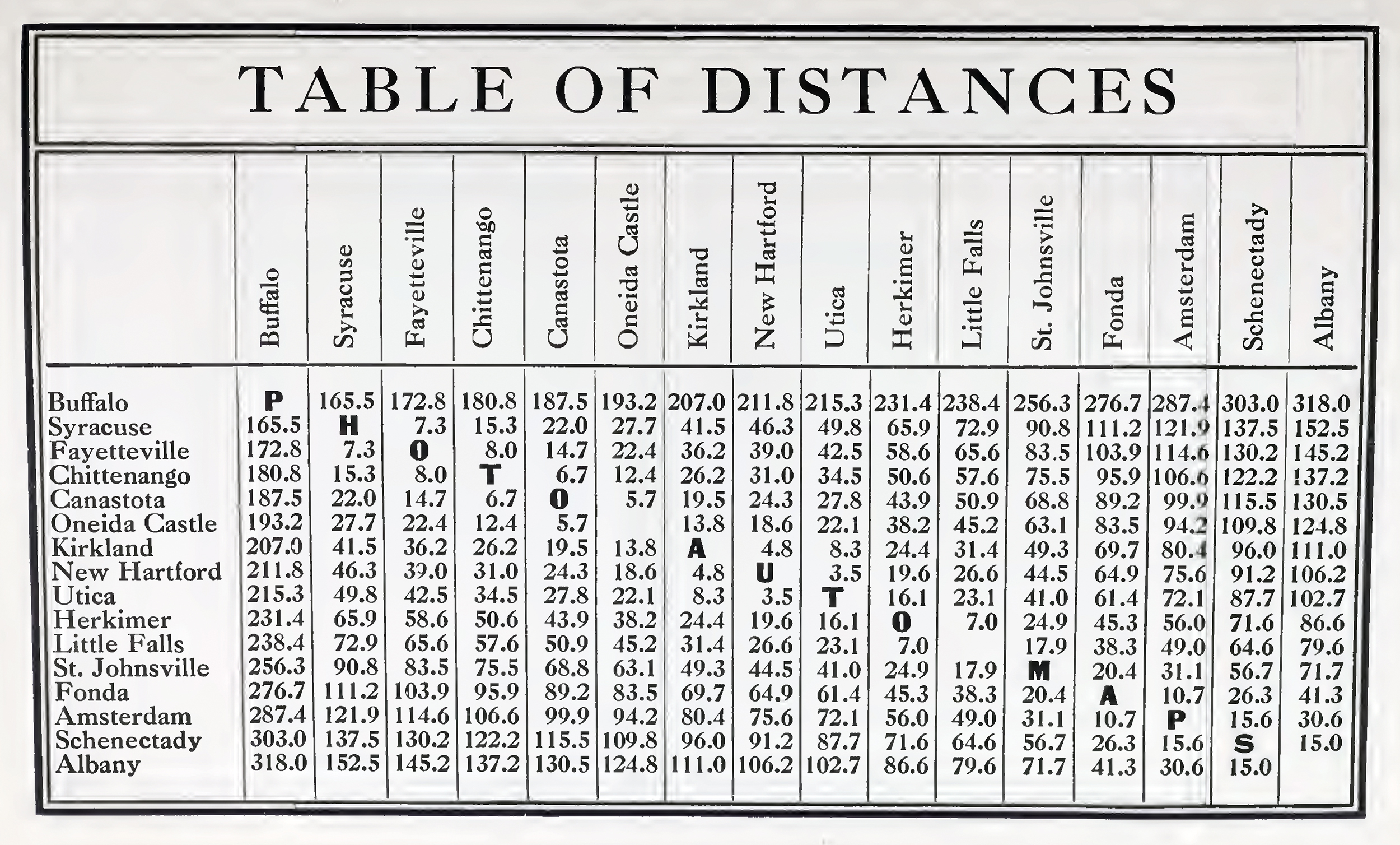
Plus, the guides included mileage tables, like the chart shown below, for distances between cities in New York. I like how the cartographers and editors worked the words “Photo Auto Maps” into the empty spaces within the chart. We include mileage charts like this in most of our maps and atlases today, because they are handy and helpful if you want a quick distance calculation between larger cities.
Finally, I will wrap up with one side story. Andrew McNally II (son of Frederick McNally and grandson of Andrew McNally) personally took photos for the Chicago-to-Milwaukee edition. In June of 1908, when Andrew and his new bride Eleanor set out for their honeymoon from Chicago to Milwaukee in their automobile, he brought along a big box camera to photograph every “puzzling intersection” along the way. His intent was to collect photos and document directions and information so he could contribute to this specific Photo-Auto Guide since he knew it was going to be a future title in the product line.

Pictured: an older Andrew McNally II (left) and the younger version working the camera while on his honeymoon to Milwaukee (center image).
Overall, I find these guides remarkably interesting, and I was truly thrilled that photos and information about these innovative products still exist to share and appreciate today. To me, this is just another product that highlights how progressive and opportunistic the leaders of Rand McNally were back in the early days.
Tournament of Roses Parade
Rand McNally corporate headquarters have always been in the Chicago area, whether downtown or in the suburbs, and while the company was located here, the family had multiple residences in other parts of the country. I recall on a trip back in 1990 to the Thousand Islands area in upstate New York, my wife and I took a drive to see the McNally estate on the American Narrows in Alexandria Bay after we learned the family had a house there.
In 1887, the west coast was also considered home to Andrew McNally after the family added a second residence and working ranch near Pasadena, California, in the town of Altadena. The ranch was one of the first land developments in the region and soon became a successful business in the production of citrus fruit and olive oil. The property stayed in the family until it was sold in 1953. The McNally family also helped draw other prominent families, including William Wrigley Jr., to the area as well. Unfortunately, the original McNally family house was one of the many structures destroyed during the recent southern California wildfires.
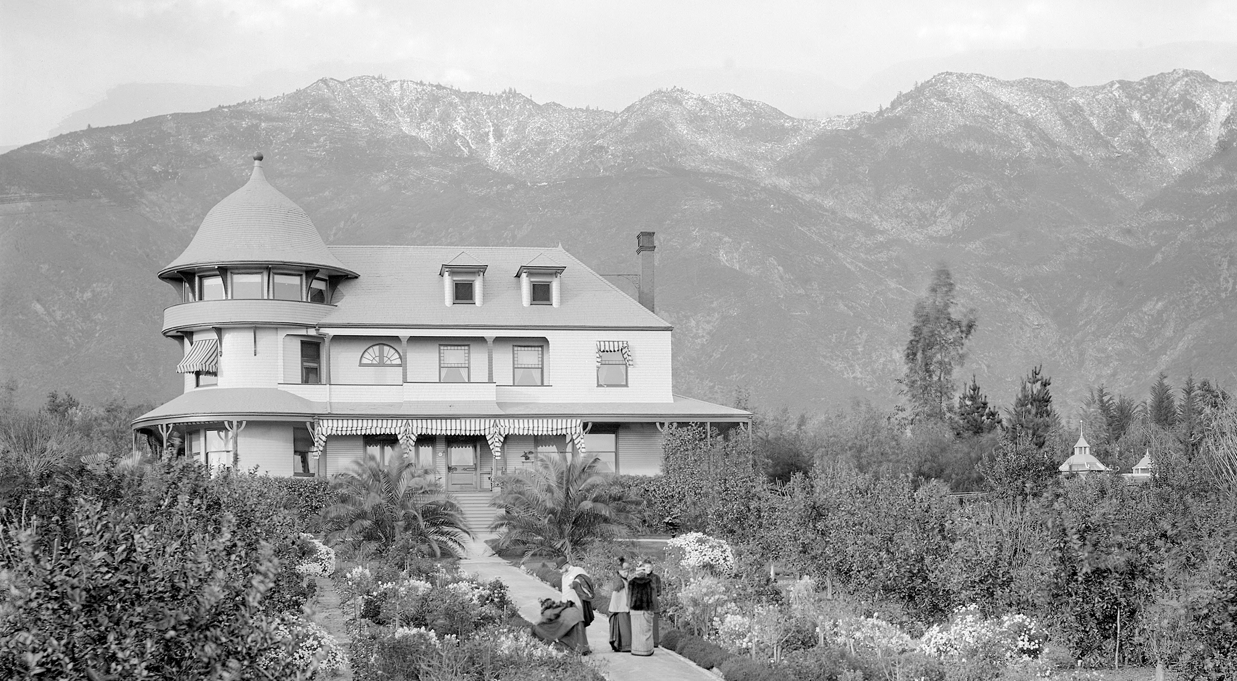
Pictured: the McNally family residence in Altadena, California around 1900.
One of the most famous events held in Pasadena is the Tournament of Roses Parade, a New Year's Day tradition since the late 1800s, when horse-drawn carriages covered in flowers were on display at the Valley Hunt Club. Later, motorized floats were introduced, and over a hundred years later, the floats are now beautiful structures using state of the art technology. What you might not realize is that Rand McNally was part of this tradition for many years.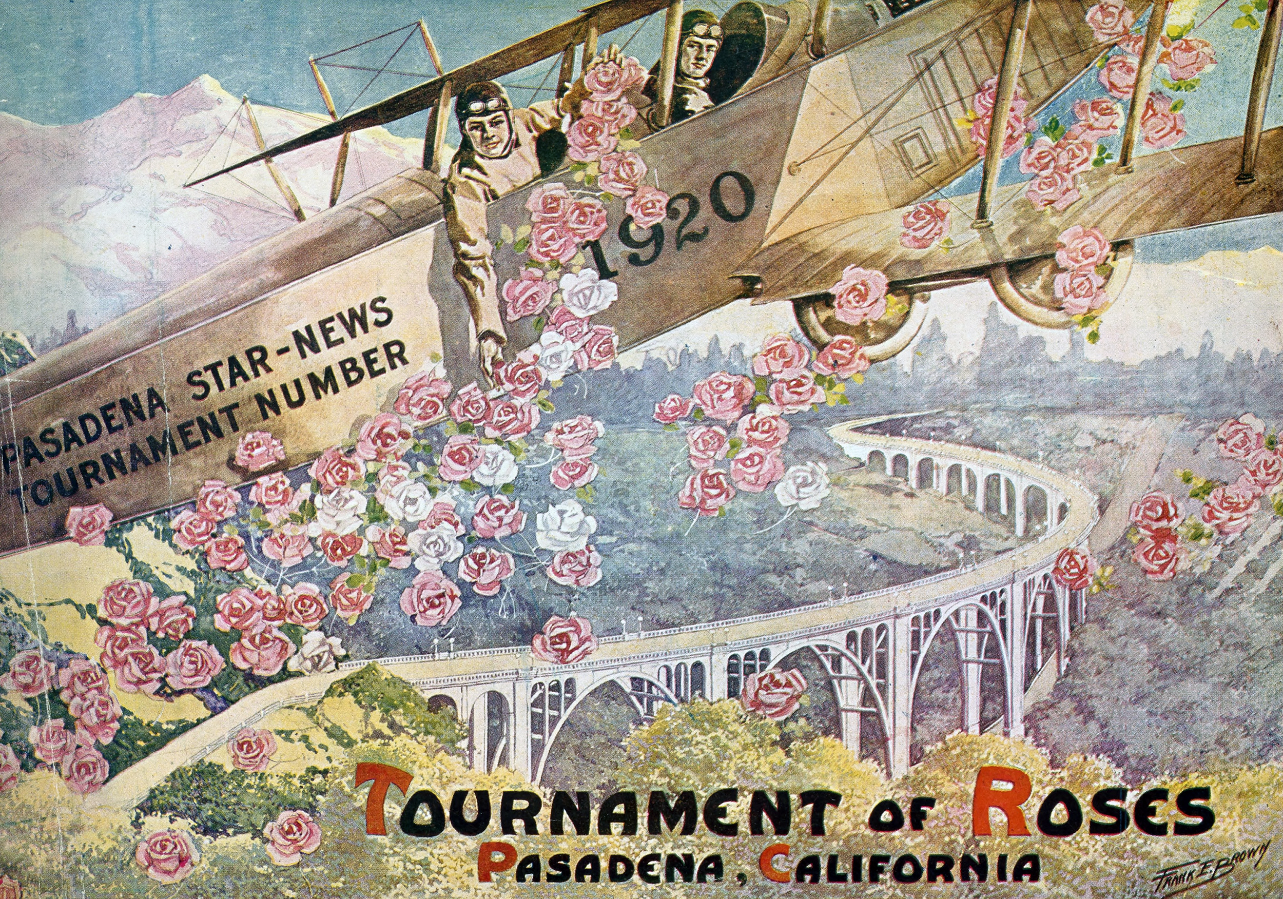
Rand McNally entered their first float in the Tournament of Roses Parade in 1973. The participation in the parade was part of a long-established institutional advertising program and they continued to enter floats for the next two decades. Throughout the years, the theme of exploration and travel was always incorporated into the design of every Rand McNally Float. Unfortunately, we do not have many photos in our archives from the parade, but we do have a few that I can share.
The first photo below is an artist rendering of the 1982 Rand McNally float called Discovery, a massive depiction of a Viking ship, created to celebrate the achievements of the proud Viking explorers who set out for the New World centuries ago.
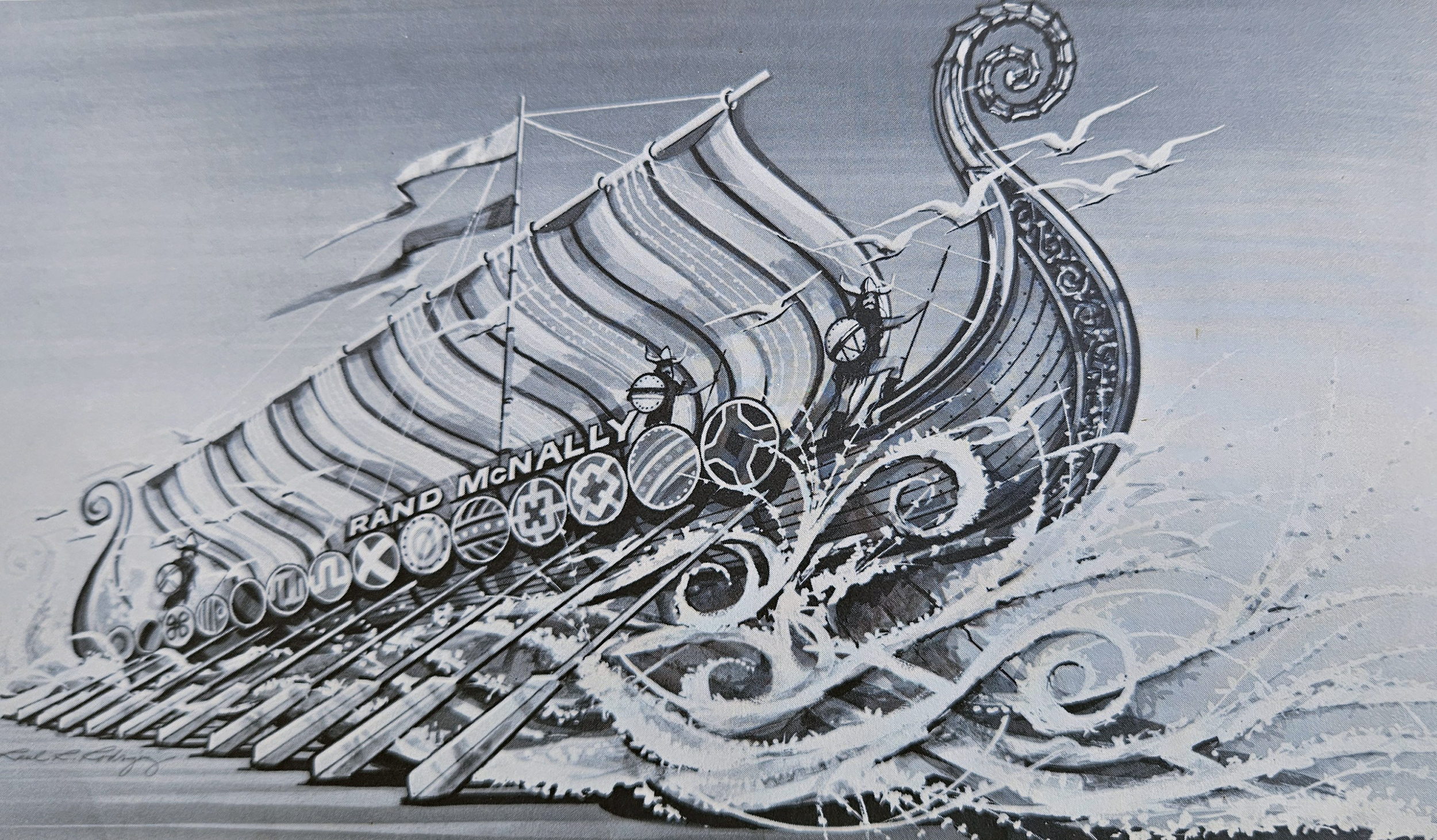 Pictured: The Rand McNally float called Discovery in the 1982 Tournament of Roses parade.
In 1983, the float was entitled Harvest and was Rand McNally’s seasonal interpretation of the “Rejoice” parade theme. Andrew McNally III is shown on the left below with some of the riders who were dressed up to complement the Native American inspiration for the float.

Pictured: The 1983 Rand McNally float with Andrew McNally III shown on the left.
For the 1984 parade, Rand McNally entered Lewis and Clark, a tribute to the American pioneers who volunteered their lives to the exploration of the new territories.
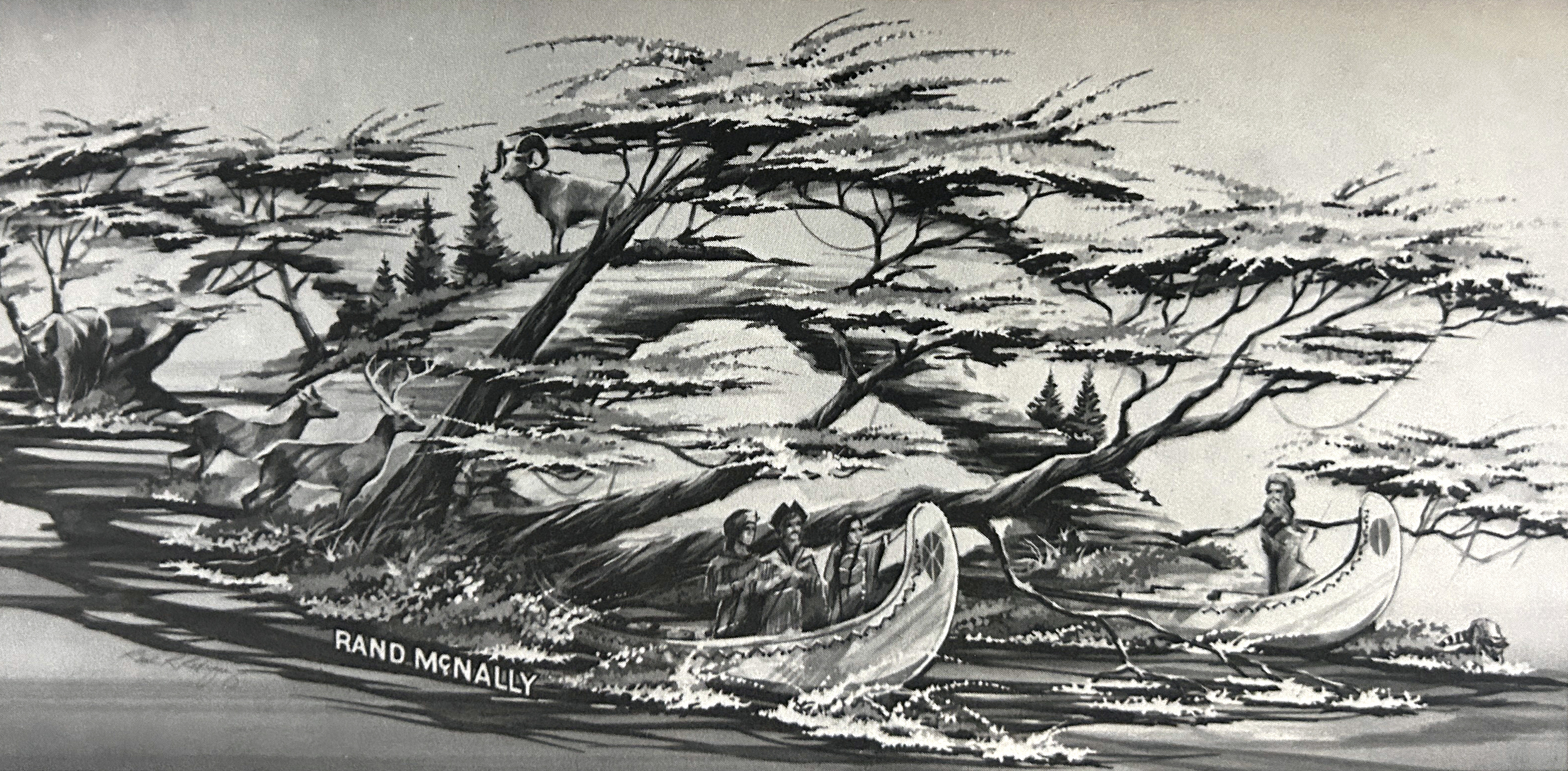
Pictured: An artist rendition of the 1984 Rand McNally float called Lewis and Clark.
The “California, Here We Come!” float was awarded the Pioneer’s Trophy for the best characterization of the romance of California in 1985. The large float included two horses pulling a covered wagon as you can see in the photo to the left below. Andrew McNally III is shown standing in front of one of the horses on the right, demonstrating just how large this float actually was.
I honestly do not know why Rand McNally stopped entering floats in the parade after 20 years of participation. I started working at the company in 1986, but I do not recall talking about the parade or the floats with colleagues early in my career unfortunately, so I can only offer the details and photos highlighted above, taken from the company newsletters at the time.
Thanks again to Steve Wiertz, a Senior GIS Analyst here at Rand McNally Publishing, for providing much of the content and historical facts for this post.
Feel free to submit your map or cartography questions below and check back soon for another installment of "Ask a Cartographer"
Have a question for our cartographer? Email us at printproducts@randmcnally.com with “Ask a Cartographer” in the subject line and your question could be featured next!


