
Lost in longitude or confused by contour lines? Want to know all the tips and tricks for getting the most out of your atlas? Curious if paper towns still exist? "Ask a Cartographer" is your opportunity to get the facts straight from the source. Tom Vitacco, Rand McNally Publishing’s Director of GIS is here to answer your burning questions, and geek out over fascinating map lore – one exploration at a time.
This week, we are discussing satellite imagery and its role in making maps…
Question: What role do satellite imagery and aerial photography play in modern mapmaking?
Tom’s answer: Another interesting question—thanks for asking! The role of satellite imagery in modern mapmaking is a long, complicated process requiring a lengthy response so I will try to keep it brief. Plus, here at Rand McNally Publishing, the role of satellite imagery is limited. However, I will try to offer a quick summary of how it is used in the industry while also demonstrating how we use the technology in our production processes or atlases.
A Brief Overview of Satellite Imagery
For many years satellites have been orbiting the planet taking images of Earth from space. These satellites are equipped with sensors which detect different types of light waves and high-resolution composite images are made from the captured data. Aerial imagery is similar, but usually captured at lower altitudes, so it provides more detailed images, but they can be more limited in their use because they often cover less area.
Satellite imagery has many uses in a variety of different fields and professions. It serves as a critical tool for data analysis, information gathering, urban planning, environmental conservation, military/defense, plus it can be helpful to teams focused on public safety and disaster management. As maps and spatial data become more prevalent in our daily activities, satellite imagery use will continue to grow in importance.
Rand McNally Publishing has incorporated satellite imagery in a few different ways during my 38 years as a cartographer. Goode’s World Atlas, a college textbook we produced for many years, was the first atlas where I was part of the cartographic team that added satellite imagery to a printed product. Some sections of the atlas contained four thematic maps for each continent, and one was a satellite map as shown below.
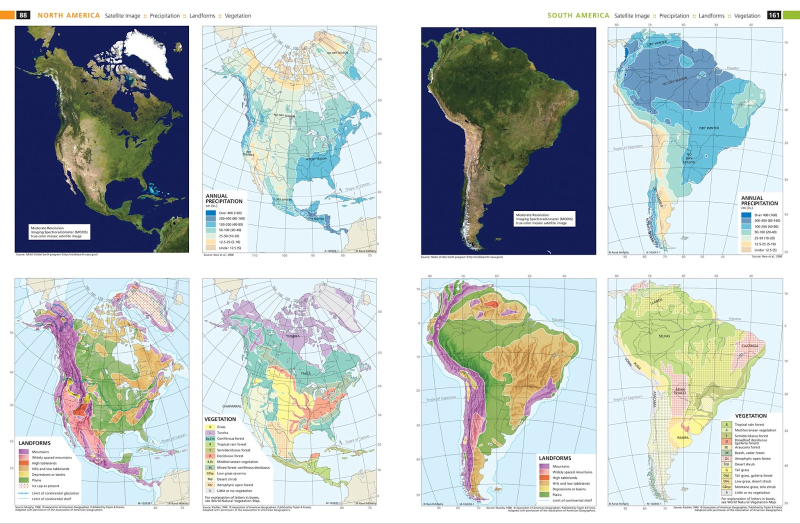
Pictured above: Example maps from Goode’s World Atlas highlighting how satellite imagery was added to simple maps of the continents.
Rand McNally Education
Another example can be found on our website. The Rand McNally Education group uses satellite imagery in the World Atlas online digital tool—an interactive, geography-focused teaching platform. We include maps within the digital atlas showing satellite imagery along with a base map called Night Lights which uses satellite imagery provided by the NASA Earth Observatory and the NOAA National Geophysical Data Center.
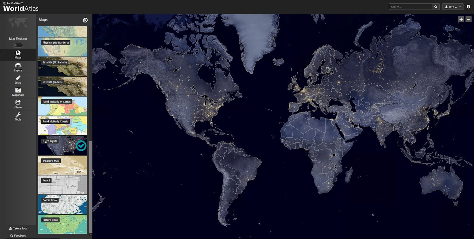
Pictured above: Night Lights base map included in WorldAtlas from Rand McNally Education
Satellite Imagery with the Road Atlas
We occasionally use satellite imagery in our map production and research processes when we compile new map features into the proprietary map database used to produce the Road Atlas and other state map titles. These new features could include roads, parks and even water features. For example, we used satellite imagery when we shrunk the Great Salt Lake polygon in Utah a few years ago to more closely represent the actual shape at the time. A more recent example would be how we used satellite imagery to compile the new road section for the “Complete 540” project currently under construction south of Raleigh, NC to extend the Triangle Expressway. On our map, this road is shown as a green dashed line to indicate a possible future toll road that is under construction. So, while we do not use satellite imagery often, it does have a practical use within our cartographic production environment here at Rand McNally Publishing.
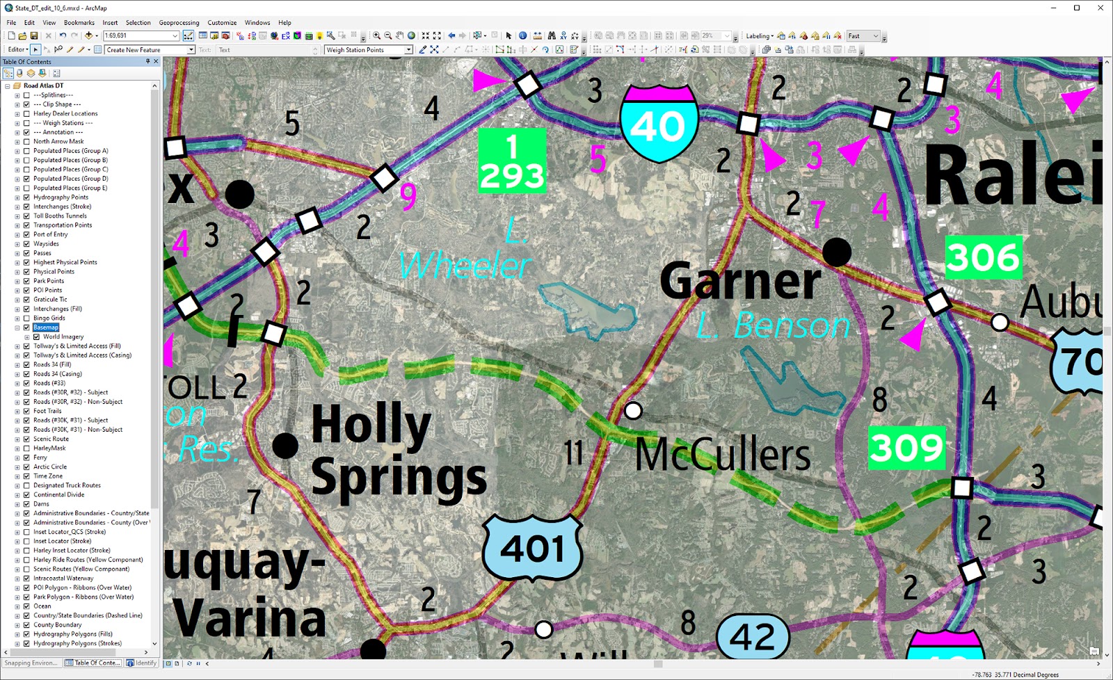
Pictured: Digitizing a new road in the map database using satellite imagery as our guide since the image layer displays the construction progress within our GIS environment.
Thanks for the question. Feel free to submit your burning questions below and check back next Tuesday for the next installment of "Ask a Cartographer".
Have a question for our cartographer? Email us at printproducts@randmcnally.com with “Ask a Cartographer” in the subject line and your question could be featured next!