Lost in longitude or confused by contour lines? Want to know all the tips and tricks for getting the most out of your atlas? Curious if paper towns still exist? "Ask a Cartographer" is your opportunity to get the facts straight from the source. Tom Vitacco, Rand McNally Publishing’s Director of GIS is here to answer your burning questions, and geek out over fascinating map lore – one exploration at a time.
This week, we are discussing the time zones and how we display them on our maps…

Question: I have an old Rand McNally map of Nevada and Utah, and I noticed the time zone lines do not follow the national standards from that time. Do you know why?
Tom’s answer: A few weeks ago, we got a question regarding time zone boundary lines depicted on an old Rand McNally map, and with daylight saving time ending soon I thought it was a great opportunity to try to answer the question.
Legacy Time Zone Boundary Lines
First, I want to provide a little background on the specific question, which is paraphrased above. A customer recently emailed us at printproducts@randmcnally.com and mentioned they have a Rand McNally map showing Nevada and Utah from the late 1940s, which was made for Sears & Allstate at the time. They had been researching the history of the small towns on the border of Nevada and Utah and included some of the images and information used below.
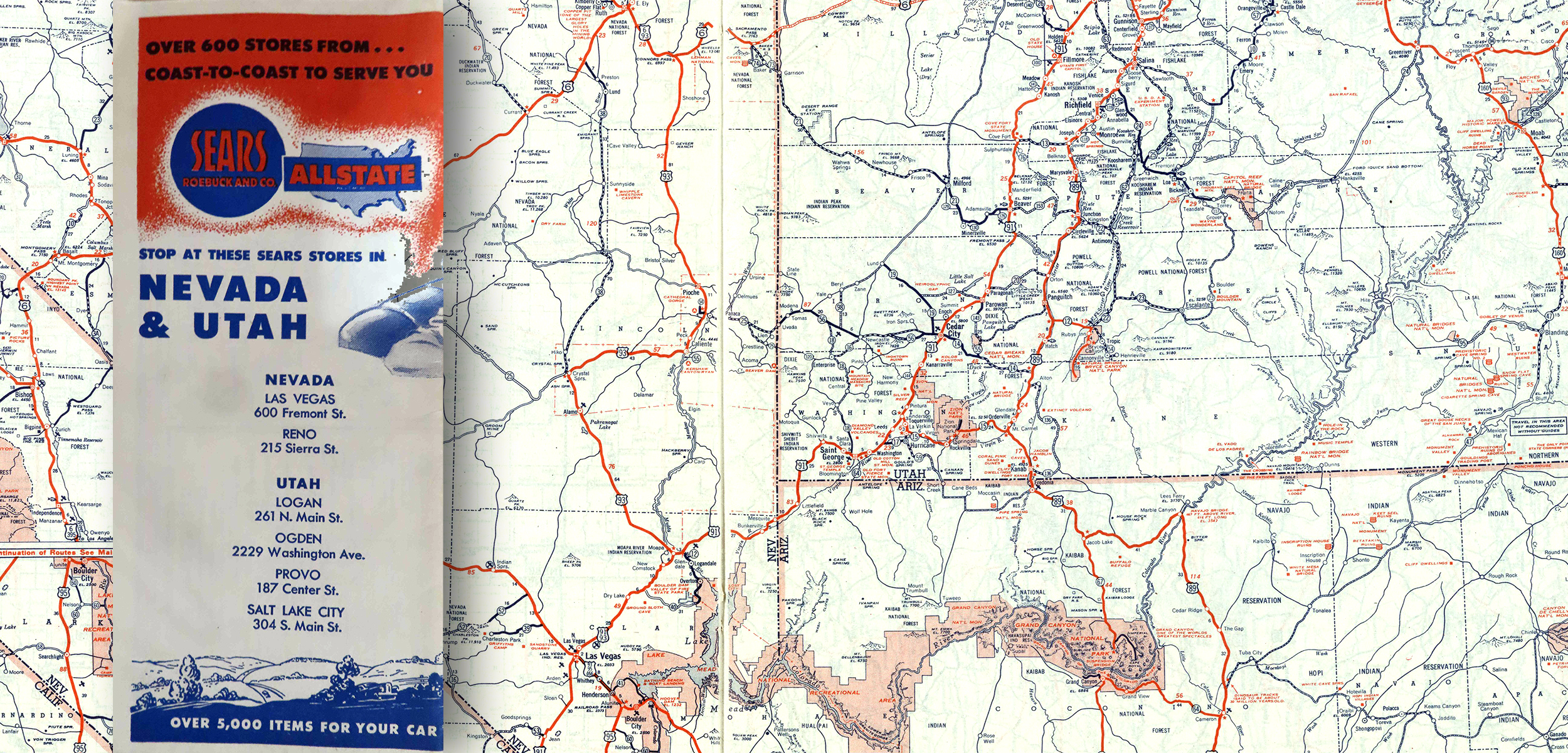 Pictured: Rand McNally paper map of Nevada and Utah created for Sears and Allstate in the late 1940s.
The customer noticed the time zone boundary that follows the Nevada/Utah state border deviated in specific areas (as shown with the red arrows below) to include a small part of Nevada as part of the Mountain time zone. They wondered if Rand McNally cartographers were working with local communities back then who observed different time zones than the national standards and how the cartographers would collect this information.
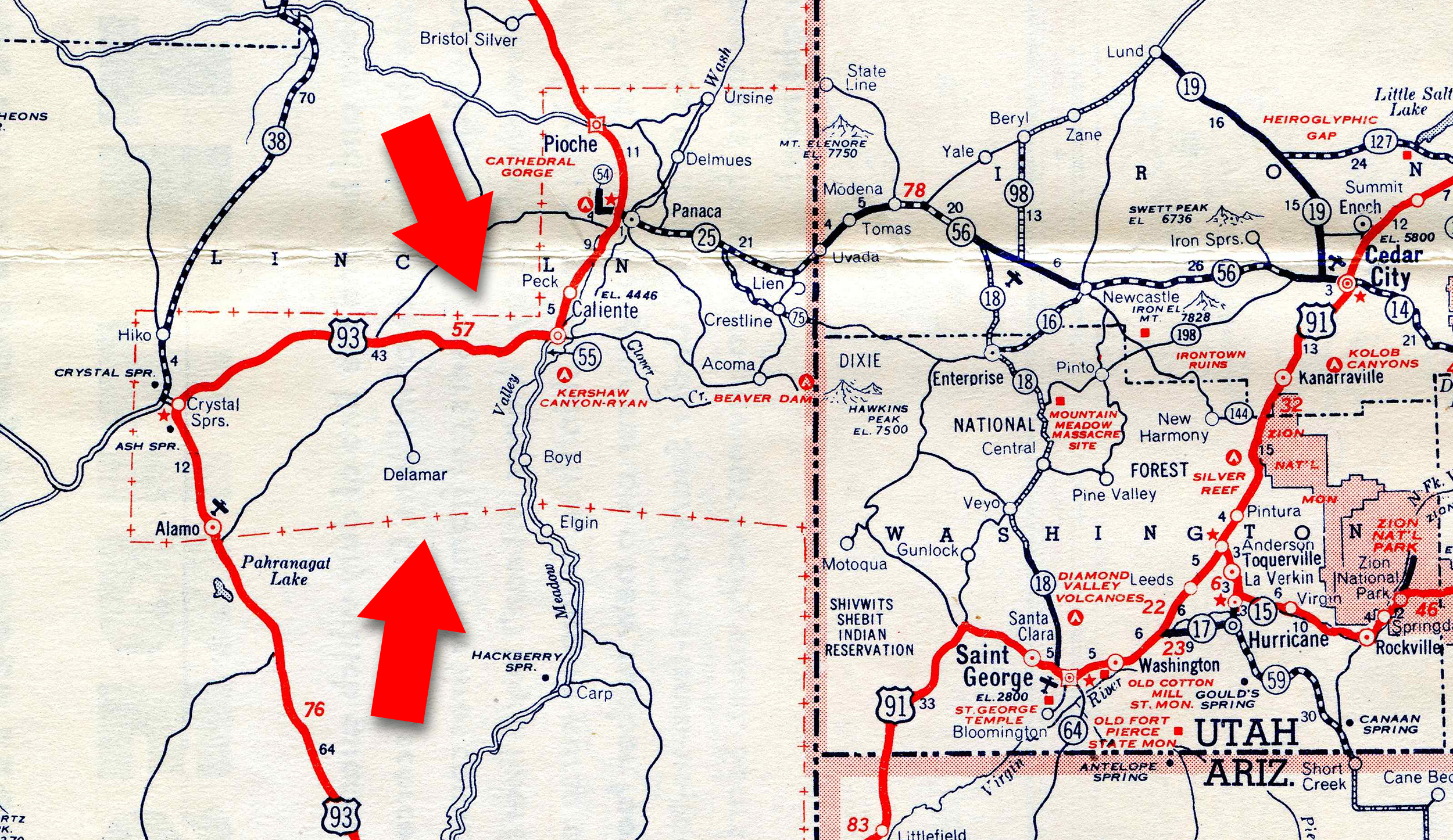 Pictured: Time Zone line includes towns in Nevada instead of following the state border between Utah and Nevada.
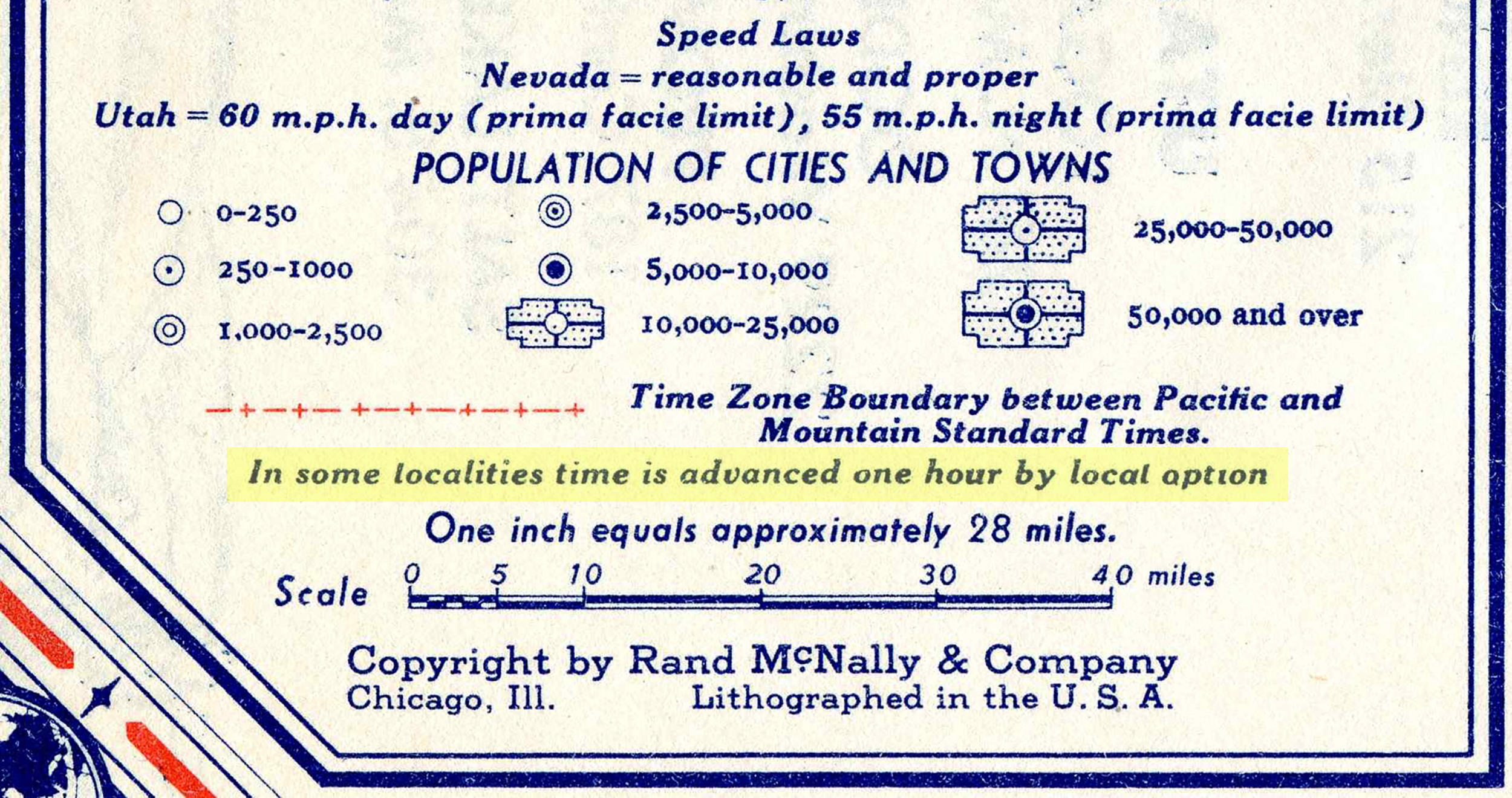
Interesting side note: The map legend includes the line “In some localities, time is advanced one hour by local option” (shown highlighted below). The customer noticed this line was included on many older maps from the era created by Rand McNally during their research on this topic. We do not include this line in any of our modern map legends.
 Although I was not around in the 1940s, I believe the Rand McNally cartographers worked closely with state and local officials to create the time zone lines for each map produced and factored in “observed time” as well as national standards shown on the official government maps. To this day, we still reference official government maps or the US State Department when making policy and even cartographic decisions.
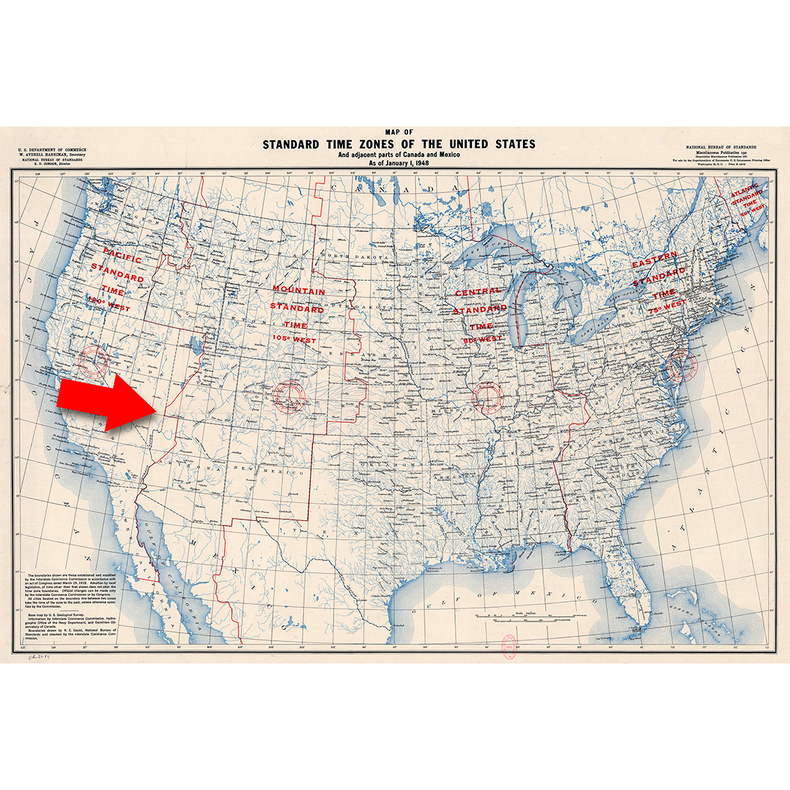
For example, the map below produced by the National Bureau of Standards from 1948 does not show the same time zone boundary lines as the Rand McNally map the customer is inquiring about from the same period. Only a small portion of the red time zone line follows the Nevada/Utah border as shown with the red arrow below.
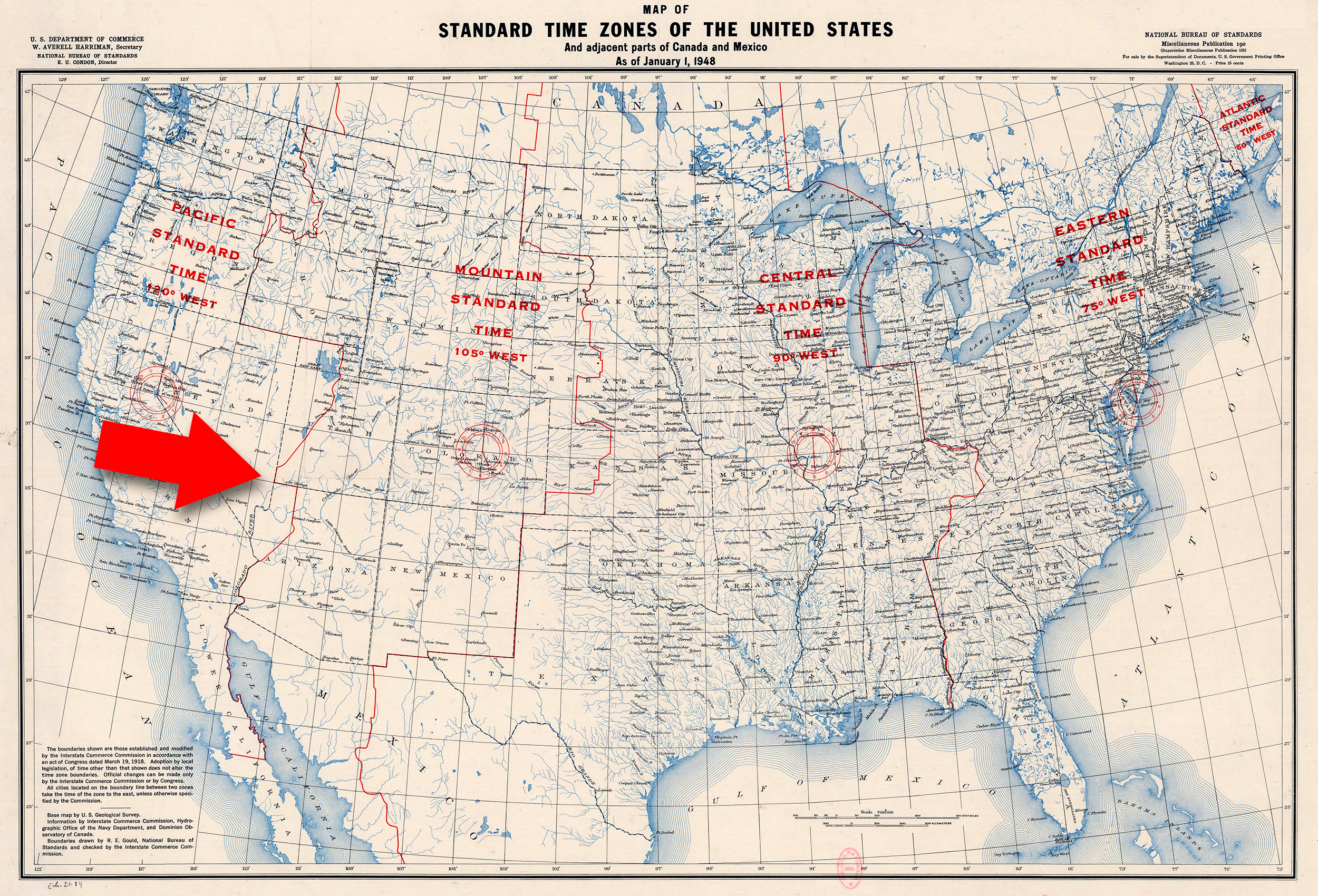 I would assume the cartographic team communicated with the regional and state authorities and based on information gathered about local options and other factors such as available commerce or religious influences, decisions on how to show the time zone boundaries were made. There could have been more opportunities on the Utah side of the border and local people from Nevada traveled to Utah and became used to the mountain time zone region. Thus, the line was added to the legend letting the customer know there might be deviation in the time zone lines from the national standards because local options were considered when adding the line work. Again, just my best guess here since I do not know the detailed history of this area.
Modern Time Zone Boundary Lines
Today, we follow the time zone standards set by the government where borders usually follow state and county lines or natural landmarks like national parks. Time zone boundaries can be legislated at the state or county level and also by the U. S. Department of Transportation.
In some instances, counties are split into two time zones. In fact, the last major time zone adjustment we made on our maps was around 2009 in Morton County, North Dakota. In the image below, the time zone boundary shown with the red arrows used to follow the Missouri River and then cut across part of the county, so it was split between the Central and Mountain Time Zones. The Department of Transportation moved the entire county to the Central Time Zone in response to a petition filed by the Board of County Commissioners as well as extensive comments made at a public hearing. Since most county residents traveled to Bismarck or the county seat of Mandan for business, entertainment, supplies, and travel, changing the entire county to the same time zone was considered important enough to adjust the boundary. So, while time zone boundaries do not change often, when they do, we alter our maps accordingly.
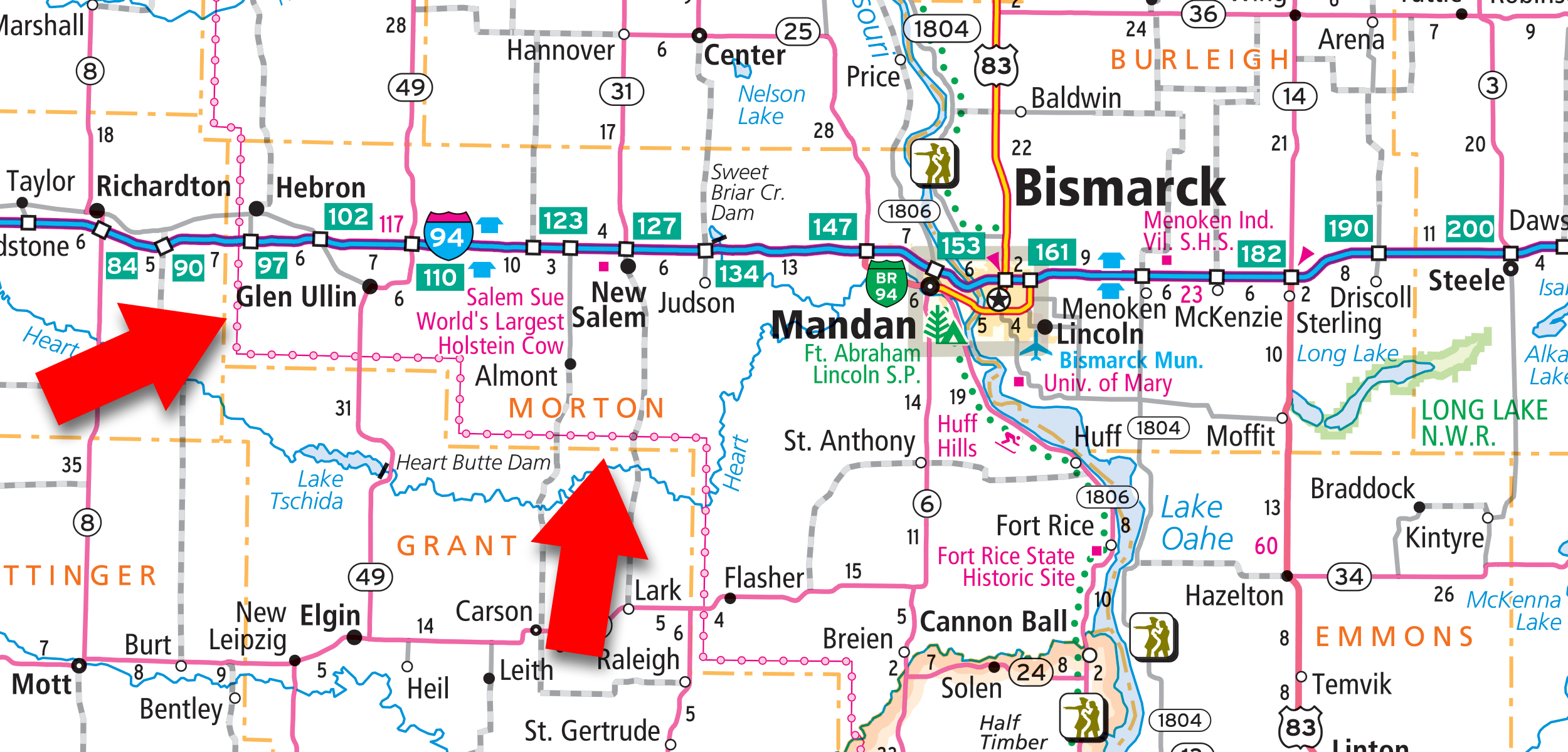 One last comment on time zone boundaries. You will notice in the map image above the red time zone line is offset from the orange county line. We do that so it is easier to follow both sets of lines on the map, but in reality the time zone line follows the county line in this instance. Just wanted to point that out in case you were wondering.
Thanks again for the question and hopefully I was able to provide some insight on time zone boundaries and how standards and policies from 75 years ago are not much different than those we use today! Feel free to submit your map or cartography questions below and check back next Tuesday for another installment of "Ask a Cartographer".
Have a question for our cartographer? Email us at printproducts@randmcnally.com with “Ask a Cartographer” in the subject line and your question could be featured next.


