
Navigating the Terrain
Embarking on a journey through unknown territory often invites the age-old debate between relying on traditional paper maps or on the modern convenience of GPS systems.
Each option comes with its own set of benefits and drawbacks, making the choice not as straightforward as one might think.
Traditionalists swear by the reliability of paper maps (no need to worry about dropped signal or low battery), while tech enthusiasts may champion the dynamic and real-time updates of GPS technology.
This comprehensive guide aims to illustrate the pros and cons of both navigation methods, helping you make an informed decision for your next adventure.
Key Takeaways
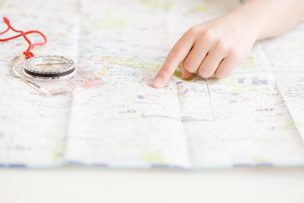
●Paper maps enhance spatial awareness and navigation skills unlike GPS.
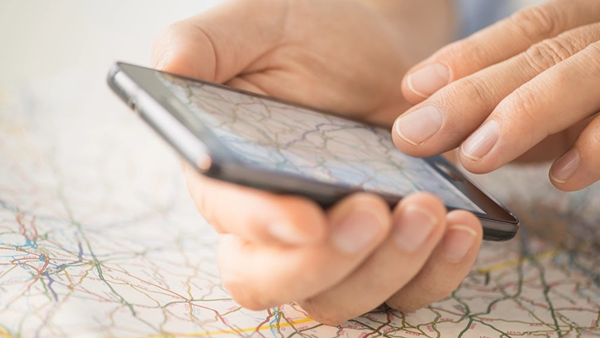
●GPS technology offers real-time location tracking and turn-by-turn navigation, enriching travel experiences.
●The reliability of paper maps in areas without digital connectivity highlights their value for explorers.
●Integrating GPS technology with traditional navigation skills ensures a comprehensive navigational toolkit.
●The future of navigation involves a balanced use of both digital and analog methods for effective exploration.
Benefits of Traditional Paper Maps
In an era where digital navigation dominates, the timeless value of traditional paper maps often goes unheralded.
Yet, these analog tools offer unique advantages that contribute significantly to our understanding of the world and our place within it.
From enhancing spatial awareness and navigation skills to providing reliable guidance in areas devoid of digital connectivity, paper reading maps bring an irreplaceable dimension to exploration and learning.
They serve not just as a tool for finding our way, but also as an educational resource for teaching geography, encouraging a deeper engagement with the physical landscape around us.
As we delve deeper into their benefits, it's clear that paper maps hold more than just nostalgic value—they are a fundamental component in developing a comprehensive understanding of navigation, reading maps, and geography.
Understanding the Timeless Value of Paper Maps
Paper maps, like those published by Rand McNally, have served as steadfast navigational companions long before the advent of the global positioning system (GPS). The tactile experience of unfolding a map, tracing routes with a finger, and deciphering symbols enriches the journey, making it more of an interactive experience than merely reaching a destination. Studies have found this direct engagement enhances memory retention and spatial orientation.
If we don't actively use our brains, especially as we grow older, our memory can decline. Neuroscientists believe that one of the secrets to aging well is to keep our minds active. Research has shown that activities like exploring new places and navigating spaces can actually strengthen the part of the brain responsible for memory, known as the hippocampus. For instance, London taxi drivers, who are constantly navigating through the city, have been found to have larger hippocampus than the average person due to their extensive experience with spatial navigation.
So, with the importance of navigation for brain health in mind, it's worth questioning why we often let our smartphones take over this task. Using GPS apps to get from point A to B turns us into passive followers rather than active participants in our journey. This reliance on technology doesn't just strip us of the chance to make our own choices; it also prevents us from developing a detailed mental picture of our surroundings, which is key for a healthy hippocampus.
While technology certainly makes our lives easier in many ways, it's important to remember that it can also affect our brain's health. Our aim should be to use technology in a way that supports our brain's needs and enhances our interaction with the world around us, rather than diminishing it.
How Paper Maps Enhance Spatial Awareness and Navigation Skills
Spatial awareness is the ability to understand and interact with our environment in terms of the location and relationship of objects within it. Using paper maps promotes this skill by requiring us to actively engage in locating positions, plotting routes, and assessing distances, unlike the passive navigation offered by digital maps. This hands-on mapping effort boosts our brain's capability in visualizing spatial relationships, essential for effective navigation and cognitive health. It involves interpreting map symbols and geographical features, enhancing our ability to make informed decisions in navigating. Thus, paper maps don't just aid in physical navigation; they enhance our cognitive well-being by fostering a deeper, active understanding of our surroundings, ultimately improving our spatial awareness.
The Reliability of Paper Maps in Areas With No Digital Connectivity

In places where there's no internet or phone signal, paper maps become very important for explorers and travelers. Maps like those we publish at Rand McNally are especially useful because they help people find their way in areas where you can't rely on digital navigation.
| Feature | Paper Maps | GPS |
| Connectivity Requirement | None | Dependent on signal or internet connection |
| Reliability in Remote Areas | High | Variable |
| Impact on Spatial Skills | Enhances understanding and orientation | May reduce engagement with physical navigation |
| Operational Lifespan | Enduring as long as the paper lasts | Limited by device battery and electronic durability |
When venturing into regions beyond the reach of satellites and cellular towers, the value of a reliable Rand McNally Road Atlas becomes immeasurably clear. With these atlases, travelers not only chart a course across unfamiliar landscapes, but also engage in an educational odyssey, enriching their understanding of geography and cartography without the crutch of modern technology.
Paper and Reading Maps Cognitive Benefits
Reading maps and practicing navigation skills have significant benefits for the brain. Engaging with maps stimulates the hippocampus, a part of the brain involved in spatial orientation and memory. This activity can lead to increased mental agility and memory capacity.
Exploring how navigation affects our brains, research suggests that traditional map reading and finding our way in new areas can significantly boost our spatial orientation skills. Such activities encourage the growth of the hippocampus, a part of the brain involved in memory and navigation, as we learn to create and use mental maps. This mental exercise can lead to increased mental agility and an enhanced capacity for memory.
There's concern about the heavy reliance on GPS for navigation. Studies have found that using GPS doesn't engage the hippocampus in the same way, potentially leading to less brain activity in this critical area over time. Unlike the active mental mapping stimulated by traditional paper maps, GPS use could mean our spatial orientation skills and memory capacity might not get the same workout, potentially impacting our cognitive abilities in the long term.
To prove this, a study highlighted on Geography Realm shows that people who frequently use maps and navigate through unfamiliar areas can enhance their spatial orientation skills and grow their hippocampus as they form and recall mental maps.
Overall, studies have found that paper maps:
●Stimulates the hippocampus
●Increases mental agility and memory capacity
●Enhances spatial orientation skills
Paper Maps as an Essential Backup in Technology-Free Scenarios

When there's no technology around, paper maps become very important. They help you find your way when you can't use your phone or other devices, because they don't need a battery or a signal. This makes paper maps a must-have for explorers and travelers exploring more remote places.
Paper maps let you see where you are and where you're going without any gadgets, which is great when you need to save battery power. They keep you on track in new or tough places, even when you don't have your usual tech tools.
Developing Navigation Skills Without Digital Aids
Developing navigation skills without digital aids creates a deeper connection to the environment and strengthens essential survival instincts. By relying on traditional methods such as reading a paper map or using a compass, people build a better sense of direction and spatial awareness.
Using these types of navigation tools encourages a comprehensive understanding of the land, and also promotes a more intuitive grasp of distances, landmarks, and topography:
1.Learn to identify natural landmarks and navigational clues in the environment.
2.Calculate distance using scale and understand map symbols.
3.Increase mental mapping capabilities through observation and memory.
Because electronic devices are sometimes prone to fail, being able to use paper maps is helpful to create independence from technology and ensure reliability. Adventurers are able to gain confidence to explore new lands and find their own way.
The Importance of Blending GPS Technology With Traditional Navigation Skills
To get around efficiently using both maps and GPS, it's smart to first make a game plan using a paper map. This lets you get the big picture and understand the lay of the land in detail. Once you've got that down, you can switch to GPS to guide you with its up-to-the-minute directions and updates, giving you the best of accuracy and convenience.
Many Rand McNally customers tell us they use their Road Atlas to help plan their trip, then use their GPS for step-by-step directions while driving, but keep a paper map handy as a backup, especially in places where they might lose signal or their battery dies. This way, they are familiar with the route and more in tune with their surroundings. It's a great way to blend the ease of technology with the solid skills of traditional map reading.
This hybrid approach to navigation demonstrates an understanding that while GPS technology offers unparalleled convenience and real-time data, the foundational skills learned from traditional map reading, such as spatial awareness and topographical interpretation, are invaluable. It reinforces the principle that true navigational prowess stems from being adaptable and proficient with both digital and analog tools.
Why does Rand McNally like paper maps?
Using paper maps along with a GPS device or other electronic map tools can be beneficial. According to Tom Vitacco, Director of GIS at Rand McNally Publishing:
“In general I believe our customers use a paper map in conjunction with their GPS device for two main reasons:
1. GPS devices, whether it is a cell phone, tablet or a dedicated device, can run out of power or lose signal, so a printed map serves as a reliable backup and reference. Especially in rural areas or for hiking and outdoor adventures.
2. The ‘big picture’ view offered by a paper map is often superior to the small screen of a GPS, phone or tablet. A good quality paper map shows appropriate map content at a fixed scale which is often useful for planning a trip, finding new and interesting places to visit, calculating distances, finding rest areas along the way and deciding on multiple route options all at a single glance."
Frequently Asked Questions

What are the advantages of using traditional paper maps over GPS systems?
Traditional paper maps, like those meticulously detailed Rand McNally Atlases, offer invaluable lessons in spatial reasoning and map-reading skills, fostering a deeper understanding of geography. Unlike GPS systems, they require no internet connection or signal, ensuring reliability in remote areas where digital navigation may falter.
How has GPS technology evolved over time and what are the benefits it offers?
GPS technology has evolved dramatically from bulky, expensive units that were once exclusive to military and aviation use, to the compact, user-friendly devices integrated into almost every smartphone and vehicle today. This evolution has brought about unparalleled benefits, including real-time turn-by-turn navigation, global coverage, and the ability to pinpoint exact locations with precision, enhancing safety, efficiency, and convenience in travel and transportation.
In what scenarios can relying on paper maps be more reliable than GPS technology?
Relying on paper maps often proves more reliable than GPS technology in scenarios where there's a limited or nonexistent internet connection, such as remote wilderness areas or when traveling through extensive mountain ranges. Additionally, in regions where digital maps might not be updated with the latest road changes or detours, the detailed, manually curated information available in a Rand McNally Road Atlas can provide a more accurate guide to your surroundings.
When should you use a GPS in addition to your atlas?
You should use a GPS along with your atlas when you need up-to-date information, such as traffic updates or finding the fastest route. A GPS is really handy for step-by-step directions in real time, especially in unfamiliar places. But an atlas is useful for getting a big picture of where you're going and understanding the layout of the land. Using both helps you plan better and stay informed while you're on the move.
When is it best to use maps or GPS for navigation based on specific circumstances?
The choice between using maps or GPS for navigation largely depends on the circumstances, such as the availability of an internet connection and the level of detail required for the journey. Maps are often preferred in areas with poor signal reception or when a comprehensive overview of the terrain is needed, while GPS is ideal for real-time navigation and traffic updates.