

In the age of GPS and smartphones, the art of map reading might seem like a lost skill.
Yet, whether you're traversing the wilds of Alaska or hiking in a national park with no signal, the right map can be your most reliable companion.
With an array of options from the detailed cartography of our Rand McNally Road Atlases to the dynamic layers of digital maps, knowing how to choose and use the right map becomes a vital part of planning any journey.
This guide aims to arm you with the knowledge to select the best maps for different types of adventures, understand universal map symbols, and leverage modern tools to enhance your exploration experience.
Keep reading to discover how to navigate your world more effectively, blending tradition and technology.
Key Takeaways
●Identifying your travel goals is crucial in choosing the right map for your journey
●Rand McNally Atlases provide detailed geographic information catering to various travel needs
●Understanding map symbols and scales is essential for effective navigation
●In the digital age, GPS and offline map features enhance navigation, but don't entirely replace the value of paper maps
●Custom map software and satellite imagery offer advanced tools for personalized and informed travel planning
Understanding Map Types for Different Journeys

Whether planning an epic road trip across the U.S. using a Rand McNally Road Atlas or preparing for a wilderness hike where topographic maps are indispensable, the process requires matching the right map types with specific needs.
This not only streamlines navigation, but also enhances the journey's safety and enjoyment.
Through exploring various travel scenarios, such as road trips versus wilderness hiking, one gains insight into how different maps serve diverse purposes, equipping travelers with the necessary tools to navigate their world with confidence.
Identifying Your Trip Type and Matching Maps with Your Needs
Identifying the type of trip you’re taking is the first and possibly most crucial step in choosing the right map for your journey. This clarity helps in narrowing down the vast array of available maps to those that best suit your specific needs.
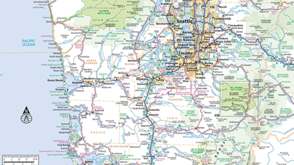
Different journeys require different details from a map. Rand McNally Atlases, renowned for their precision and detail, offer a range of options catering to different needs. A road warrior plotting a cross-country adventure would find the comprehensive U.S. Road Atlas invaluable with its detailed highway systems, points of interest, and state-specific features. Conversely, explorers embarking on backcountry treks might lean towards topographic maps that present a three-dimensional perspective of the terrain, essential for understanding the landscape’s contours and planning routes accordingly.
Navigating the bustling streets of a major city calls for a detailed street map, while the vast expanse of the ocean necessitates nautical charts that highlight coastal areas, depth contours, and navigational hazards.
This decision-making process is key to selecting a map that not only provides the necessary geographical information, but also complements the travel experience.These differences underline the importance of mapping out your travel intentions before moving on:
1.Understand the nature of your journey: road trip, wilderness exploration, urban navigation, or overseas travel.
2.Assess the level of detail needed: highways and rest stops for drivers; trails, elevation, and water sources for hikers.
3.Consider the mode of travel: by car, on foot, by boat, or by plane.
| Trip Type | Map Type |
| Hiking Trip | Topographic Map |
| Road Trip | Road Atlas |
| City Trip | Detailed Street Map |
| Sailing Trip | Nautical Chart |
Planning a cross-country road trip? You’ll want one of our 4 road atlases depending on your preferences:
If your eyes strain when you read small print: Large Scale Road Atlas: This spiral-bound, updated 2025 Large Scale edition contains maps of every U.S. state, Canada, and an overview of Mexico, that are 35% larger than the standard atlas version. The atlas also includes detailed inset maps of 375 cities and 28 national parks, plus a comprehensive, unabridged index. Plus, the spiral binding allows the book to lay open easily.
If you want large print, but a more compact size:Mid-Size Easy to Read Road Atlas:This spiral-bound midsized atlas contains updated, easy-to-read, large print maps of the U.S., Canada, and Mexico, plus detailed maps of over 50 North American cities, in a convenient travel size that fits in a glove box. The spiral, stay-flat binding allows the book to lay open easily. Because of its smaller trim size, the maps are not as detailed as the other three editions.
If you want something that’s more portable than the spiral-bound atlases and also more detailed than the Mid-Size Easy to Read Atlas:
Road Atlas: This staple-bound Road Atlas contains maps of every U.S. state and Canadian province, an overview map of Mexico, and detailed inset maps of over 375 cities and 28 national parks. It’s lighter and easier to handle when traveling than the Large Scale Road Atlas and the maps are more detailed than the Midsize Easy to Read Road Atlas.
If you’re planning a trip to a national park:Road Atlas and National Park Guide: Showcasing this country's astonishing beauty, the Rand McNally Road Atlas & National Park Guide is packed with hundreds of photos, essential visitor information, and insightful travel tips for all 63 of America's national parks.
Planning a shorter road trip within one state?
Planning a short road trip within one state:
You may want to buy individual state fold maps because they have more map detail than the Road Atlas version of the state and sometimes include additional city inset maps which can only be found in the paper version of the state fold maps. Plus the smaller size fits easily in the glove compartment or seat pocket of the car.
Looking for a durable, foldable map:
The laminated state maps (Easy to Fold) are the exact same maps found in the Road Atlas, just in a laminated format so they are convenient, waterproof and easy to fold, while also offering the same exact detail as the state maps found in the Road Atlas products.
Planning a wilderness hike?
Choose one of the DeLorme topographical atlases which are available for each state. With an incredible wealth of detail, DeLorme's Atlas & Gazetteer is the perfect companion for exploring the outdoors. Extensively indexed, full-color topographic maps provide information on everything from cities and towns to trailheads, boat ramps and prime fishing spots.
Decoding Map Symbols and Legends
Mastering navigation must include understanding the basics of map symbols that help identify both natural and man-made features, and understanding how scale and distance are represented.
Increasing knowledge of topographic and terrain features on a map is important for comprehending the challenges and opportunities of a trip, so the explorer can gain an idea about the three-dimensional aspects of a landscape.
Acquiring these skills not only augments the navigation experience, but also ensures travelers can make informed decisions, transforming map reading from a task into a tool for unlocking the world’s secrets.
Learning the Basics of Map Symbols
Symbols serve as the shorthand of cartography, allowing Rand McNally and other cartographers to depict complex landscapes and man-made features using simple, universally recognized icons.
For the navigator, understanding these symbols unlocks the ability to swiftly read and interpret the foundational elements of terrain, such as bodies of water, types of vegetation, urban areas, and elevation changes. This skill transcends basic navigation, enhancing one's capacity to engage with the geographic narrative of an area, thus enriching the overall traveling experience.
Understanding Scale and Distance
Grasping the concepts of scale and distance is pivotal in effectively leveraging maps for navigation. The scale of a map, often represented as a ratio or graphical bar, directly influences how a traveler interprets the distance between two points: the real-world distance represented on a map might span hundreds of miles or just a few feet, depending on the map’s scale. This understanding allows travelers to estimate travel times and distances accurately, a crucial aspect of journey planning.
Maps employ a variety of scales to convey distances, with each serving a different purpose based on the map's intended use. For road travelers using a Rand McNally Road Atlas, scales suitable for long distances highlight essential details like highways and rest areas. Conversely, hikers might rely on maps with a more granular scale that depicts subtle terrain features and elevation changes, guiding them safely through challenging landscapes. Knowing how to interpret these scales ensures a more informed and prepared navigation experience:
| Type of Map | Scale | Use Case |
| Rand McNally Road Atlas | Varies by state; average 1:1,000,000 | Long-distance road travel |
| Topographic Map | 1:24,000 | Detail-oriented outdoor activities |
Let's break it down with a couple of examples:
Rand McNally Road Atlas: Think of this as your go-to guide for long road trips across the country. Map scales in the Road Atlas vary by state. Check the verbal scale which says “One inch equals ___ miles” to tell you the scale of the map. The average scale of the road maps is 1:1,000,000, which means the map simplifies a lot of details to help you see the big picture. This scale makes it perfect for understanding how to get from one city to another but not great if you're trying to find a specific street in a town.
Topographic Map: This is the map you want when you're going on an outdoor adventure, like hiking or camping. With a scale of 1:24,000, it offers a much closer look at the landscape. This means you can see all the little details like hills, valleys, trails, and even small streams. It's super useful when you need to know what the terrain is going to be like or find your way around in nature.
In simple terms, the Road Atlas helps you see the forest, while the topographic map helps you see the trees. Depending on your activity - planning a road trip or heading into the wilderness - you'll choose your map based on what you need to see and understand about your journey.
Interpreting Topographic and Terrain Features
Interpreting topographic and terrain features on maps opens the door to a deeper understanding of the landscape before you even set foot on the ground. These maps, often detailed with contour lines, illustrate the elevation and slope of the terrain, thereby allowing travelers to visualize the three-dimensional aspects of their surroundings. This knowledge is vital for assessing the difficulty of a trail, planning the safest routes, and identifying potential viewpoints or landmarks that could enhance the journey.
Mastery of terrain features through topographic maps, such as the DeLorme maps sold by Rand McNally, equips adventurers with the ability to navigate challenging environments with confidence. By interpreting the spacing of contour lines, one can discern steep gradients from gentle slopes, offering insights into the physical effort required to traverse different parts of the landscape. This layer of understanding transforms map reading from a simple task into a strategic tool for adventurers aiming to fully engage with the natural world around them.

How Paper Maps Complement Digital Navigation
In an era where technology continually reshapes our approach to daily tasks, the realm of navigation and travel experiences is no exception.
Digital maps, evolving beyond mere electronic versions of their paper counterparts, now offer a suite of functionalities designed to enhance the journey of every discerning traveler. From real-time updates and alerts to the ability to download maps for offline use, these features collectively represent a significant leap forward in mapping technology, bridging the gap between traditional cartography and the dynamic needs of modern exploration.
While digital maps offer real-time updates, alerts, and GPS location tracking, enhancing the travel experience with their convenience and safety features, paper maps hold distinct advantages that make them superior or, at the very least, an excellent complement to their digital counterparts.
- Paper maps provide a broader, uninterrupted view of an area. They allow travelers to see the bigger picture without the need to zoom in and out or scroll around, as is often necessary on digital devices. This comprehensive perspective can help with route planning and understanding the geographic context of a destination, fostering a deeper connection to the place being visited.
- Paper maps are reliable and do not depend on battery life or internet connectivity. In remote locations where digital devices might fail due to lack of signal or power, a paper map remains a steadfast navigational tool. This reliability can be crucial in emergency situations or when exploring off-the-grid areas, offering peace of mind that technology cannot always guarantee.
- Using paper maps can enhance spatial awareness and navigation skills. The act of reading a map and orienting oneself fosters a skill set that is becoming increasingly rare in the age of turn-by-turn navigation. These skills can be invaluable in situations where technology fails or when trying to communicate directions to others without the aid of digital devices.
- Paper maps can serve as unique souvenirs and educational tools. Unlike digital maps, a paper map can be annotated, folded, and kept as a memento of an adventure. It can also be a way to engage more actively with the landscape, noting points of interest, paths taken, and personal observations. For children and adults alike, the tactile experience of handling a map can stimulate learning and curiosity about geography and cartography.
Rand McNally customers love using their paper maps in conjunction with their digital maps.
There are lots of people who like mapping on their phones, or even the internet. But if you really want to see where you are or want to go, this paper Atlas is the best read. It shows every route…if you want to plan a long car trip this Atlas cannot be beat.
-5-Star Amazon Customer Review
I love this Road Atlas. In this modern day electronic maps are OK but sometimes I need to see the whole country at once and the small screens just don't do it. Great atlas to put in the car and hit the road!
-5-Star Amazon Customer Review
In summary, while digital maps offer unmatched convenience and real-time functionalities critical for modern travel, paper maps possess qualities that digital platforms cannot replicate. Their provision of a broad, uninterrupted view, reliability in all conditions, ability to enhance navigation skills, and value as educational and sentimental objects make them not only superior in certain aspects but also an invaluable complement to digital mapping tools. Together, they offer a complete toolkit for travelers seeking to navigate the world more effectively and enrich their travel experience.
The Reliability of Paper in Remote Areas
The reliability of paper maps in remote areas cannot be overstated. In locales where digital signals fade into the wilderness, a paper map stands as a beacon of guidance and assurance, unfazed by the lack of internet connectivity or GPS signal. This characteristic makes paper maps an indispensable resource for adventurers who venture beyond the confines of cellular coverage, providing a level of dependability that digital formats struggle to match.
Learning to Read a Physical Map Compass
Mastering the skill of reading a physical map and using a compass is akin to unlocking a timeless method of navigation, one that does not rely on modern technology or fleeting battery life. The ability to decipher landscape features, interpret map symbols, and correctly align oneself with cardinal points fosters a fundamental connection with the environment, enhancing both the journey's safety and its enjoyment.
This traditional skill set also encourages a distinct kind of spatial awareness, encouraging travelers to engage more deeply with their surroundings and develop a keener sense of direction. Alongside a physical map, a compass acts as a dependable guide through thick forests, mountain passes, and vast deserts, offering clarity and confidence in the most remote corners of our world:
| Navigation Tool | Benefit |
| Physical Map | Provides comprehensive geographical details without the need for power or signal. |
| Compass | Enables accurate orientation and direction finding, enhancing map reading efficiency. |
Planning and Marking Routes on Paper
Planning and marking routes on paper before embarking on a journey offers an unparalleled level of preparation and personalization. This hands-on approach enables travelers to highlight routes, pinpoint landmarks, and note alternative paths, effectively creating a customized travel guide tailored to their unique adventure. The tactile process of marking a paper map not only aids in visualizing the journey but also serves as a tactile memory aid, enhancing recall and spatial understanding.
Engaging with a physical map to plan and mark routes fosters a deeper connection between the traveler and their destination. It encourages a thoughtful consideration of the terrain, distances, and key features of the area being explored: a critical step in journey preparation that digital maps can sometimes gloss over due to their automated nature. The act of plotting a course by hand, armed with a pen and a Rand McNally Atlas, embodies the essence of personal adventure planning, merging anticipation with strategic preparation.
●Highlighting preferred routes and noting landmarks personalizes the travel experience.
●Marking alternative paths ensures readiness for unexpected journey adjustments.
●The tactile process of engaging with a physical map aids memory and spatial awareness.