
Lost in longitude or confused by contour lines? Want to know all the tips and tricks for getting the most out of your atlas? Curious if paper towns still exist? "Ask a Cartographer" is your opportunity to get the facts straight from the source. Tom Vitacco, Rand McNally Publishing’s Director of GIS is here to answer your burning questions, and geek out over fascinating map lore – one exploration at a time.
This week, we are discussing whether or not I actually use GPS…
Question: "As a cartographer, do you use GPS?"
Tom’s answer: Great question! You might assume my answer to this question would be yes since I work in the mapping field, but in general I do not use GPS except for in certain situations. I will do my best to explain what I mean by that statement in this post. Also, when I mention GPS, I am referring to turn-by-turn directions or routing applications for the most part.
Why I do not use GPS
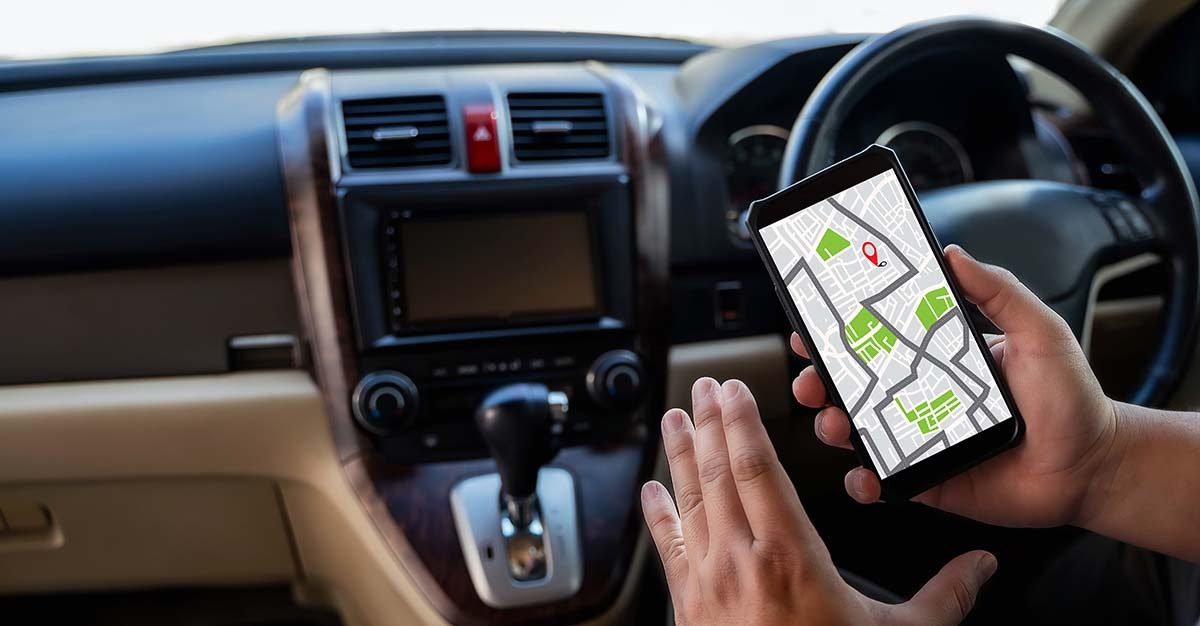
As my family can attest, there are a couple of reasons why I rarely use GPS or routing apps on my daily commute or while traveling. First, I have always had a very good sense of direction and understanding of where I am at any given time. I learned to drive before GPS was really a thing and relied on verbal directions and paper maps to get around. Plus, I tend to be observant by nature which can be a beneficial trait for navigation. I guess I just prefer to trust my own instincts and planning when I am in unfamiliar places or on the road. The stock photo below is probably a good representation of what I look like when I travel with a paper map in hand!

Instead of using a GPS as a guide when I travel, I prefer the old school approach described below, which works for me. When I am heading to a new place or destination, the first thing I do is look at a map, like the Road Atlas, or even an online map if I have an address. I do this to get my bearings as well as an overview of the area in general, and to figure out a route visually. The road hierarchy in the Road Atlas helps me plan my route and offers some visual clues to watch out for along the way. I often take notes or type up a doc when I first check out the location or route I am going to take. Again, the stock photo below is probably what I look like when I plan for a trip.
 No GPS required
Here is an example to clarify what I mentioned earlier. Let’s say a friend called and asked me to help them move to a new house in Waukesha, WI – a town I have never visited. They plan to meet me at the new house at 233 Park Ave. My first step would be to grab my Road Atlas, open it to the Wisconsin map, and locate Waukesha. I see it is a western suburb of Milwaukee (see image below).
I am leaving from the northwest suburbs of Chicago, so I quickly plan a mental route following US 12, Interstate 43, then WI 164 because I notice it is a four-lane highway on the state map. Basically, I visualize the route in my head after reviewing the paper map and try to follow the route from memory. I think this type of exercise is good for your brain as well (more on that later).
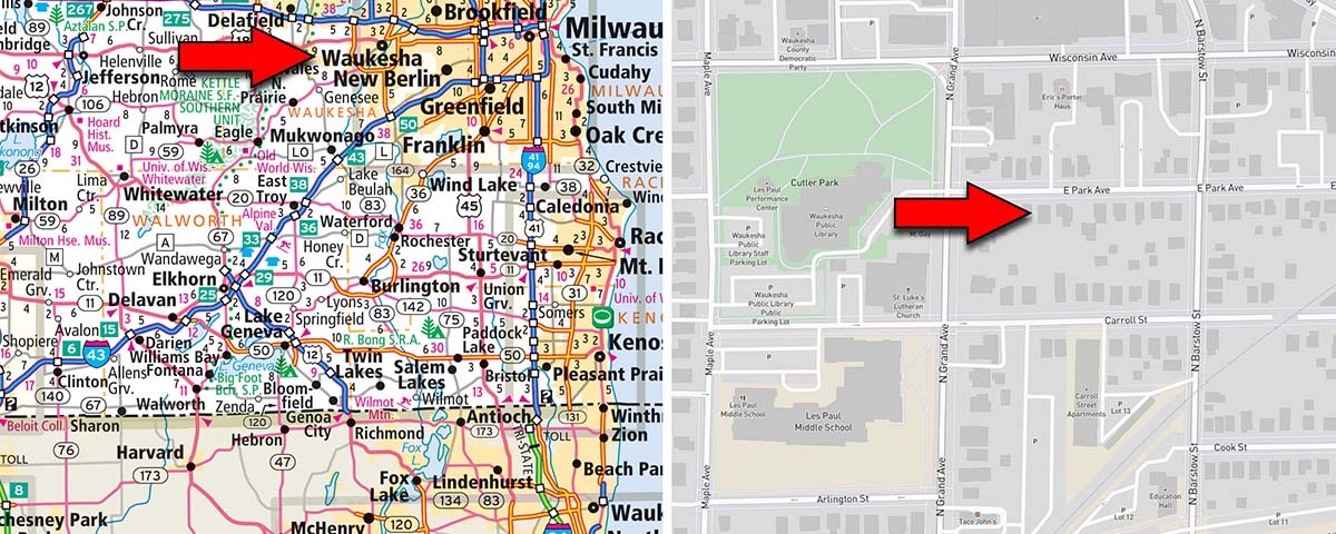
Pictured: Waukesha, WI location in the Road Atlas and the address location from an online map.
Since I have the address, I will find my destination via an online map engine to visualize the nearby streets while mentally noting some key landmarks or points of interest along the route. I do not consider using an online map the same as using GPS because I am using the online map as a reference, just like the printed state map, but not using it to route me to the address.
I believe spatial awareness has a visual component that is key to understanding where you are at any given time. I do pay a lot of attention to what I see along the way when I visit a new location for the first time. After checking out both maps, I feel confident I can navigate to the new house without GPS. Sure, I could just plug in the address and have an app tell me where to go, but I trust myself more and do not feel turn-by-turn directions are needed in this scenario.
 I should point out, however, that I sometimes run a route just to check the traffic and often notice the GPS route is not what I planned in my head. I will quickly scan for “red areas” on the map indicating heavy traffic, road construction, or possibly an accident. So, when I mentioned above that there are certain situations where I do use GPS…this is what I meant. Basically, I use it to check for heavy traffic.
“You do not use GPS because you are too old…”
I have heard the quote above many times in my life, but it really has nothing to do with my attitude towards using GPS. For background, I have been a cartographer for almost 40 years, starting right before the digital revolution in the GIS and Cartographic industries, so my early training focused on paper maps and materials. Computers were just starting to infiltrate the coursework at the time, but it was not until I started my career at Rand McNally that I was introduced to digital cartography, GPS and online mapping. I feel fortunate to have experienced both the manual and digital sides of cartography over the years and my early training in manual techniques was definitely influential as I began to use more digital mapping tools and processes.
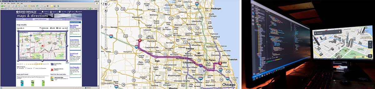 During my career, I have worked on every major digital mapping and GPS project that Rand McNally produced. Starting with the original online Maps & Directions website in the late 90s which continued until recently, plus the company’s first attempt at a consumer GPS in 2006, and eventually the Truck GPS devices still in production today. I have manipulated the map data, helped test the routing systems and was the cartographic designer who implemented the map specifications for most of these projects. I am very familiar with map data and how GPS systems function, so the reason I do not use GPS has nothing to do with me not understanding the technology or how the routing engines work. In fact, I think these systems are helpful to many people and I do not have any problem with those who choose to use GPS. For me, I just prefer the old-school methods of reading a map and planning the route on my own.
The benefits of paper maps for your brain
One last point on this topic. There have been some recent studies suggesting that reading maps or navigating without GPS is better for your brain health and I tend to agree with this sentiment. The studies focused on the part of the brain associated with memory, navigation and the perception of time, and the researchers found that when we rely solely on GPS we stop exercising this important part of the brain. I found the study very interesting, especially how it might relate to mental health in the long term, and feel it supports some of the topics mentioned in this post. So, the next time you decide to have a GPS tell you where to go, maybe turn it off, pull out a Rand McNally Road Atlas, and plan your route the old school way!
Thanks again for the question! Feel free to submit your map or cartography questions below and check back soon for another installment of "Ask a Cartographer".
Have a question for our cartographer? Email us at printproducts@randpublishing.com with “Ask a Cartographer” in the subject line and your question could be featured next!