
Lost in longitude or confused by contour lines? Want to know all the tips and tricks for getting the most out of your atlas? Curious if paper towns still exist? "Ask a Cartographer" is your opportunity to get the facts straight from the source. Tom Vitacco, Rand McNally Publishing’s Director of GIS is here to answer your burning questions, and geek out over fascinating map lore – one exploration at a time.
This week, we are discussing how to read a road map…
Question: I saw National Read a Road Map Day is Saturday. Can you explain the basics of how to read a road map?
Tom’s answer: Thank you for the timely question. You are correct in that “National Read a Road Map Day” is Saturday, April 5th. This unofficial holiday is a throwback to the “olden days” before online maps and directions, GPS devices, or your phone telling you where to go.
Hopefully you will take advantage of this unique day and put down the phone or turn off the GPS, then pick up a Rand McNally Road Atlas or even a State Map and follow along with all the detailed information we provide on our maps. There is nothing like driving down the open road with a trusted map to guide you on your journey.

The very first “Ask a Cartographer” blog discussed “how to use a road atlas”, so if you are interested in viewing the post again, here is the link. As a cartographer, I can definitely offer some tips and practical advice on reading a road map or atlas, since these types of maps have been our specialty at Rand McNally for more than 100 years! Map reading is a useful skill that anyone can learn, and it can be helpful whether you are viewing a map in print or on a digital platform.
Simple Map Elements
The art of reading a map is quite easy, especially once you comprehend map elements such as the legend, index, table of contents (if applicable), travel information, compass rose or north arrow, and a map scale. In the past, when someone would ask me to teach them how to read a map, I would always start with the “simple map elements” highlighted below, then move on to the map details.
The first item is the map legend, a key part of any map or atlas in my opinion. Recognizing the map symbology is crucial to understanding what you are looking at when you view a map or atlas. A good map legend displays all the different types of map content you will encounter and offers a brief explanation of each item. Without a legend, the icons or colors on the map would be meaningless, leaving the user to guess what different features represent. In general, checking out the map legend and learning the symbology is a good first step in learning how to read a map.
Next is the index, which is often at the back of an atlas or in close proximity to the map on an individual state, city or park map. The index helps you identify where a place, point of interest, or park appears on the map. Sure, you can just browse the map and discover places, but if you want to quickly pinpoint a location, the index is extremely helpful. Usually, the place is listed with a reference to the grid position on the map. For example, Rand McNally maps use a “letter and number” combination for the index references.
Also, if you are looking at an atlas, there should be a table of contents near the beginning which lists all the maps and their associated page numbers. Often customers do not look at the table of contents, but in reality it is one of the fastest ways to find the map you are searching for, so I highly recommend using this reference when using an atlas. Plus, it provides a comprehensive list of all the maps included within the atlas, which is valuable information as well.
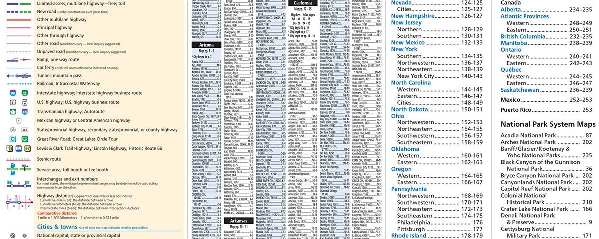
Pictured: Examples of the map legend (left), index (center) and table of contents (right) from the Road Atlas.
Another often overlooked but equally important map feature is the travel information provided along the margins of the page, which is usually found in an atlas but can also be included on a stand-alone map title. Rand McNally is the only major map publisher to add a large quantity of information on the page, which includes important phone numbers, websites, distances between cities and along interstates, plus state facts and even whether the state is part of the 511 system, the single traffic information telephone number system set up by the government. Although this information does not help with reading the map directly, I wanted to point out that we do include these helpful details in our products.
Pictured: Travel information included in the page margin from the Road Atlas.
The last two simple map elements I will mention are the compass rose or north arrow and the map scale. Most maps contain a north arrow or compass rose graphic, allowing the user to know which way is north as they use the map on the road or during a hike for example. Although most maps are designed with north facing up, not all maps are as you can see in the South Carolina example below from the Road Atlas. While the state map is facing north, the inset maps for Myrtle Beach and Hilton Head Island are not so the included north arrow is helpful for orientation.
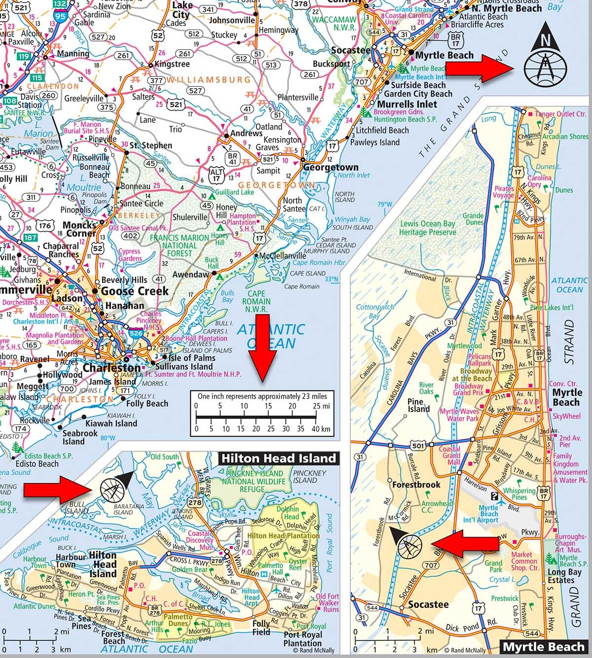
Pictured: Three different north arrows are shown on the South Carolina map in the Road Atlas, along with a detailed map scale graphic showing that one inch on the map is approximately 23 miles in reality.
Additionally, almost every map will include a scale graphic (shown above with red arrow), providing a ratio of map distance to actual distance. which enables the user to calculate distances between two places or features on the map. You can use your finger or a piece of scrap paper to measure the length of the scale, then apply the measurement to your route or compare the distance between two cities or points of interest. Some maps include mileage numbers on the map which also help with distance calculations, and I will briefly talk about these numbers in the next section.
Once you understand the simple elements, you can immerse yourself in the details of the map itself and become a true “map reading” expert.
Detailed Map Elements
Now that you understand the simple map elements, we can discuss the concepts with a real example. In this scenario, two friends are driving west on I-10 in Texas and suddenly the driver needs to use the bathroom, so the passenger reads the map to decide where to stop.
The cropped map image of Texas from the Road atlas shown below provides a lot of detailed and useful information in this situation highlighted by the red arrows. First, the map shows the distances between not only cities, but also interchanges and towns. You will notice two small red triangles which indicate cumulative miles between the icons and the actual mileage numberunderstand their surroundings at a glance and the relative distances between places and locations of interest.s shown by the red numbers 39 and 22. The small black numbers also show more detailed mileage distances, so the user can quickly determine distances by reading the red and black numbers on the map or use the map scale to calculate the distance themselves.
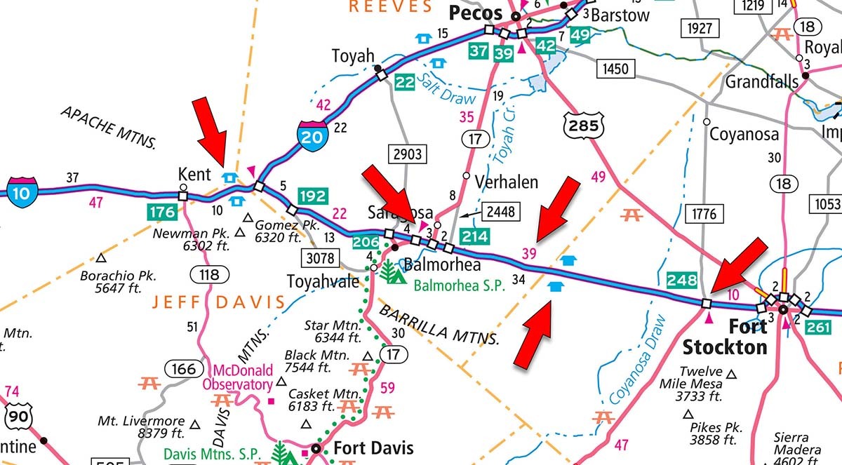
Pictured: The red arrows highlight important and helpful navigational features on a Road Atlas map.
Next, the navigator searches for a rest area, displayed on the correct side of the road on the map. According to the map legend, the “solid blue house symbol” implies a rest area with bathroom facilities and the “hollow blue house symbol” means the rest area does not have bathrooms, a particularly important distinction in this scenario. So, the navigator decides that the rest area shown halfway between the red triangle icons is the right place to stop, making the appropriate choice after reading the map, recognizing the symbols from the legend, and understanding distances and the map scale. This is just one simple example of how map reading skills can prove valuable on the road.
Rand McNally maps contain a lot of useful travel information and learning to read a map can be an empowering skill to help travelers make the most of their road trips. Paper maps provide the “big picture” view that you just do not get from digital maps, offering the user a chance to get more context around where they are.
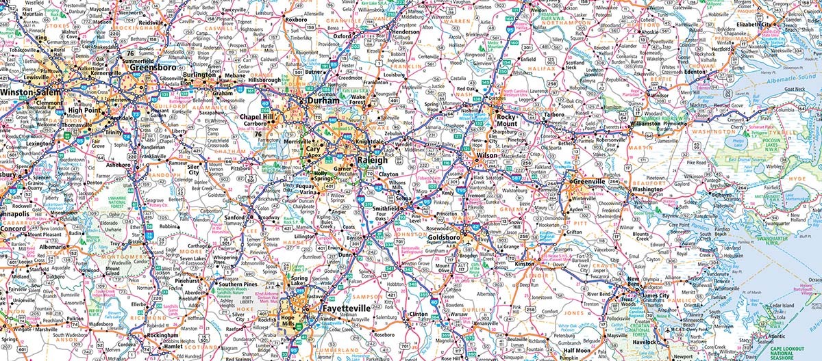
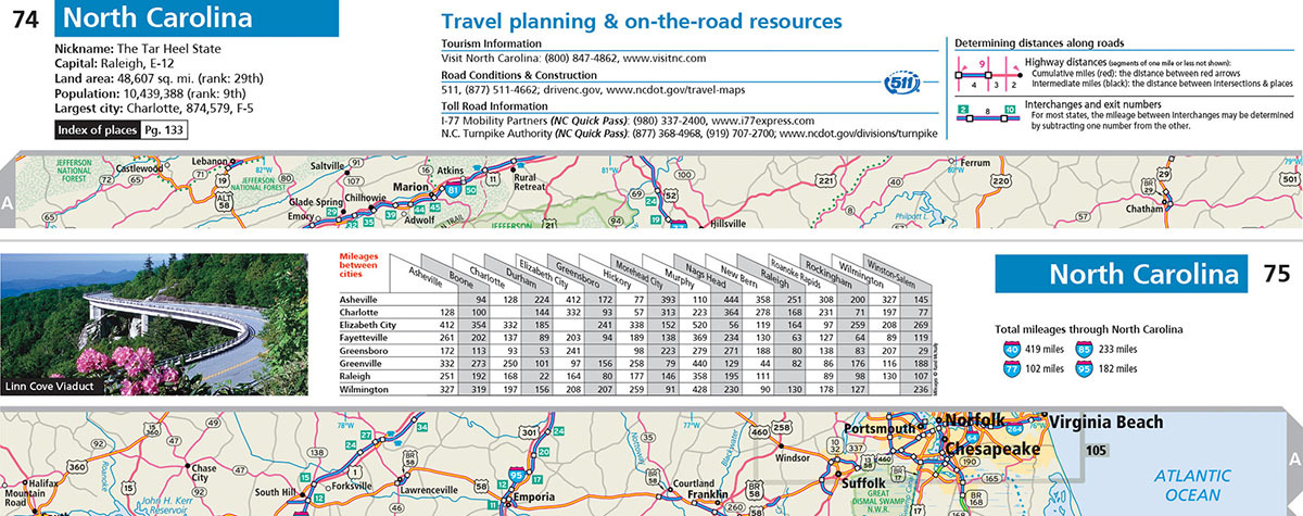
Pictured: Part of the North Carolina map displaying the large variety of map content featured in the Road Atlas.
To me, printed maps have always been an indispensable tool to have on your journey – not only to provide updated geographic content in a clear format, but also to potentially inspire you to travel and explore different places. Learning to read a map is not as difficult as it might seem, and by understanding the simple elements included with most maps, you can then explore the details which might encourage some exciting new adventures!
Thanks again for the timely question! Hopefully, this information will help teach you the basics on how to read a map and will encourage you to put down the device and use your new map reading skills. We posted a blog about how to be a good navigator recently as well if you want to check it out since it is a good companion piece to this blog.
Feel free to submit your map or cartography questions below and check back soon for another installment of "Ask a Cartographer".
Have a question for our cartographer? Email us at printproducts@randmcnally.com with “Ask a Cartographer” in the subject line and your question could be featured next.