
Lost in longitude or confused by contour lines? Want to know all the tips and tricks for getting the most out of your atlas? Curious if paper towns still exist? "Ask a Cartographer" is your opportunity to get the facts straight from the source. Tom Vitacco, Rand McNally Publishing's Director of GIS is here to answer your burning questions, and geek out over fascinating map lore – one exploration at a time.
This week we’re back to basics.
Question: What’s the best way to plan a road trip using an atlas?
Tom’s Answer: It’s probably easiest if I use an example. Let’s say your plan is to drive from the San Francisco area up the coast to Seattle, but you want to take a fast route while stopping to see a few coastal Oregon beaches.
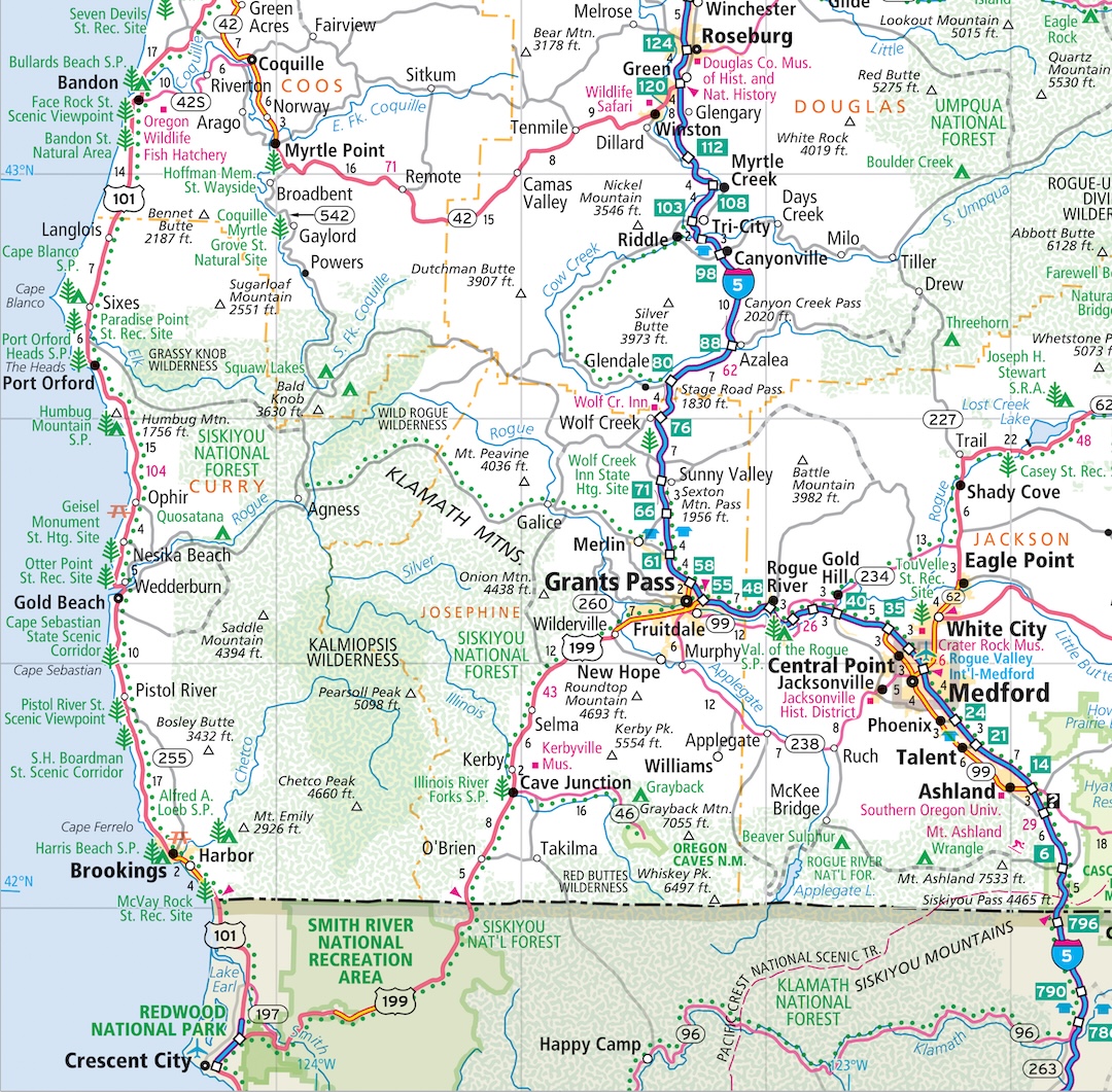
Here’s how I’d use the atlas to plan a trip:
- First, review the map legend which explains the map colors and symbols in more detail.
- Look up California, Oregon, and Washington in the table of contents to find the appropriate pages which cover these states.
- Most maps will include a bar scale to provide a general guide for distance in miles or kilometers.
- Notice the highways which travel across multiple states, like Interstate 5 or US Highway 101. Interstate 5 is shown as a thicker dark blue line which the map legend says is a limited access highway while US 101 is shown with a thinner red line or a principal highway which are often just two-lane highways. In this case, the interstate would be a faster route but the US Highway runs along the coast so it might be a more scenic drive. Both routes on the Oregon map show small green dots running along the side of the road meaning they are both considered a scenic route.
- The interstate shows rest areas along the route which could be important if you often take breaks on longer drives, but the coastal US 101 highway is close to many state parks which offer similar facilities and stopping at some of these parks and beaches is part of your itinerary so US 101 might be a good choice then. If the road color is shown in green, that means it is a toll road as well.
- Notice how US 101 has many more towns along the route which often means slower travel times since you need to stop more often than if you were traveling on the interstate.
- There are many points of interest along both routes shown with small red squares on the map so you might discover new places to visit by following either route based on what you see in the atlas.
- If you notice a lot of green patterns on the map, then most likely these are forest or wilderness areas where you could lose your cell signal so you might want to pick alternative routes if that is a concern.
- Many small triangles with elevations shown often means a mountainous area which could represent rough terrain or hazardous conditions if the weather turns bad.
- Thin gray lines or dashed gray lines are minor and unpaved roads that might be scenic but also can present challenges while driving at night or during bad weather.
- The small numbers along the roads indicate the mileage between towns or road junctions which are helpful in calculating distances.
These are just a few examples of how the road atlas can help you plan a trip.
Have a question for our cartographer? Email us at printproducts@randmcnally.com with “Ask a Cartographer” in the subject line and your question could be featured next!