Lost in longitude or confused by contour lines? Want to know all the tips and tricks for getting the most out of your atlas? Curious if paper towns still exist? "Ask a Cartographer" is your opportunity to get the facts straight from the source. Tom Vitacco, Rand McNally Publishing’s Director of GIS is here to answer your burning questions, and geek out over fascinating map lore – one exploration at a time.
This week, we are discussing some interesting company stories from the past…
Question: Rand McNally has been around for a long time. What are your favorite stories from Rand McNally’s history? (Part 2)
Tom’s answer: We received a lot of positive feedback and engagement from Part 1 of this question, so we plan to continue with this theme for some of the future “Ask a Cartographer” blog posts. Rand McNally has a long and illustrious history, filled with interesting stories and anecdotes that might be informative and educational to our customers, readers and followers, so I will discuss some more topics this week in Part 2.
First, I would like to say thank you to Steve Wiertz, a Senior GIS Analyst here at Rand McNally Publishing who leads our research efforts, for providing much of the content and historical facts for these new blog posts. While I am summarizing and paraphrasing the stories from our past, much of the factual content was provided by Steve.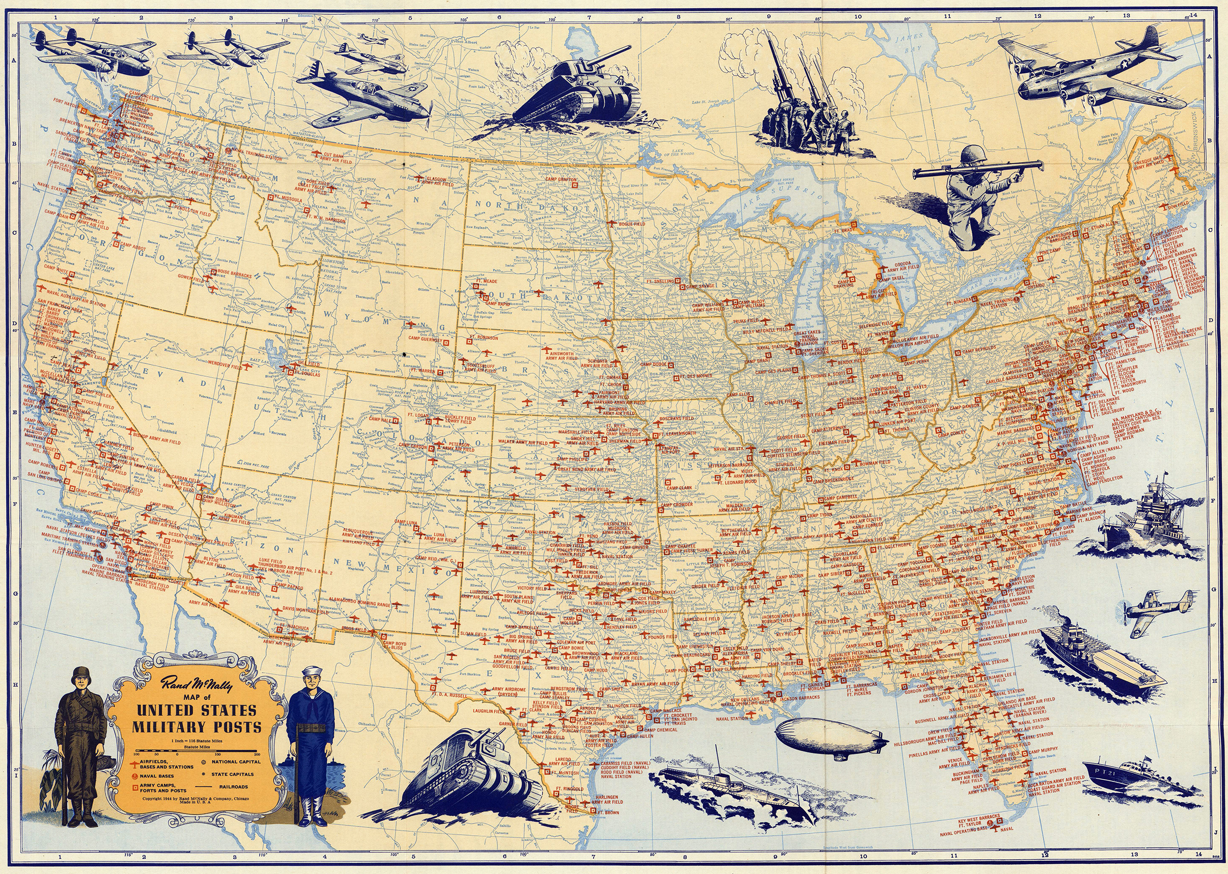
Rand McNally During the World Wars
I recall when I first started my career at Rand McNally, some of the cartographers would mention how the company contributed to the war efforts in the first half of the 20th century. I was fresh out of college and took my share of history courses, and hearing some of the staff talk about cartography and some of the maps used during the wars was intriguing to me at the time. Therefore, I thought I would start this post by sharing some facts and tidbits from that period of company history.
During the First World War, Rand McNally published the New Reference Atlas of the World and the War in 1918. Company leaders understood that more and more people were interested in what was happening around the world and the war was definitely a major world event at the time. The atlas featured maps of every country, plus detailed maps of European war zones and battle regions in Belgium, France, and Italy. It also displayed many charts and tables, including one that showed the different industries supporting the war efforts and the resources produced in the various regions of the United States. This specific chart was an effective reminder that highlighted how the war touched many Americans, not just those fighting on the front lines. There was also an introductory “war summary” which discussed war maps and how to use them.
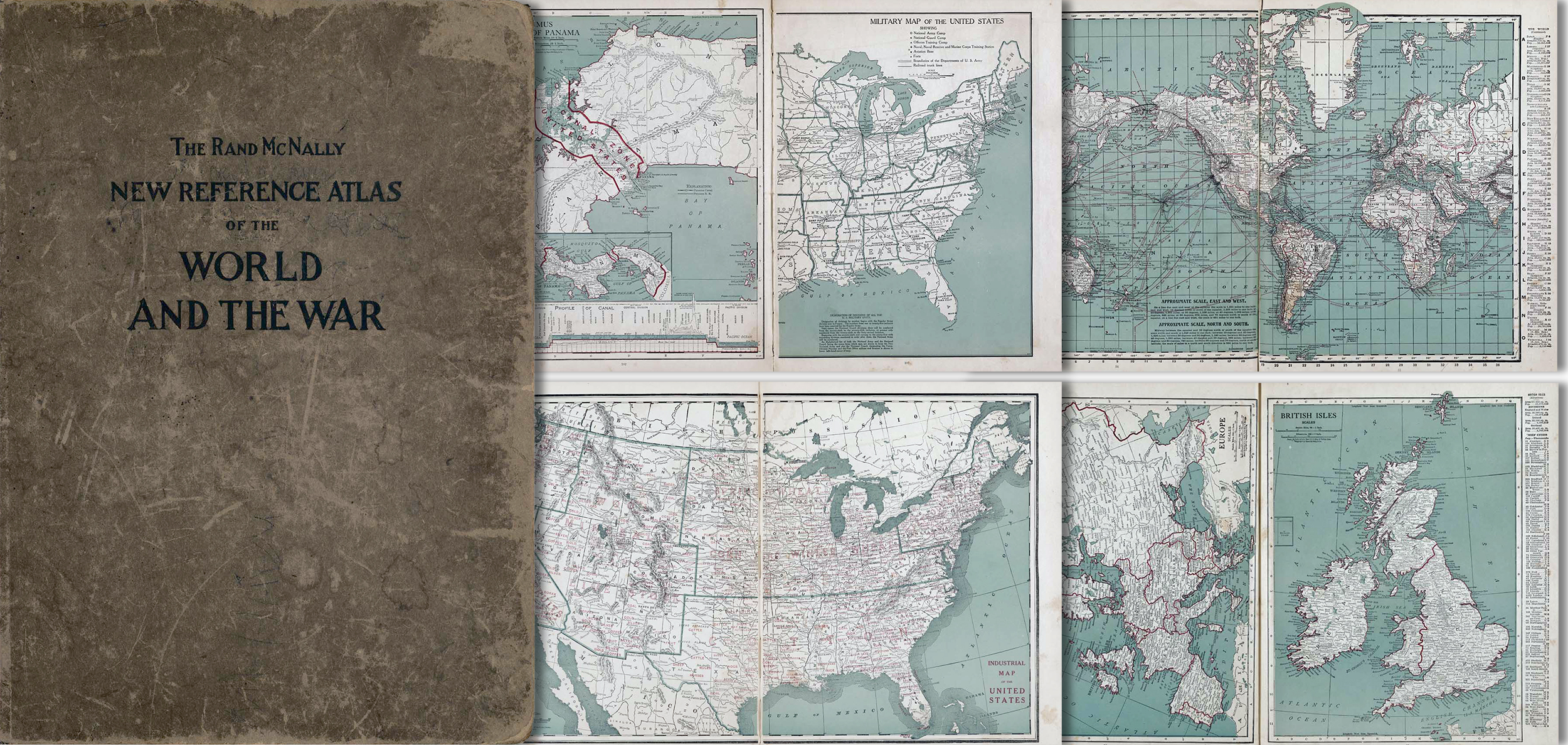
Pictured: The Rand McNally New Reference Atlas of the World and the War produced in 1918.
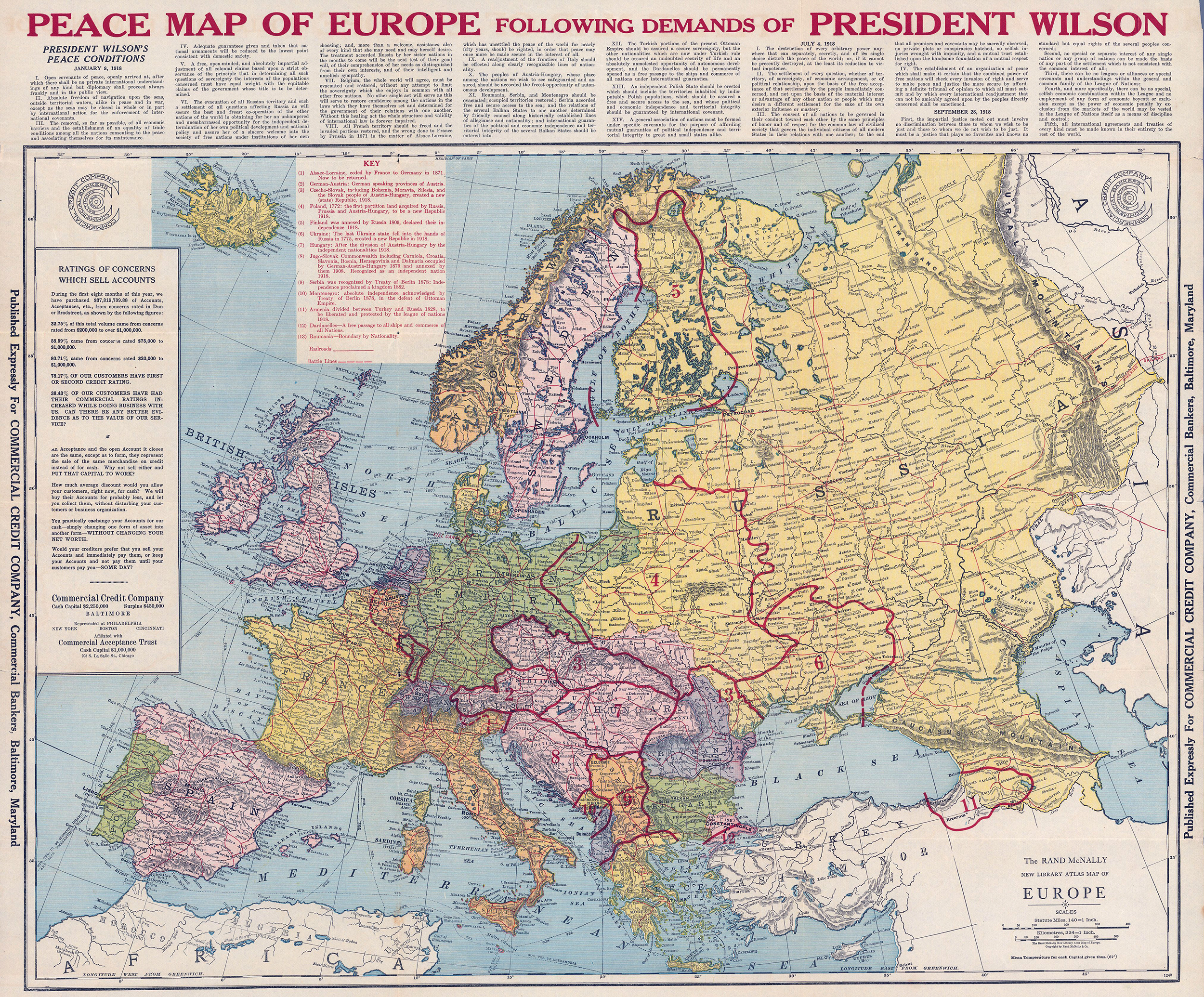
Individual maps were also created for specific companies related to the First World War, including a “peace map” published for the Commercial Credit Company, a bank based in Baltimore, Maryland. The map is shown below, with map content such as political boundaries, railways, battle lines, topography, drainage, and a legend indicating locations of historical events. I find the title particularly interesting: Peace map of Europe following demands of President Wilson.
Demand for Rand McNally maps, particularly European maps, escalated during World War II. The press operations ran 24 hours a day throughout the war years to meet the demand. In fact, immediately after Germany invaded Poland in 1938, stores across the United States sold out of Rand McNally's map of Europe. Maps were shipped daily all over the country.
Before the war, domestic map sales were good, but most citizens did not focus on maps of other countries except maybe in school or via the news. However, as newspapers started to mention foreign cities and areas affected by the war, demand for maps increased as families wanted to understand where military personnel were being deployed. Rand McNally was quick to place many advertisements in newspapers and magazines, promoting their maps and globes as essential and reliable representations of current world events. As a result, map sales improved.
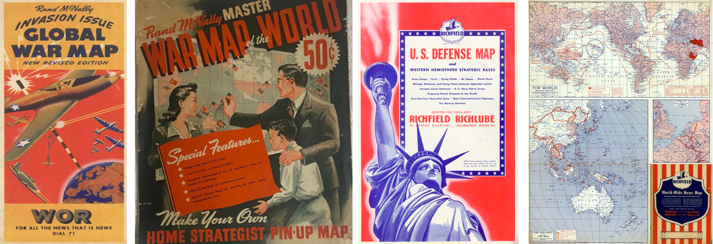
Pictured: Rand McNally products released during the Second World War.
Andrew McNally III joined the U.S. Army Corps of Engineers soon after the start of World War II, supervising the production of battlefield maps at the St. Louis office to aid with military planning. The map requirements were assigned from Washington along with source material and ranged from broad strategy type of maps to detailed maps of small local areas. After his service ended, he returned to the family firm and began producing maps reflecting the great changes that had taken place in the world since the end of the war. He believed in the concept that Americans should comprehend and appreciate world affairs, therefore a better understanding of world geography was required, and maps were an integral part of improving their knowledge base.
Women played an important role related to mapping during the war and worked in a range of jobs associated with wartime production, including drafting, photogrammetry, binding, and mapping. These women were known as “Military Mapping Maidens” and created accurate and up-to-date maps used by all branches of the military and government during the war. There were 224 young women who were recruited by the Army Map Services in 1943 to research and draw maps by hand for the war effort. After the war, many continued to work within the defense mapping and other government agencies, and some even went into the private sector, including Rand McNally.

Near the end of the war, the Army Map Service bestowed an award to some of the staff at Rand McNally for their excellence in the production of maps used by the Armed Forces of the United Nations.
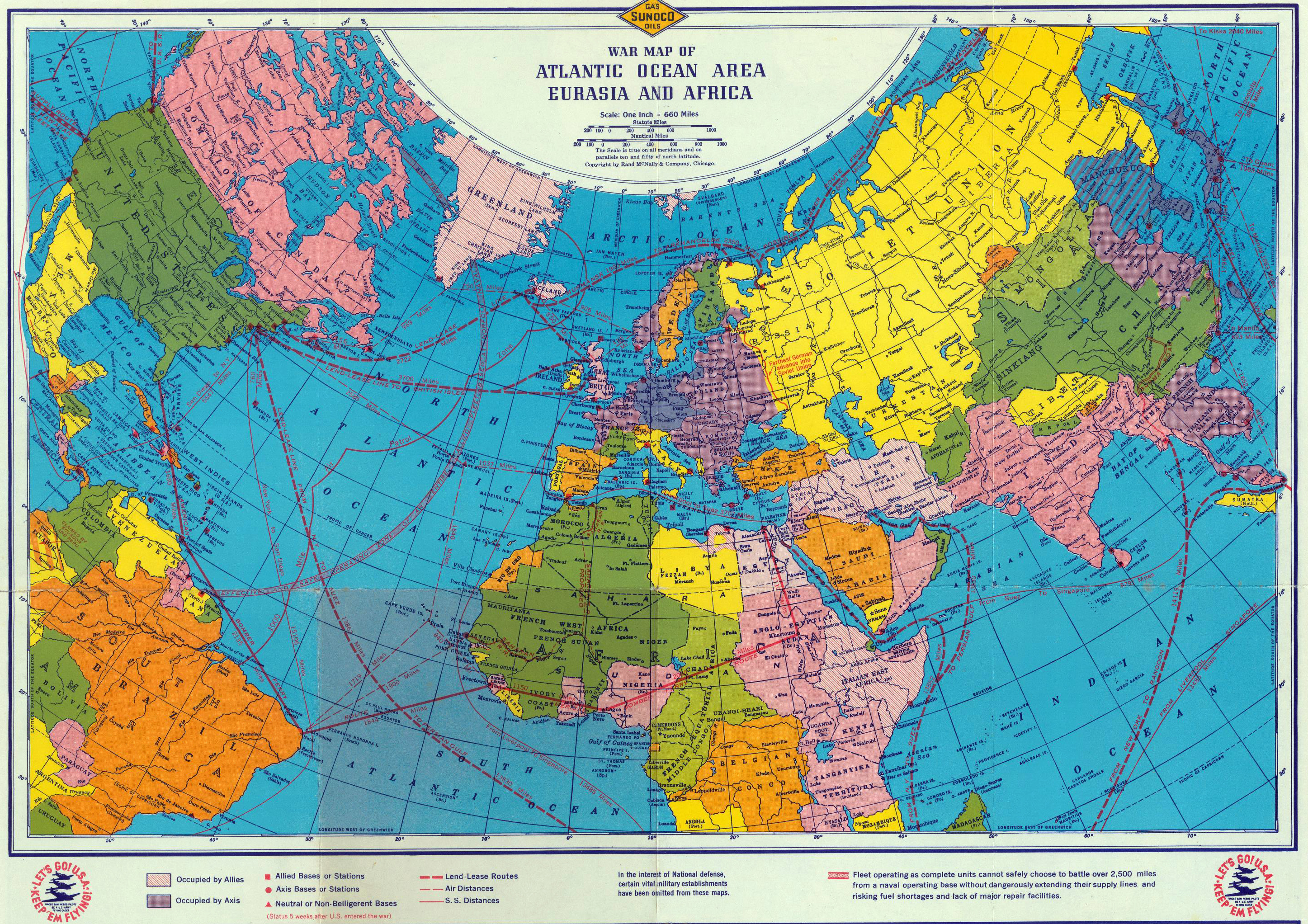
Pictured: A 1942 war map of the Atlantic Ocean areas, Eurasia and Africa created by Rand McNally for Sunoco.
Bird's Eye View
I have always enjoyed looking at a “bird’s eye view” of maps or city skylines. To me, there is something special about viewing a familiar area from a different perspective. Often this view allows you to see the big picture more clearly, and maybe even discover something new you did not see before. Rand McNally was a pioneer in developing this unique perspective and used this technique in a variety of maps and images. Think about how this “viewing angle” is used today in popular online map engines or GPS devices, which allow users to tilt the perspective or get a 3-D view of a city. Rand McNally was using this technique without any modern technology over 130 years ago.
One of the first illustrations I came across using this perspective was a map showing the World's Columbian Exposition in Chicago back in 1893, also known as the Chicago World’s Fair (see image below). Andrew McNally served as a director and financially supported the fair. For a map created during that era, the details are amazing in my opinion. Also, including the names of the buildings and exhibits outside the map area, with a key to finding each location on the map, is a style and format we still use today for some of our atlas maps.
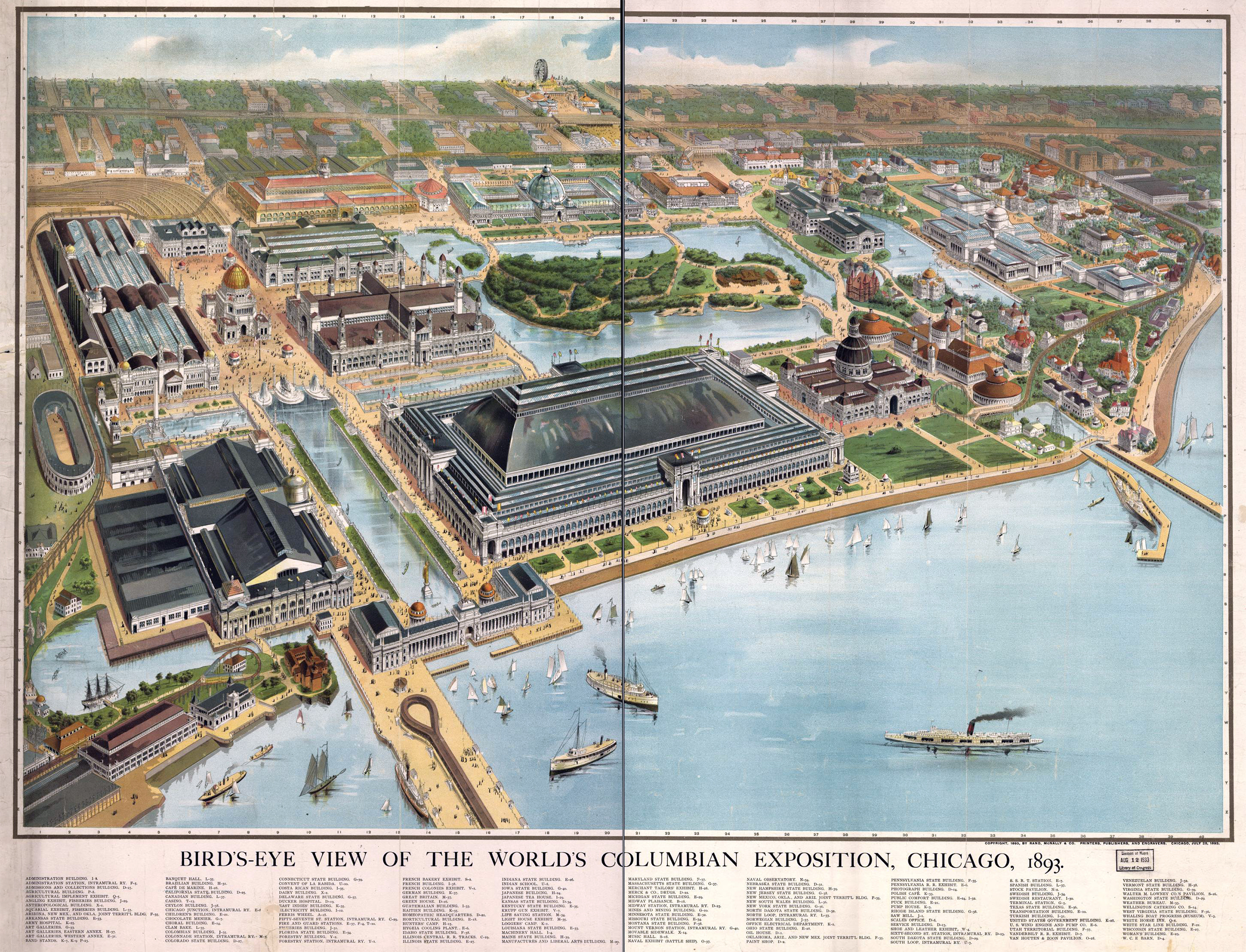
Pictured: A bird’s eye view of the Chicago World’s Fair produced by Rand McNally.
Back in 1898, Rand McNally released a guide to Chicago full of “bird’s eye views” created by their talented cartographers, engravers, and artists. The guide took a long time to produce, and was an indispensable tool for visitors, businesses, and residents with some very interesting depictions of this beautiful city. In one image, Rand McNally corporate headquarters is shown (see red arrow below) and their use of small numbers within circles to match an accompanying legend is still in practice today.
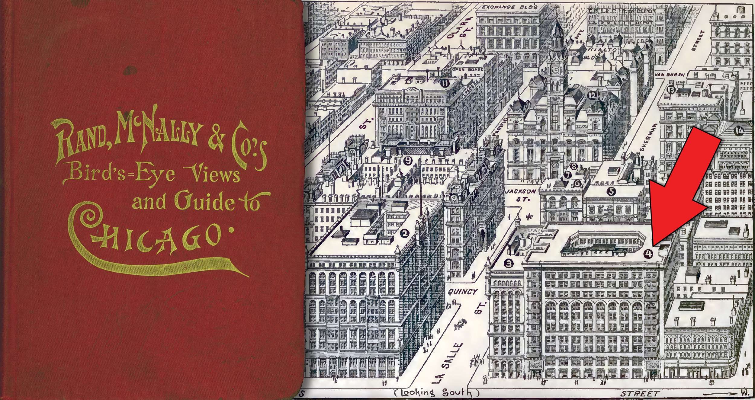
The methods used to create the almost 400-page guide included both photography and topography, offering the best combination of stunning views and useful information. Travelers from around the country and even the world used the guide when visiting Chicago.
Additionally, Rand McNally also created illustrations using a bird’s eye view for different businesses, buildings, or tourist attractions, including the panoramic views from the Observatory of the Empire State Building in New York City (shown in the image below).
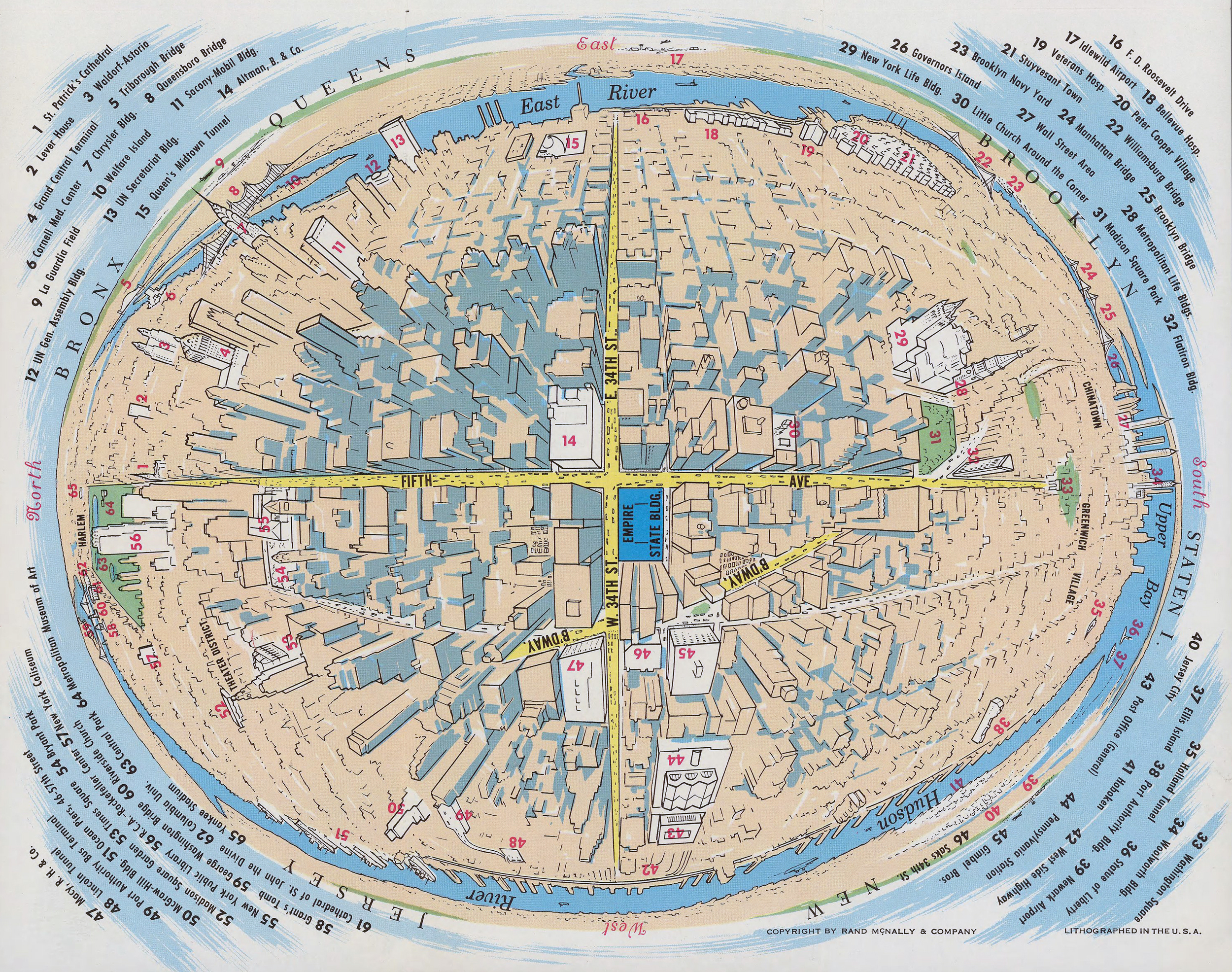
The 3-D panoramic map was designed by Rand McNally for a brochure in 1952 and each quadrant conformed to the view registered by the naked eye from the 86th floor observatory. I personally find the use of descriptive text along the perimeter of the map and the numeric key to the buildings and landmarks around the Empire State Building to be innovative and fascinating at the same time.
Finally, the image below is another bird’s eye view the company produced for Pure Oil, considered a “pathfinder” for the Century of Progress exposition along the lakeshore of Chicago in 1934. Another really cool, but functional map and drawing which demonstrates the level of artistry incorporated by the cartographers and production teams at the time.

Thanks again for the question! As I mentioned, we plan to continue using this question in future blog posts to tell more cool and interesting stories from the history of Rand McNally that hopefully you will find fascinating and educational.
Feel free to submit your map or cartography questions below and check back soon for another installment of "Ask a Cartographer".
Have a question for our cartographer? Email us at printproducts@randmcnally.com with “Ask a Cartographer” in the subject line and your question could be featured next!


