
Lost in longitude or confused by contour lines? Want to know all the tips and tricks for getting the most out of your atlas? Curious if paper towns still exist? "Ask a Cartographer" is your opportunity to get the facts straight from the source. Tom Vitacco, Rand McNally Publishing’s Director of GIS, is here to answer your burning questions, and geek out over fascinating map lore – one exploration at a time.
This week, we are discussing some of the educational products Rand McNally Publishing still creates…
Question: "Does Rand McNally still make “back to school” or educational products?”
Tom’s answer: Thank you for the question! Since school has started here in Illinois, it is a great time to talk about our educational products. The simple answer to your question is yes and I will try to highlight some of the past and present products with this post.
Rand McNally Publishing still creates educational products which will help students of all ages understand the world around them better. Rand McNally Education is a separate department with their own section on our main website. If you would like to browse all of the products we produce, please check out the products site here. My focus with this blog will be to talk about some of the atlases, wall maps, desk maps and digital products available today, plus offer some historical insight into globe production and end with some commentary on gifts.
The educational publishing department actually started back in the 1880s, so it has been an important part of the company for a very long time. Back then, the department focused on globes, maps and geography textbooks. In the 1980s, when I first started, the company acquired the assets of Denoyer-Geppert Company, a leading educational map and globe publisher, which added fresh new content to our growing catalog. Today, even though our product catalog is smaller, we still make wonderful educational products, trusted by teachers and students within collaborative classrooms and at home.
Atlases for Students
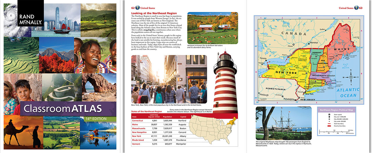
One of the best educational products we produce is called the Classroom Atlas (Grades 4-9), an award-winning atlas which can help students master essential map reading skills and improve their geographic literacy. The atlas was recently updated, offering geographic content like physical, political, and thematic maps, interesting photos, and informative graphics. The United States is broken into regions within the atlas, and each section features narrative about the area, facts and figures, appropriate questions, fun puzzles, and simplistic maps created with students in mind. The atlas has 208 pages in total and is the first book I recommend when someone asks if we make educational or back-to-school products. It truly is a great resource for students of all ages.
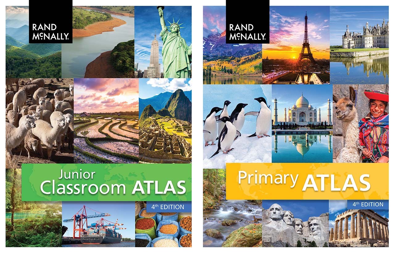
We also produce many other atlases with different levels of content including the Junior Classroom Atlas (Grades 2-4) , the Primary Atlas (Grades K-3), the Atlas of World Geography (Grades 6-12), the Atlas of the United States (Grades 3-6) and the Atlas of American History (Grades 5-12), full of historic maps depicting important periods of American history. All of these atlases are useful for students who want to learn more about geography, maps, and the world in general. You can find them on our online store here if you would like more information.
Wall and Desk Maps
If you attended a public or private school growing up, you might have encountered large maps on the wall attached to rollers which the teacher could pull down to discuss geographic topics. Rand McNally Publishing has been making these wall maps for a long time, and we continue to produce a set of U.S. & World wall maps, focusing on both political and physical map styles. In general, these wall maps are made for schools and classrooms but can also be used in homes if you have the space. Interesting side note - my daughter is currently a high school teacher, and she always had a play classroom set up in our basement growing up. We actually had an old set of “roller wall maps” mounted in her classroom and it was a big hit with the neighborhood kids.
We also make a small “desk map” showing the United States on one side and a World map on the other side, which is laminated and about the size of a large place mat. The desk map products are markable, washable, and sturdy, plus they correspond to some of the wall map titles so they can be used at home or in the classroom. As mentioned above, these products are available on our website if you are interested.
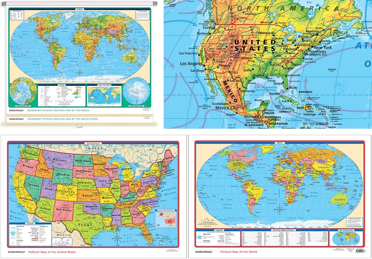
Pictured: Wall Map samples on top and Desk Map samples on the bottom.
World Atlas Online
Rand McNally Education features a digital only product called World Atlas – an interactive, web-based, geography-focused teaching platform. World Atlas enables teachers and students to discover the world around them right from their computers through dynamic, customizable maps, social studies content, and lesson plans aligned with Common Core State and National Geography Standards. World Atlas is accessible from any desktop or mobile device, making it easy to collaborate, teach, and learn both inside and outside of the classroom.
I was heavily involved in the cartographic side of World Atlas, working with our GIS team to create base maps and thematic map layers using content pulled directly from our printed atlases. It was a challenging but rewarding project because we learned a lot about map formats and data layers within a digital platform which was quite different from the software we use to create our printed map products. As a cartographer, these types of new and innovative projects are exciting to work on, and I thoroughly enjoyed helping to build this online World Atlas.
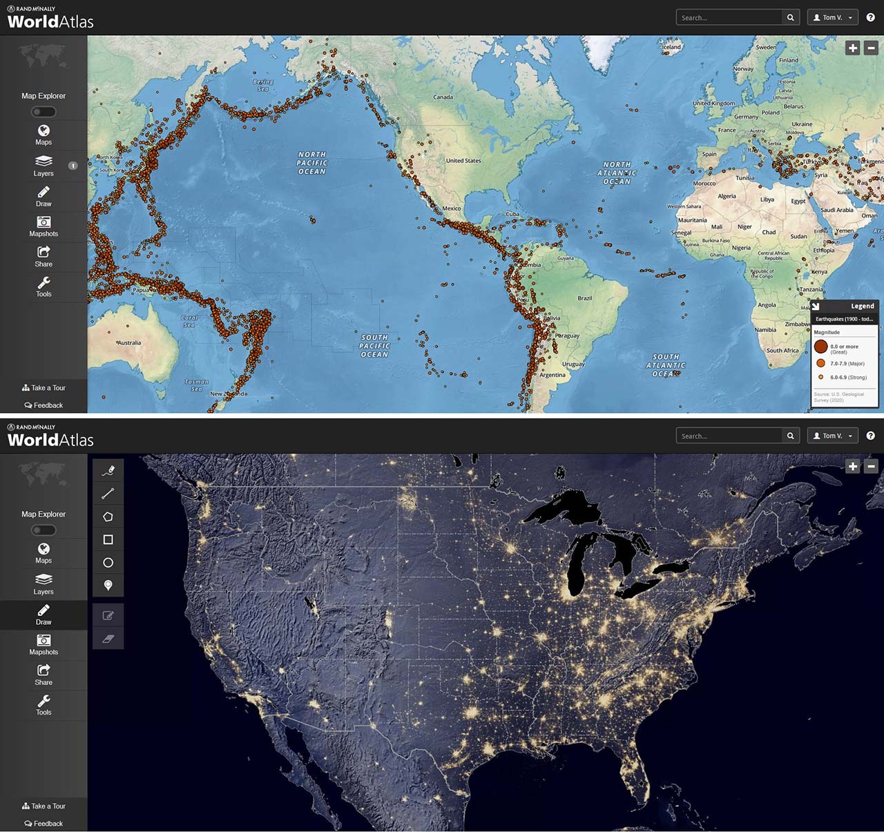
Pictured: a physical style base map showing earthquakes (top) and a map of “night lights” in the US (bottom).
Globes
I wanted to spend a little time in this post about globes since Rand McNally used to be heavily involved in globe production and I actually worked on some globes when I first started at the company in the late 1980s.
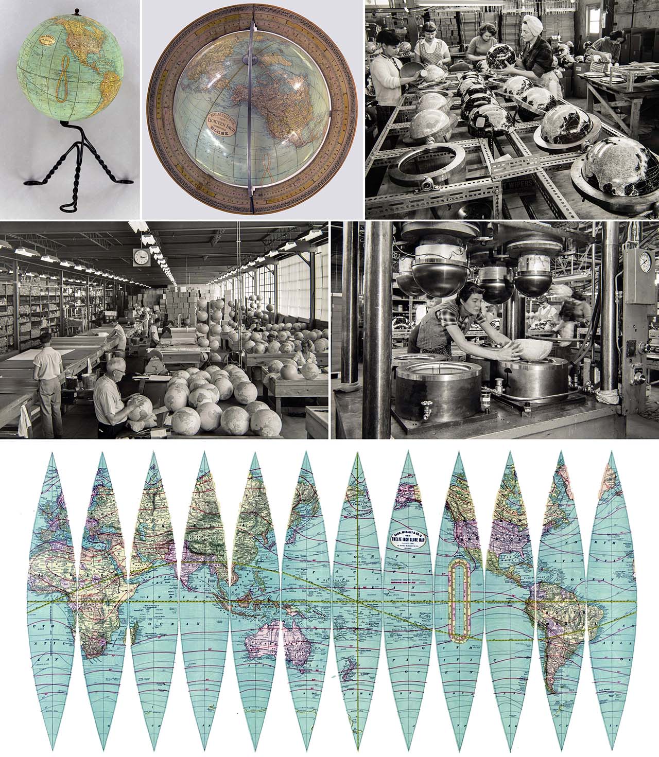
It seems appropriate to begin with some historical background on globe production. Rand McNally started to make terrestrial globes in 1891 from their Chicago headquarters. The company produced a variety of globes, including small 3-inch globes to large 30-inch models for libraries, usually with elaborate stands designed to store maps and atlases. The company also created globe “gores” - the map sections overlaid onto the globe base - for other Chicago-based globe manufacturers at the time, such as the American Globe & School Supply Company. In fact, throughout the 1900s, Chicago established itself as a leader in globe manufacturing with other companies such as Replogle, Nystrom, and Weber Costello to name a few.
The image below is a compilation I put together for this post showing two globes from the late 1800s in the upper left corner, numerous old photos of globe production from back in the day, and an example of map gores used to produce a globe long ago.
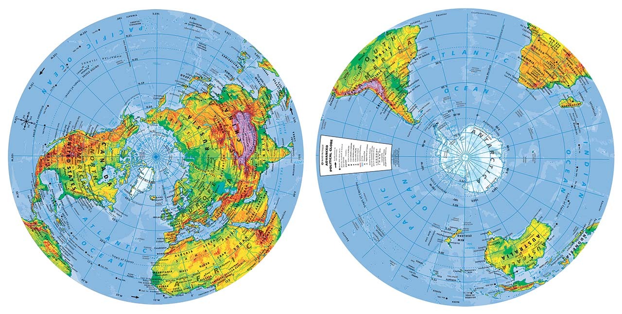
I was fortunate to have worked on globes when I started in 1986, although the cartography was all film based and quite difficult to work with because of the curvature of the base maps. Eventually, we started to produce the different globe hemispheres using Adobe Illustrator software, which made the curved labels much easier to place. The image below is an example of the northern and southern hemisphere globe sections we created for a globe made back in 2003.
Unfortunately, we do not cartographically produce globe data anymore, but we do sell quite a few of them on our website if you are looking to get a new globe. They make great gifts for anyone interested in maps or the world in general and are the perfect accessory to any classroom.
Kids Road Atlas and Gift Ideas
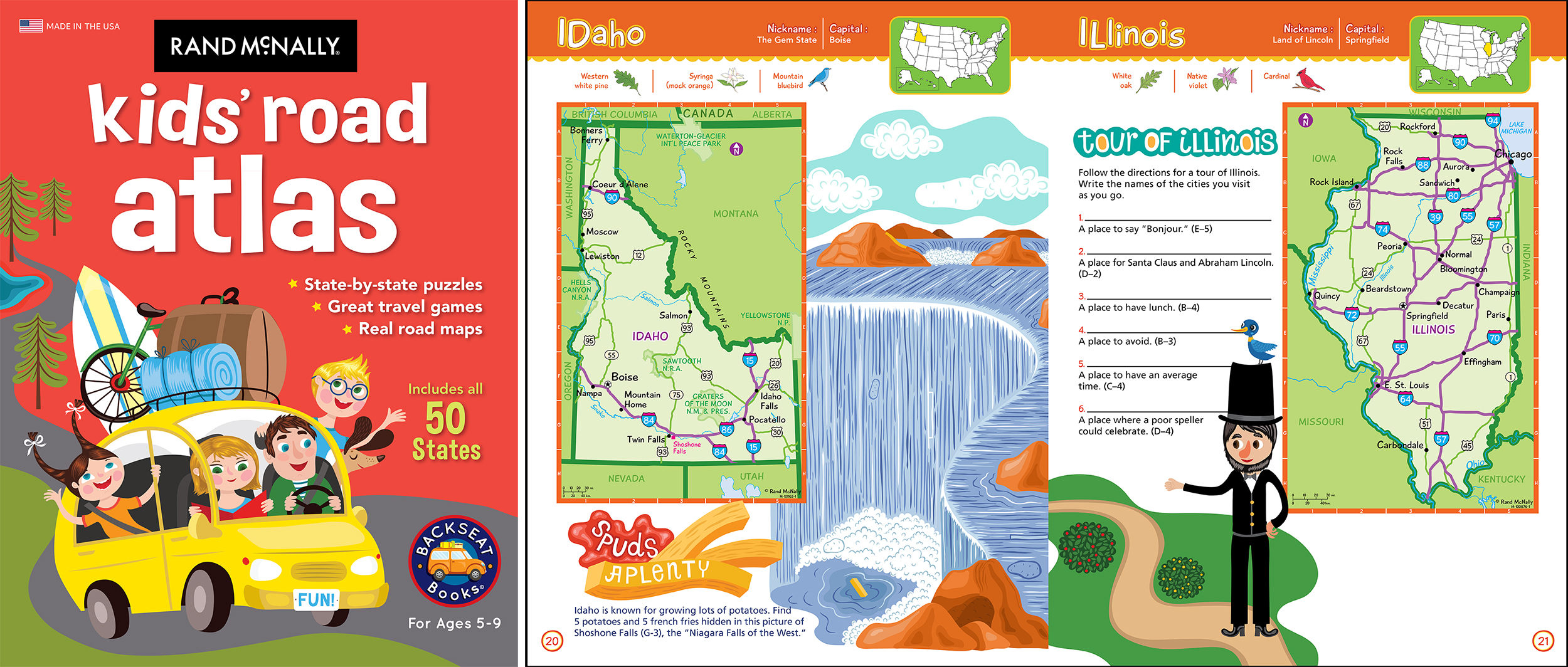
Finally, although not really a “back to school” item, I wanted to mention the Kids Road Atlas and the regular Road Atlas product line because they are great “educational tools” to teach the younger generation about spatial awareness and how to read a map. The Kids Road Atlas (shown below) is full of simple, up-to-date state maps, puzzles, and games to learn about geography for very young students.
The regular Road Atlas line is a perfect gift for a recent college graduate, or Gen Z and Millennials who might have learned about maps and geography only from their phones. Offering a Road Atlas and demonstrating how reading a map is an essential life skill is a thoughtful gift idea. As one customer named Ron Finch recently posted on our social media page, the Road Atlas and some cash make a great graduation gift with a personalized note stating, “It will take you places and always bring you home.” What a wonderful sentiment and we could not agree more!
Thanks again for the question! Feel free to submit your map or cartography questions below and check back soon for another installment of "Ask a Cartographer".
Have a question for our cartographer? Email us at printproducts@randpublishing.com with “Ask a Cartographer” in the subject line and your question could be featured next!