
Lost in longitude or confused by contour lines? Want to know all the tips and tricks for getting the most out of your atlas? Curious if paper towns still exist? "Ask a Cartographer" is your opportunity to get the facts straight from the source. Tom Vitacco, Rand McNally Publishing’s Director of GIS, is here to answer your burning questions, and geek out over fascinating map lore – one exploration at a time.
This week, we are looking at Rand McNally’s relationship with the airline industry by discussing interesting stories and collaborative products from the past…
Question: "Does Rand McNally still make products for the airline industry?"
Tom’s answer: Great question and thank you for asking! The quick answer is no since we do not produce airline route maps or print the airline tickets anymore. However, Rand McNally was heavily involved with the transportation and airline industries in the past. With this post I will try to provide some interesting historical context about this topic and offer a few stories related to air travel and the use of Rand McNally maps and products.

The Early Years of Aviation
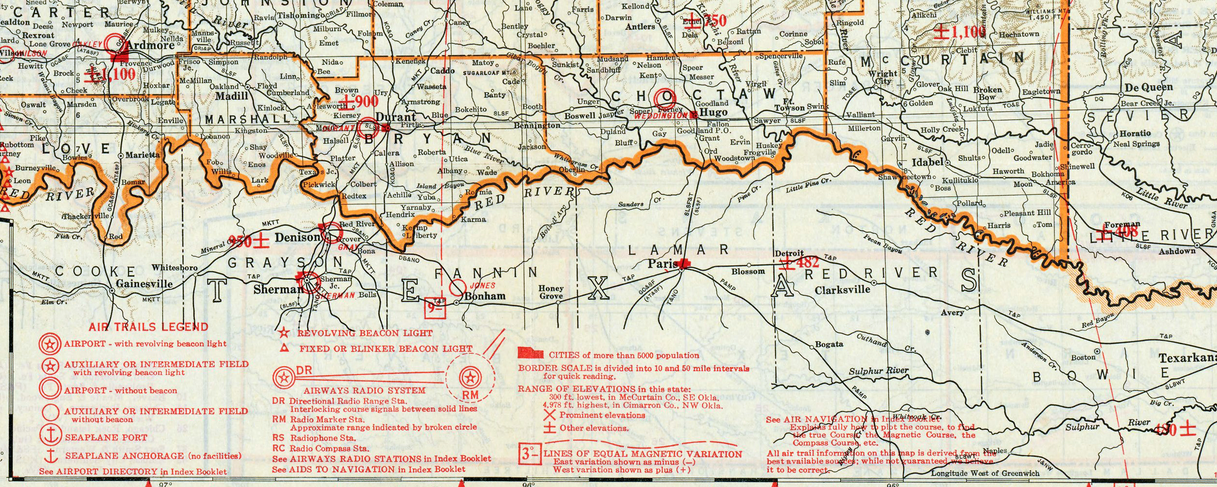
The age of aviation started at the beginning of the 20th century with the first successful flight at Kitty Hawk, North Carolina. This historic event, orchestrated by Wilbur and Orville Wright, launched the modern aviation age. Although Rand McNally was focused on creating products for the railroad and auto industries during the first part of the century, the company also had some involvement with the aviation industry too. In fact, I covered one event in an earlier blog post related to Charles Lindbergh and how he often used standard Rand McNally maps during his flying career, especially in his early days as he flew mail for the U.S. Postal Service. These maps included content such as air trails, airport beacon lights, seaplane ports, radio systems, and lines of equal magnetic variation – unique maps that were not only consumer friendly but also focused on the needs of different businesses (see image below).
Another compelling story from this era was centered around Wiley Post, an adventurous pilot who broke world records and paved the way for future aviators. In 1931, Post and Australian navigator Harold Gatty traveled around the world in a small plane called the Winnie Mae, and Post enjoyed the trip so much he purchased the plane and attempted a solo flight around the world in 1933.
A week before the flight, Wiley Post met with Douglas Haight, a rep from Rand McNally, to review maps and discuss the flight path on a world map and a globe. The meetings and discussions garnered headlines at the time, providing excellent publicity for the company and for the flight itself, which was an attempt to break a world record at the time.

Pictured: Aviator Wiley Post (with eye patch) and Douglas Haight from Rand McNally discuss the flight around the world.
Ticket Business
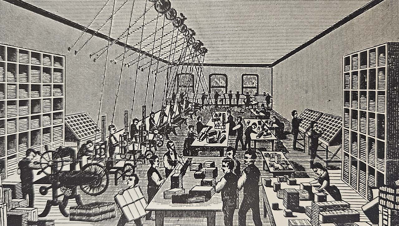
As previously mentioned, Rand McNally has been a part of the transportation industry since the company formed in the 1860s when it started to print railroad maps, guides, timetables, and tickets - the foundation with which the company was built upon. By 1876, most of the major railroad lines in the country used Rand McNally to print their tickets and the company became known as the “Railroad Ticket Printing House”. The equipment used to print tickets was upgraded often at the time and by 1879 the production teams were able to print 500,000 tickets per day. In 1906, to accommodate the expanding business on the east coast, Rand McNally purchased a plant in Ossining, New York, along the Hudson River. The new plant was used as the main ticket printing facility for many years.
The “ticket business” continued on for over a hundred years as the company began to print tickets and luggage tags for the airline industry as well. Commercial air travel took off after World War II as jet engines improved, making travel faster and increasingly affordable for consumers. Rand McNally, with their already established printing capabilities, saw the opportunity to offer tickets and tags to this growing industry while also adding innovative changes to the tickets.
One of those innovations happened in 1945 when Rand McNally created a new carbonized ticket book that eliminated the bulky accordion-fold airline and train tickets. The new development, called spot-carboning, allowed the simultaneous imprinting of two kinds of information, one blind to optical scanning and the other readable by the scanner. These revolutionary tickets helped prevent theft and allowed for new automated equipment to read the ticket more efficiently.
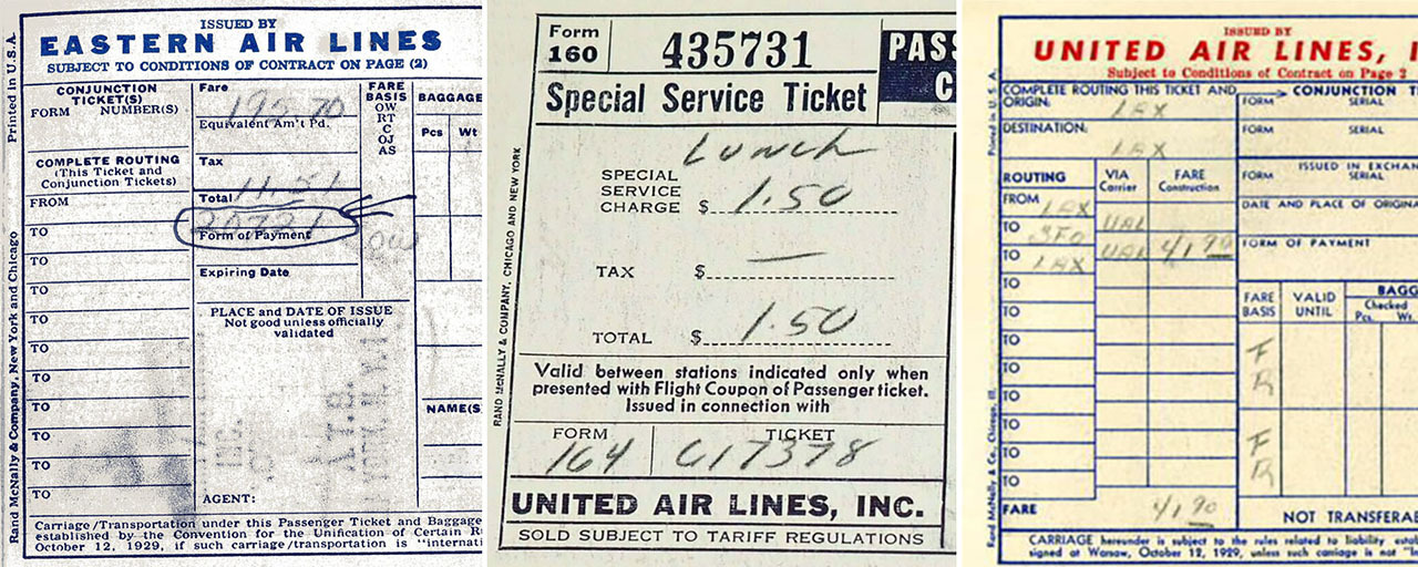
Pictured: Airline tickets printed by Rand McNally (note the small company logo along the side of each ticket).
In 1954, the company bought a ticket plant in Nashville, Tennessee to increase production, and a few years later built a brand new, modern plant in 1956, which thrived for another four decades.
When I started working at Rand McNally in 1986, the company was still printing tickets and luggage tags for the airline industry at their Nashville plant. In 1997, this division was sold to a private equity firm - the unfortunate end to our long standing history of printing tickets for the airline industry.
Airline Maps and Globes
I do not recall working on any maps related to airline brochures or promotional materials early in my career, but I do know that Rand McNally produced a variety of map products for different airlines, and I will share some examples below.
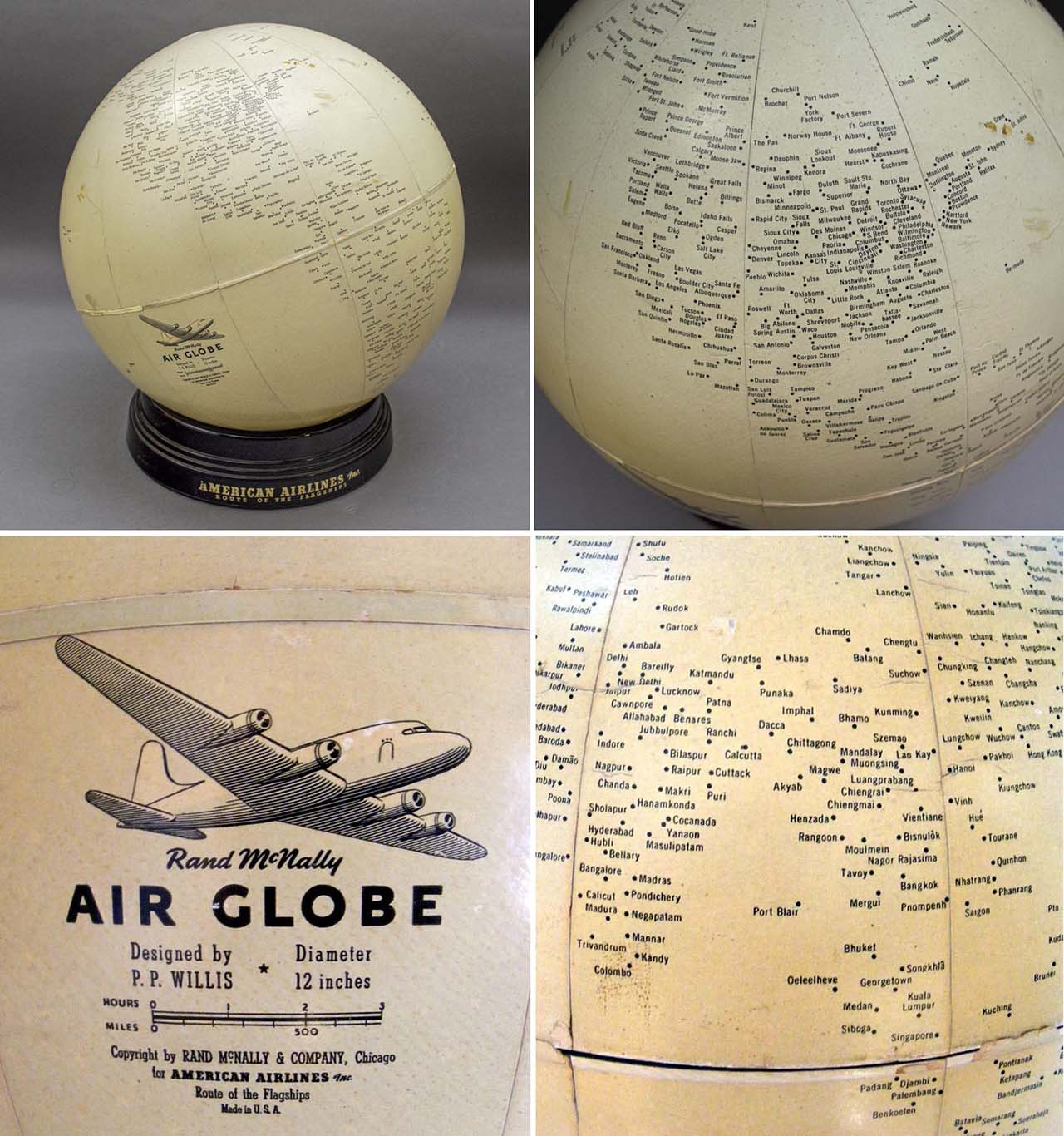
The first example is the rare Air Globe, which the company produced as a one-time promotional item for American Airlines in the 1950s and was designed by an advertising executive from the airline. This unusual globe did not include lines, land areas, or shaded relief, and featured generalized continent shapes formed by clusters of city place names. The globe sat on top of a round amethyst glass base so it could be lifted and repositioned. The lone pictorial element is an illustration of a four-engine propeller plane, most likely a Douglas DC-4, which American Airlines introduced after World War II.
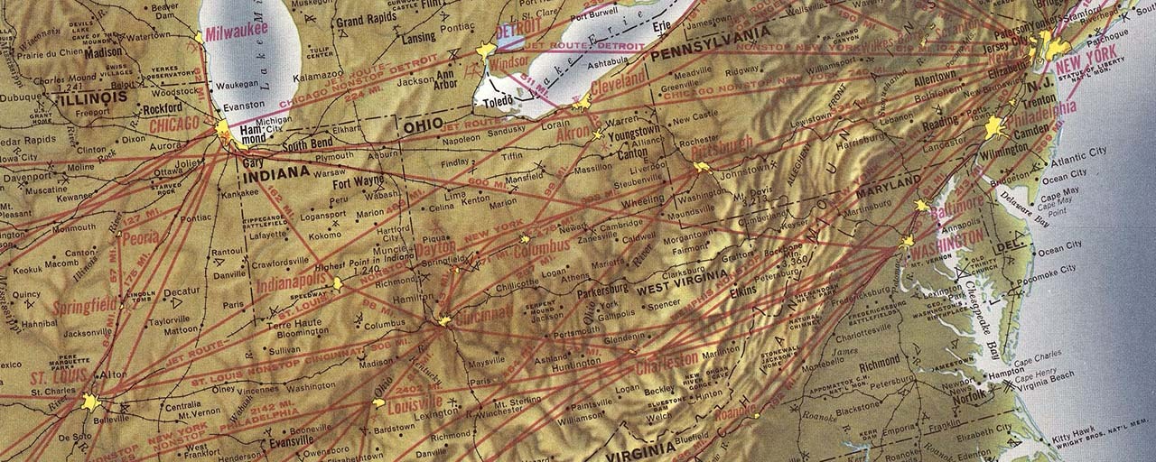
Rand McNally also produced a large map (36 x 24 inches) for American Airlines in 1962 (shown below). The map used a blend of physical and pictorial styles, highlighting topographical features along with the airline routes. The physical features and relief were created with a natural palette which stressed the varied terrain of North America. The map focused on clarity and functionality with some artistic touches, a staple of Rand McNally maps still in production today.
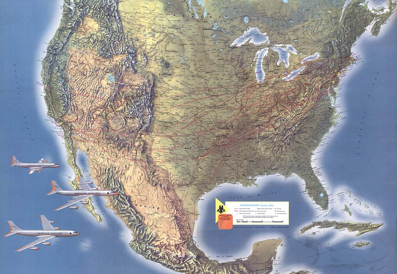
The purpose of this map was to document the American Airline flight routes at the time, shown as red lines on the map (see below). These routes connected major cities across the United States, Canada, and parts of Mexico and the Caribbean. As mentioned above, commercial air travel was growing rapidly during this time period, and airlines were expanding their networks significantly.
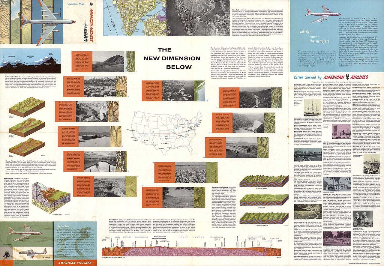
Another product designed and printed by Rand McNally for American Airlines was called “The New Dimension Below” (see image below), combining maps with elements of art, science, and commerce. The title was not only an educational tool but also reflected the spirit of scientific exploration in the 1960s. By illustrating the Earth's subsurface dimensions, the product invited users to consider the geological wonders that lie beneath their feet as they traveled the world by air.
Years before commercial air travel took off, Rand McNally created custom maps for Northwest Airlines in 1939 and Pennsylvania Central Airlines in 1940. The map for Northwest Airlines was a pocket map showing a detailed representation of their routes in the United States. The map included inset maps, pictures, textual elements and even future route plans, serving as both a practical guide for travelers of the era and a promotional tool for Northwest Airlines, showcasing their expansive reach and future aspirations.
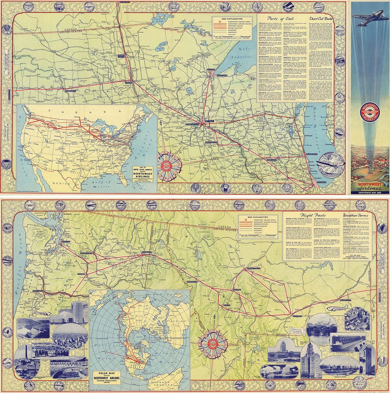
Pictured: Promotional map created by Rand McNally for Northwest Airlines in 1939.
In 1940, Rand McNally produced a “souvenir map” for Pennsylvania Central Airlines using a pictorial style, which combined advertising and detailed route information in a logical format. The map featured illustrations of significant city landmarks and regional icons near each destination. Additionally, the map incorporated advertisements for Gulf Petroleum Products, highlighting the partnership between the aviation and petroleum industries, which was crucial during this era of expanding commercial aviation. The map exemplifies the intersection of art, commerce, and technology during a pivotal era in American history.
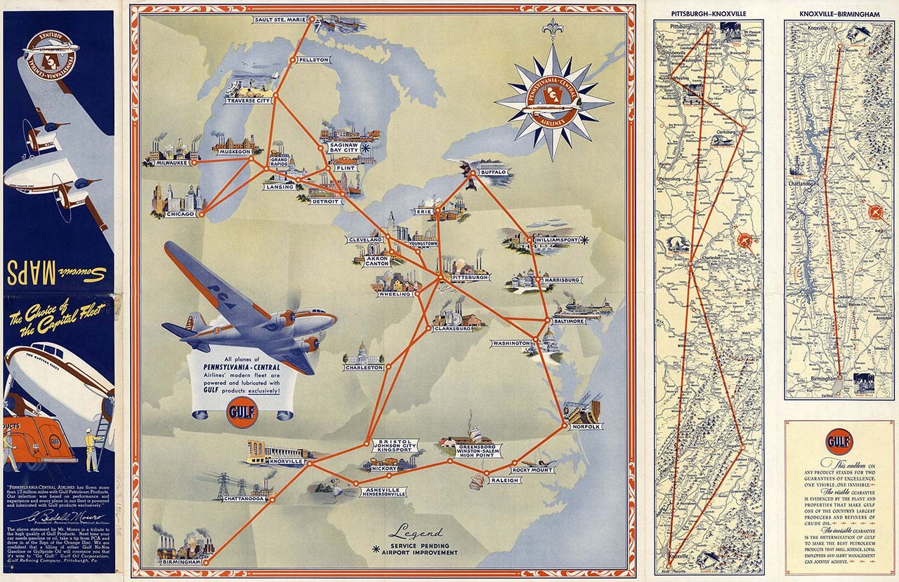
Pictured: Promotional map created by Rand McNally for Pennsylvania Central Airlines in 1940.
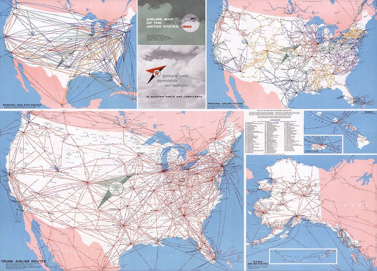
Finally, Rand McNally cartographers created the "Airline Map of the United States” for a publication called the Official Airline Guide in 1965 (see map below). The map was designed to help consumers understand the airline routes across the United States and was produced in collaboration with the Texaco Oil Company. At the time, the map proved to be an invaluable resource for understanding the development of the airline industry and the role of air travel in shaping modern transportation networks.
I hope I was able to provide some informative background information here and highlight how Rand McNally has worked closely with the transportation and travel industries since the company started, providing innovative products and solutions that continue on today.
Thanks again for the question! Feel free to submit your map or cartography questions below and check back soon for another installment of "Ask a Cartographer".
Have a question for our cartographer? Email us at printproducts@randpublishing.com with “Ask a Cartographer” in the subject line and your question could be featured next!