Lost in longitude or confused by contour lines? Want to know all the tips and tricks for getting the most out of your atlas? Curious if paper towns still exist? "Ask a Cartographer" is your opportunity to get the facts straight from the source. Tom Vitacco, Rand McNally Publishing’s Director of GIS is here to answer your burning questions, and geek out over fascinating map lore – one exploration at a time.
This week, we are discussing maps and games…
Question: I play a lot of games and was wondering if you make any map or geography games?
Tom’s answer: Thanks for your question! The quick answer is we currently do not make any games featuring our maps or geographic facts and trivia. However, the company has been directly or indirectly involved in a couple of games in the past, so I'll share all the games we have produced and highlight some of the cartographic or geographic aspects of these games or puzzle books.
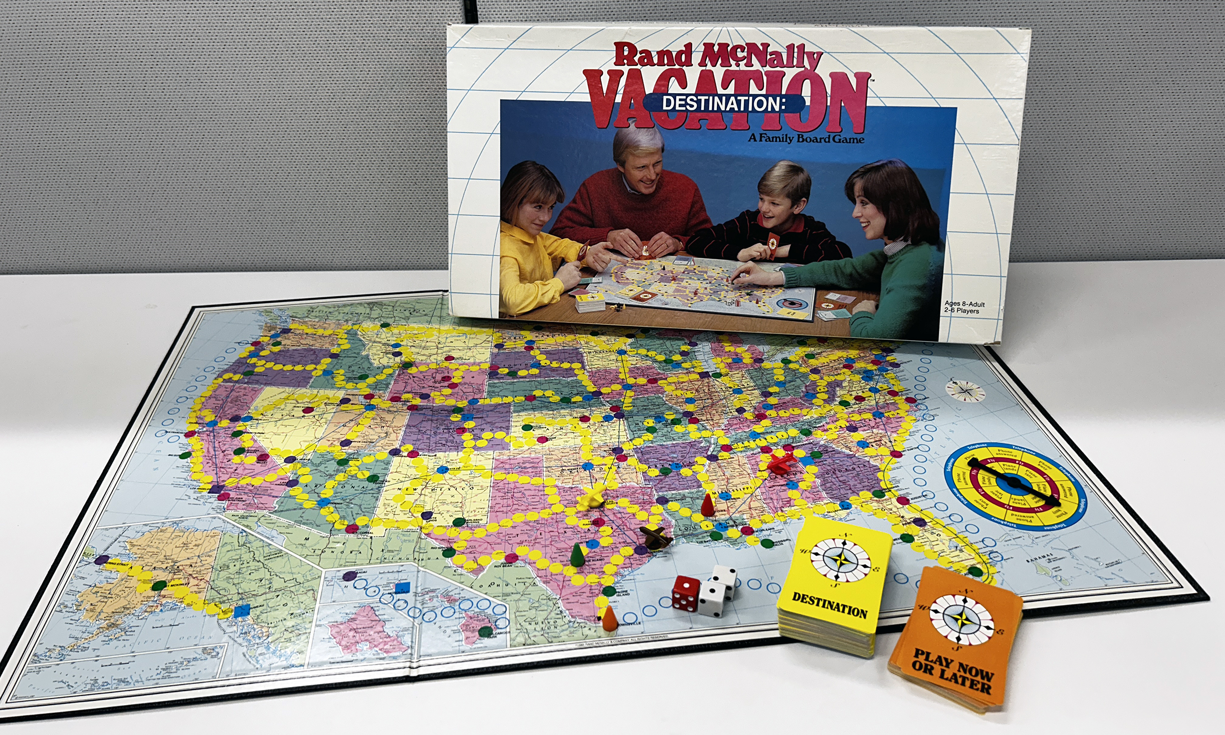
Destination: Vacation
When I first started as a cartographer at Rand McNally in 1986, I heard about a board game the company was involved in, but did not actually see the product until years later. The game was called Rand McNally Destination: Vacation and it was released in the late 1980s. To play, you travelled around the United States to different “destinations” using various modes of transportation such as a car, rail, ferry, or airplane. The objective was to be the first player to collect two of each type of “destination cards” which included themes like State Capitals and Natural or Historic Points of Interest. Rand McNally did not produce the actual game, but we did license the United States base map and our name to the company who produced the board game.

Pictured: A Rand McNally board game from the late 1980s.
Where In Europe Is Carmen Sandiego?
Back in the 1980s, there was a popular computer game series featuring a character named Carmen Sandiego, a villain who you tried to capture as part of a detective agency. The series started with a mystery and exploration format then eventually was classified more as “edutainment” after becoming popular in schools since the content often focused on teaching the player about geography, map reading, history, language arts and other subjects. The third game in the series, entitled “Where in Europe is Carmen Sandiego?”, was released in 1988 and came bundled with a Rand McNally Concise Atlas of Europe, used to help players get answers to clues and research information as part of the gameplay. There was a call out on the cover of the software packaging that referenced the included atlas as well.

Pictured: The Rand McNally Concise Atlas of Europe was bundled with the "Where in the World is Carmen Sandiego?" computer game.
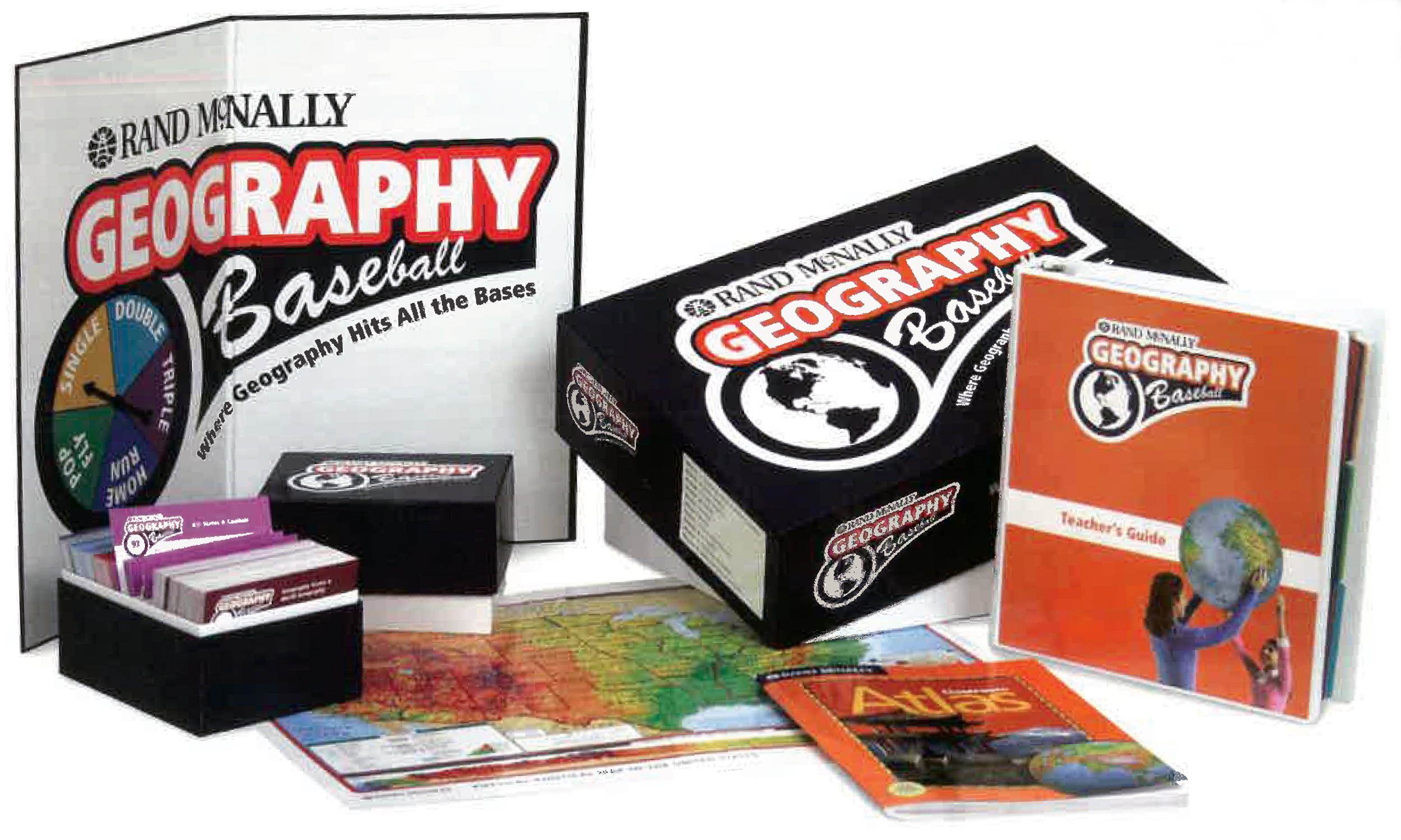
Geography Baseball
Another game we produced with a geographic theme was called Rand McNally Geography Baseball, released around 2008. The game was created mainly for the educational markets and was promoted as a new way to teach geography, social studies, and critical thinking skills all tied to state and national curriculum standards. The set included over 1000 geographically themed question and answer cards, a guide for teachers, and a spinner featuring baseball style categories. The game shipped with our Classroom Atlas, which contains a variety of maps our cartographic team created and is still sold today, as well as a two-sided U.S. and World reference map.

Pictured: The Rand McNally Geography Baseball game created for the education markets.
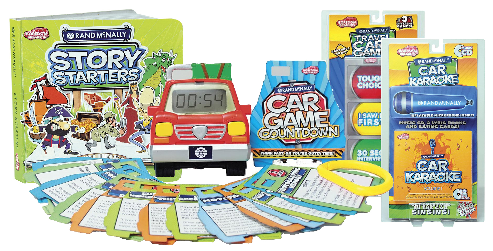
Boredom Breakers
Around 2010, Rand McNally released a set of toys and games focused on car rides and road trips called Boredom Breakers. These products included Car Game Countdown, with laminated game cards featuring classic road trip games and a digital timer, Story Starters which was designed to get families telling stories together, and Travel Card Games created for car rides, so they did not require a flat service to enjoy.

Pictured: Rand McNally Boredom Breakers toys and games made for car rides.
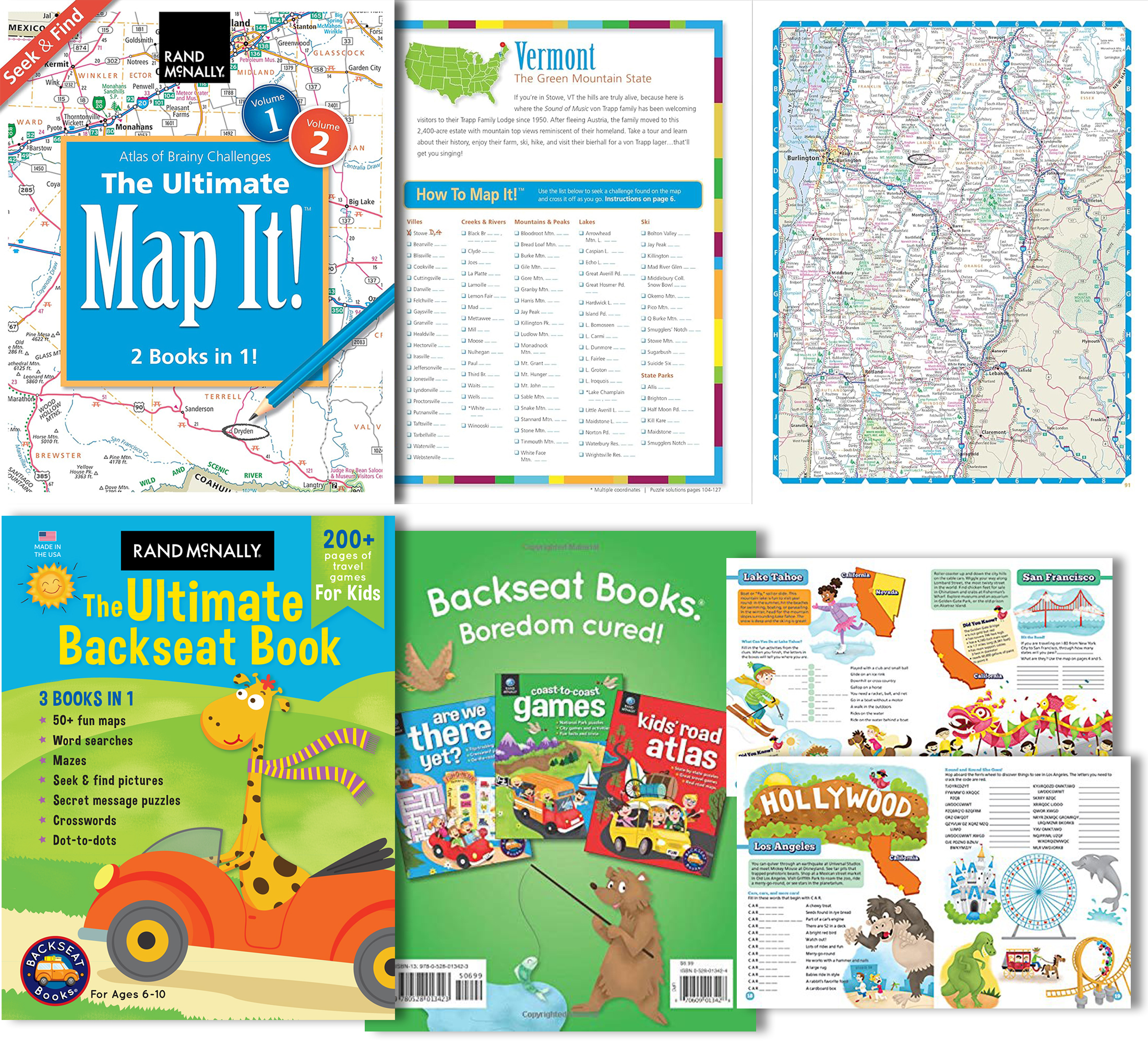
Ultimate Map It Puzzle & Backseat Books
Finally, we released a set of two puzzle books a few years back using real road atlas maps where you search for different names on the map in categories like Towns, Lakes, State Parks, etc. Originally distributed as two volumes, both are now combined together into one product called The Ultimate Map It! Seek & Find Atlas of Brainy Challenges. Each section includes a short introduction with state facts or information, plus a solutions key in the back of the book in case you get stuck finding a place on the map. Additionally, we make an awesome, fun-filled travel book for kids called the The Ultimate Backseat Book – 3 in 1 Kids’ Activity Book. It is a great activity book for the kids on long road trips and includes maps we produce along with a lot of different puzzles and games that feature geographic themes.

Pictured: The Rand McNally Ultimate Map It! Puzzle book combination and the Ultimate Backseat Book Kids’ Activity book.
Thanks again for the question! While our adventures in gaming were limited, there were some interesting collaborations and licensing agreements back in the day, plus some actual games, toys, and puzzle books we produced as we looked to expand into new product categories.
Feel free to submit your map or cartography questions below and check back next Tuesday for another installment of "Ask a Cartographer."
Have a question for our cartographer? Email us at printproducts@randmcnally.com with “Ask a Cartographer” in the subject line and your question could be featured next.


