
Lost in longitude or confused by contour lines? Want to know all the tips and tricks for getting the most out of your atlas? Curious if paper towns still exist? "Ask a Cartographer" is your opportunity to get the facts straight from the source. Tom Vitacco, Rand McNally Publishing’s Director of GIS and Steve Wiertz, Sr. GIS Analyst, are here to answer your burning questions, and geek out over fascinating map lore – one exploration at a time.
This week, we are discussing map collecting and our cartographers' most prized maps over the years.
Question: Do you have a big map collection at home? What’s your most prized map?
Tom’s answer: What an interesting question! I have been a cartographer for almost 40 years now so you might assume I would have a large map collection, but honestly I do not collect maps at all. While many of my colleagues over the years had map collections, and a few would go to collector shows to buy, sell or trade maps, I just never had an interest in collecting maps…probably because I work with maps every day! I always keep a road atlas or a state map with me when I travel, but I do not have a large collection of maps at home outside of some historical maps hanging on the wall in my den and a few maps from my earlier days at Rand McNally.
When I first started at Rand McNally, there was a map library in the building with some cool and interesting maps, plus some old maps which I am sure would be considered collector items. Most of these maps were donated to the Newberry Library in Chicago which has a nice collection of older Rand McNally titles in their archives. Later, when the company was moving to a new location, employees were given the opportunity to take maps, globes and other related items home with them since we were downsizing before the move. At that time, I took a couple of older maps and got the maps framed to hang in our den, but that was it for my “collection”.
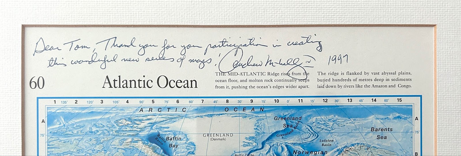
As for the most prized map I own, it must be the framed “ocean map” from when we produced the Reader’s Digest World Atlas back in 1997. This atlas was a large, complicated project and once complete, the entire cartographic team was offered a framed print of a map from the atlas. I chose the ocean maps shown below for a couple of reasons. First, I worked on the ocean maps and placed all the labels on those maps by hand and I also really appreciated the colored ocean floor relief which was manually created by an outside artist at the time.
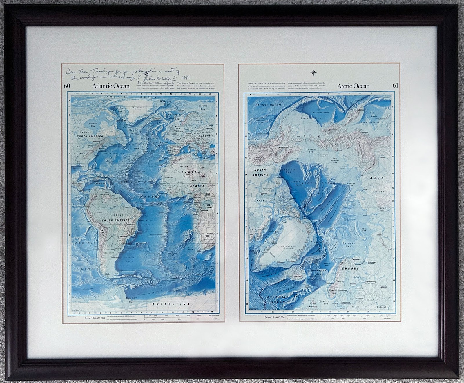
One interesting fact about these maps is they were all signed by Andrew McNally IV (Rand McNally CEO at the time) and placed within a custom wood and glass frame. Unfortunately, the map has faded a bit over the years after being exposed to direct sunlight hanging on a wall in my previous house, but the signed ocean map is one of the few maps that are part of my tiny collection.
Steve’s answer: I do have a collection of all types of individual maps and atlases at home. I ordered my first atlas when I was in grade school. It was a Hammond atlas, and I would trace maps from it all the time when I was younger. One time, my dad told me that I should work for Rand McNally someday. I have many Rand McNally published maps, and maps from other publishers too. I also have maps that I drew as a kid, as well as maps I made while working at Rand McNally during my early years with the company. The maps I made for the company were early film-based prototypes for the Road Atlas and different World Atlases.
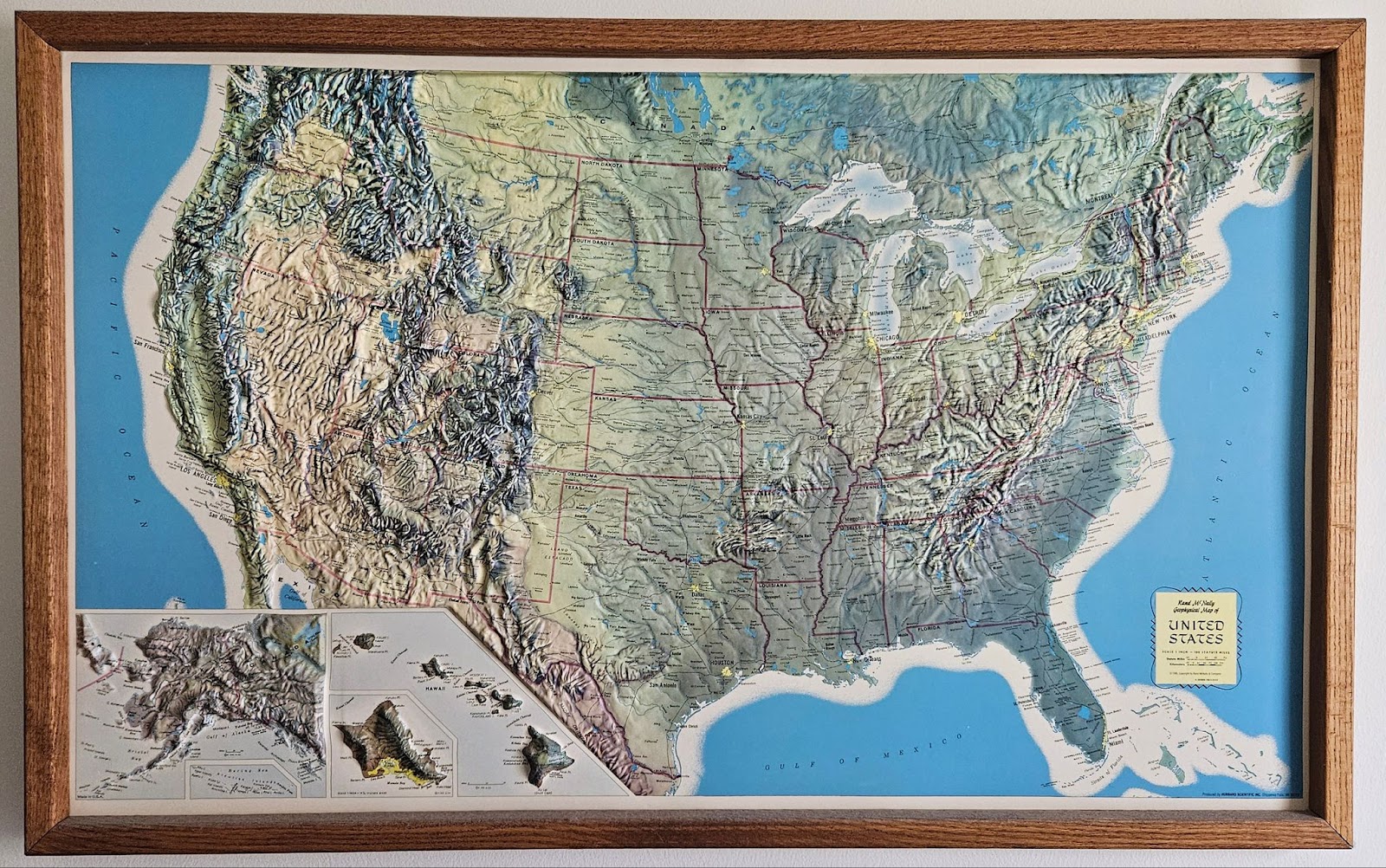
I don’t necessarily have a single favorite map, but one map that stands out is currently hanging above my desk at home. It’s a Rand McNally Geophysical map of the United States produced in 1995. I found this framed map at a Goodwill store about eight years ago. One of my favorite parts of this map is the raised relief which gives it a 3D appearance. I was always more interested in maps focused on physical features rather than political oriented maps. Essentially this map is a very cool looking flattened globe hanging on the wall!
Have a question for our cartographer? Email us at printproducts@randmcnally.com with “Ask a Cartographer” in the subject line and your question could be featured next.