
Lost in longitude or confused by contour lines? Want to know all the tips and tricks for getting the most out of your atlas? Curious if paper towns still exist? "Ask a Cartographer" is your opportunity to get the facts straight from the source. Tom Vitacco, Rand McNally Publishing’s Director of GIS, is here to answer your burning questions, and geek out over fascinating map lore – one exploration at a time.
This week, we are discussing how cartographers decide what will be designated as the scenic route.

Question: How does one decide which roads are scenic and get the green dots?
Tom’s Answer: Great question!
As cartographers, one of our goals is to present useful travel information on a map in a clear and appropriate way and I believe our depiction of scenic routes is an excellent example of our goals in action. At Rand McNally Publishing, most of the products we create are state-level road maps which are used for navigation, travel planning and ultimately helping you go on a fantastic road trip. Scenic routes often pass through beautiful areas of the country, and we display these routes on our maps using small green dots running along the side of the road like you mentioned. We experimented with different specs for this concept, including thick colored lines layered beneath the highways, but ultimately felt the small green dots were less intrusive and conveyed the theme of “scenic” better.
The Scenic Route
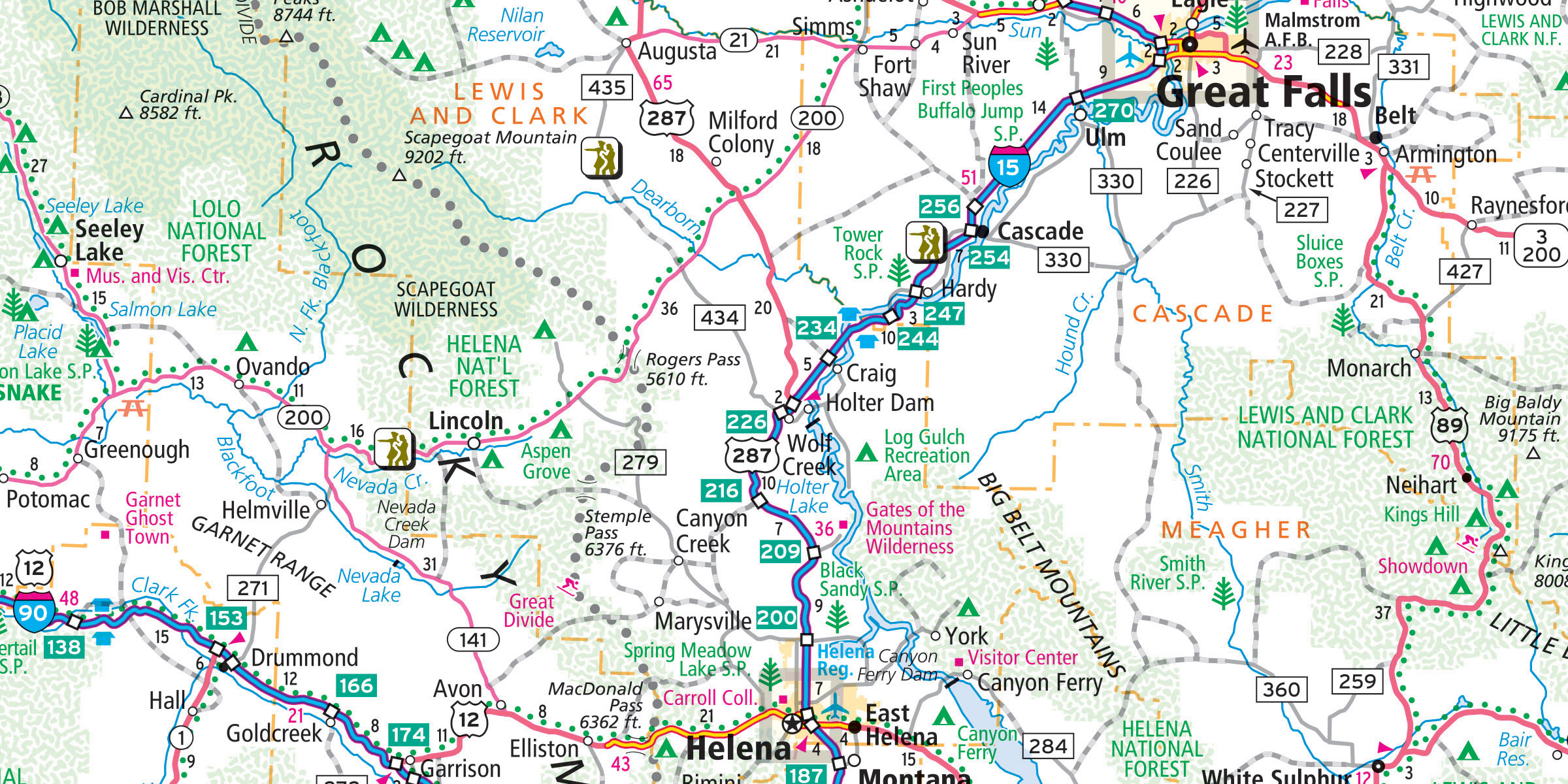
Scenic routes are a great example of how a paper map can offer more in-depth information at a glance than a GPS or a navigation app on your device. If you try zooming out on a GPS or phone to show a similar coverage area in Montana like the map shown below, you probably will not be able to tell which roads are scenic. You can easily spot the scenic routes on the paper map, however, which demonstrates the “big picture” concept we as cartographers often mention when asked how paper maps are still relevant and can offer more utility than GPS.
To answer your specific question, Rand McNally editors have traditionally decided which routes are considered scenic, not the cartographers. Most of the scenic routes highlighted in our atlases or state maps were chosen many years ago. The editors worked with state tourism and transportation departments to help decide if a route should be highlighted as scenic on our maps. Additionally, the editors would perform research on roads to pick scenic routes based on criteria set internally by the team, plus reference the Federal Highway Administration data for National Scenic Byway designations to help in the decision process. The cartographer’s involvement was mainly to implement the scenic route onto our maps based on the recommendations from the editors, which are symbolized with the “green dots” along the side of the road.
"Best of the Road"
For years Rand McNally would send the editors out on road trips to drive the scenic routes in person and these trips became our "Best of the Road" series. The cartographer would add a small red ribbon icon along the route on the map and the editorial section at the front of the atlas would highlight each trip with itineraries, photos, points of interest and places to eat.
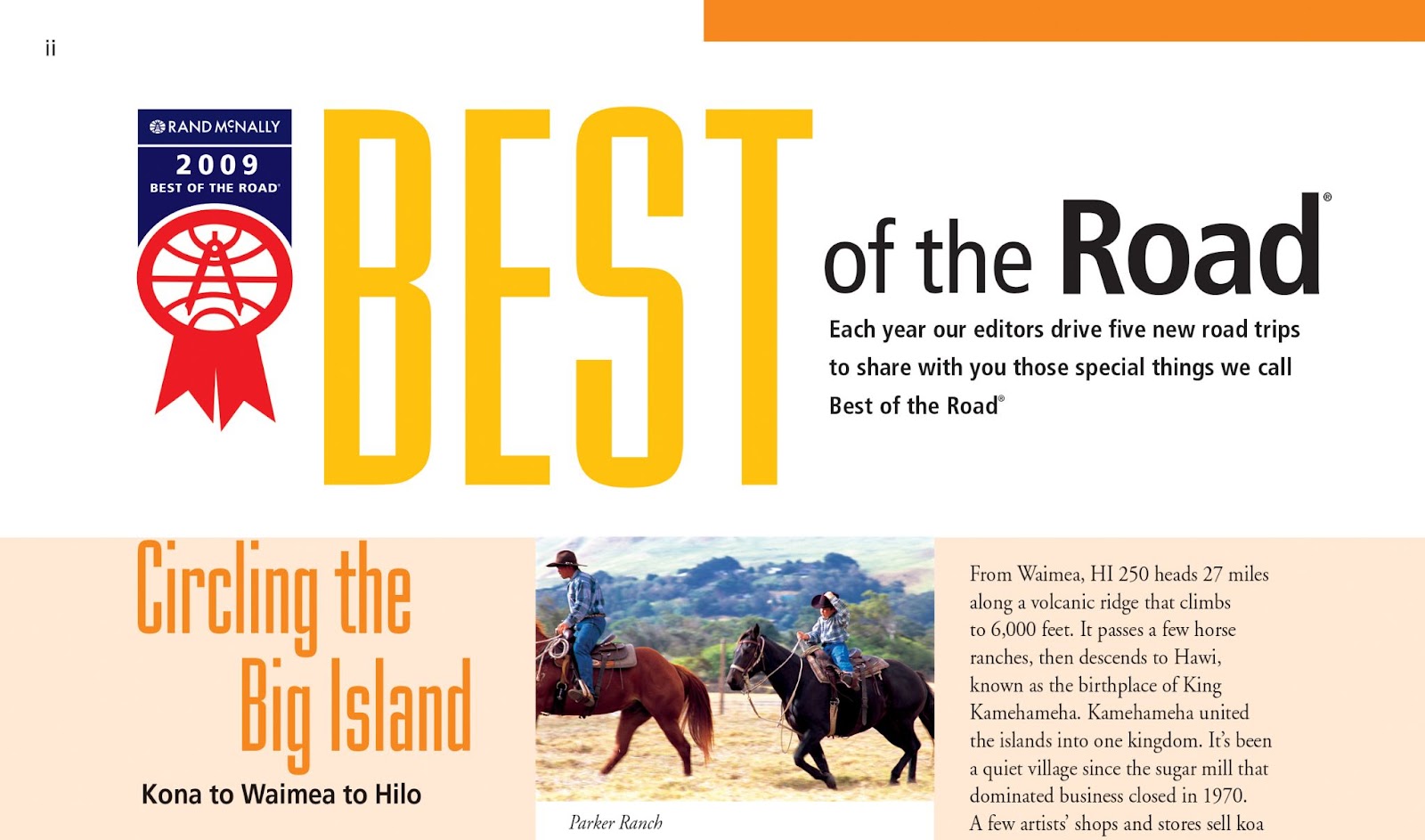
An example of the Best of the Road editorial section from the 2009 Road Atlas.
In 2012, Rand McNally even partnered with The Travel Channel and the newspaper USA Today to create a one-hour show about the "Best of the Road" concept! To this day our editorial and design teams still create and develop interesting road trip-related content shown at the front of the atlas, offering travel advice and tips in a beautifully designed section full of photos, maps and essential travel information.
Specialty Routes
Along with scenic routes, our atlases also feature five “specialty routes' ' including famous routes such as Route 66 and some lesser-known routes such as the Great Lakes Circle Tour. These routes are shown on the map with small icons periodically placed along the road to show our customers the basic path to follow. All five icons are shown in the map legend (see image below). If you haven’t checked out the map legend at the front of the atlas, I highly recommend you review the legend before any road trip since all the map icons and symbols are explained in the legend.

All-American Roads
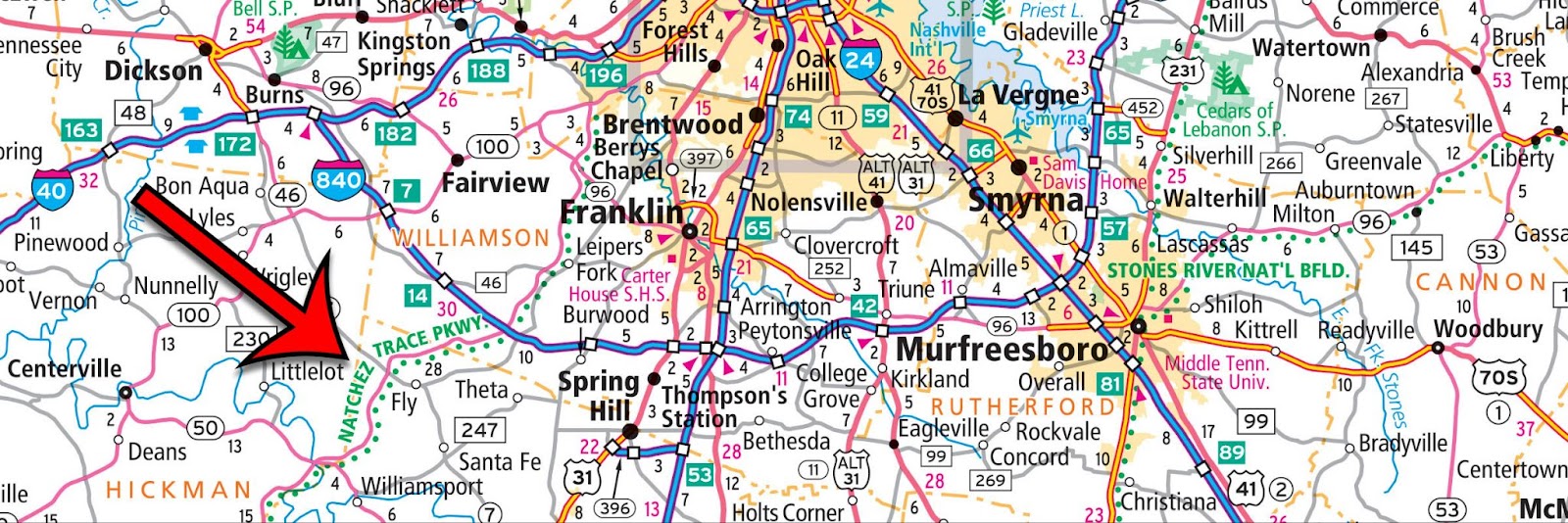
Finally, we will sometimes include All-American Roads, considered the very best of the National Scenic Byways because the road itself is a destination and an actual reason for travel. One example of an All-American Road is the Natchez Trace Parkway, shown below in Tennessee southwest of Nashville. We add a green label to the map for a few of these special roads throughout the country. Plus, roads are not the only map feature to get special treatment from our cartographic team! A few National Scenic Waterways such as the St. Croix River along the border of Minnesota and Wisconsin are also highlighted on our maps.
Thanks again for the question about scenic routes! If anyone wants to follow a scenic route for any of the states or provinces, please check out one of the many different road atlases on our website.
Have a question for our cartographer? Email us at printproducts@randmcnally.com with “Ask a Cartographer” in the subject line and your question could be featured next!