

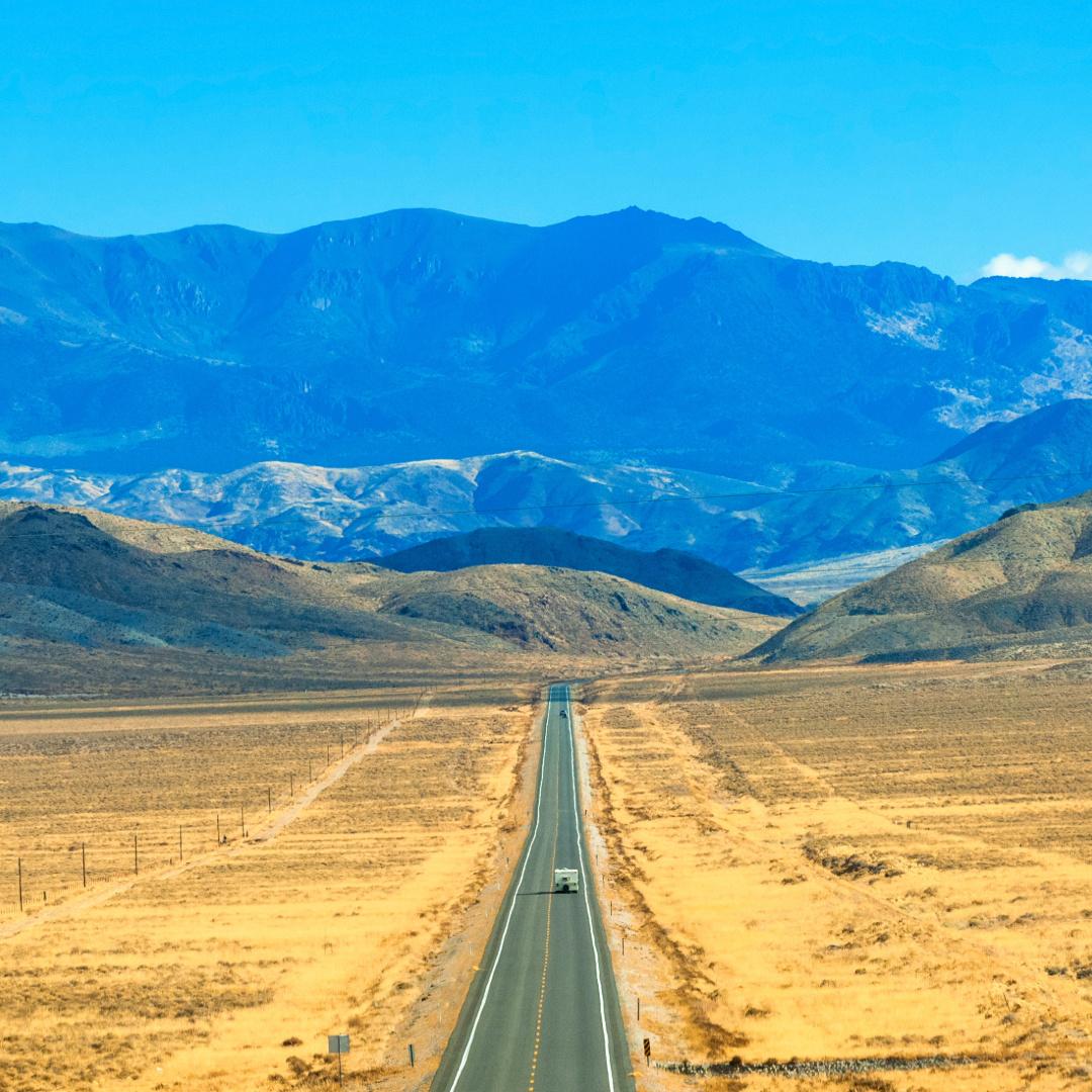
Few drives capture the spirit of the open road quite like the Loneliest Road in America. Stretching across the heart of Nevada, this legendary route invites travelers to trade traffic and crowded attractions for wide-open landscapes, historic communities and a sense of freedom that feels increasingly rare.
Along the way, you’ll cross broad desert valleys, climb over mountain passes and discover towns that helped shape Nevada’s mining and transportation history. The route’s basin-and-range geography creates dramatic vistas that are hard to find anywhere else in the country. While U.S. Route 50 continues across the country, the Nevada segment has earned a reputation all its own: travelers come here for the journey itself.
In this guide, we’ll explore what makes the Loneliest Road in America so unique, where it runs, the best places to stop and practical planning tips to help you make the most of this memorable Nevada road trip.
Key Takeaways
- The Loneliest Road in America refers to the Nevada portion of U.S. Route 50, which crosses the state’s remote interior
- The route connects historic towns, mountain ranges, desert basins and Great Basin National Park
- Most travelers benefit from spending two days exploring Highway 50 rather than driving straight through
- The Highway 50 Survival Guide adds a fun challenge with stamps and a completion certificate
- Ely, Eureka, Austin and Fallon offer unique stops that showcase Nevada’s history and culture
- Planning ahead for fuel, weather and navigation helps create a smoother road-trip experience
What Is the Loneliest Road in America?
The Loneliest Road in America refers to the remote Nevada portion of U.S. Route 50, a roughly 400-mile stretch that crosses the state from Lake Tahoe to the Utah border. Known for its long distances between towns and expansive desert scenery, it offers one of the most distinctive road-trip experiences in the American West.
Why Is Highway 50 Called the Loneliest Road in America?
The nickname originated in a 1986 Life magazine article that described Nevada’s U.S. Route 50 as the “Loneliest Road in America.” Rather than fight the label, Nevada’s tourism commission embraced it that same year, creating the Highway 50 Survival Guide and turning the route into one of the state’s most recognizable road trips.
Today, the route attracts travelers who want to experience a quieter, less-traveled side of the American West.
Where Does Highway 50 Start and End?
The Nevada portion of U.S. Route 50 enters the state at Lake Tahoe’s south shore, then passes through Carson City and Dayton before continuing east to the Utah border near Baker. Travelers typically experience the route west to east, though it can be enjoyed in either direction.
What Towns Are on Highway 50 in Nevada?
Several communities help shape the experience along Highway 50 in Nevada.
Carson City serves as a common starting point and offers museums, restaurants and historic attractions. Dayton provides a glimpse into Nevada’s early settlement history. Fallon acts as a gateway to the more remote portions of the route.
Farther east, Austin welcomes travelers with mountain views and historic buildings. Eureka preserves much of its mining-era character, while Ely offers museums, dining and lodging options. Nearby Baker serves as the gateway to Great Basin National Park.
Together, these communities provide opportunities to rest, refuel and experience local culture while driving America’s Loneliest Road. Most travelers will find fuel, lodging and dining options in Fallon, Austin, Eureka and Ely, though services become less frequent between towns.
Why Drive America’s Loneliest Road?
America’s Loneliest Road rewards travelers who slow down, embrace the rhythm of the road and appreciate the spaces between destinations. From desert valleys and mountain passes to historic communities and roadside discoveries, every segment offers something different.
Basin-and-Range Landscapes
Nevada’s basin-and-range geography gives the drive its distinctive character. Rather than crossing a single flat desert, you’ll repeatedly descend into broad valleys before climbing over mountain passes.
The route crosses more than a dozen ranges, creating an ever-changing backdrop of sagebrush plains, rocky peaks and expansive horizons. On clear days, you can often see for miles in every direction.
Historic Communities and Roadside Discoveries
Many towns along the route trace their roots to Nevada’s mining boom. Historic hotels, courthouses, churches and storefronts still line the streets of communities like Austin and Eureka.
Between towns, travelers may encounter Pony Express sites, historic markers and reminders of the transportation routes that helped connect the American West.
The Highway 50 Survival Guide
One of the most memorable traditions associated with the Loneliest Road is the Highway 50 Survival Guide.
Travelers can collect stamps from participating communities along the route and mail in the completed guide to receive an official Highway 50 survivor certificate.
The program encourages travelers to stop, explore and connect with the communities that make the route unique.
Best Stops Along U.S. Route 50 in Nevada
The communities and attractions along Nevada Route 50 help transform the drive from a simple road trip into a memorable journey.
Carson City
As Nevada’s capital city, Carson City serves as a common western starting point for travelers driving the Loneliest Road in America. Visitors can explore museums, historic sites and downtown attractions before heading east across the state.
Fallon and Sand Mountain Recreation Area
Fallon serves as a gateway to the route’s more remote stretches and provides fuel, lodging and dining options. Nearby Sand Mountain Recreation Area features a massive sand dune that rises above the surrounding desert landscape.
Austin
Austin sits high in the Toiyabe Range and offers mountain scenery, historic buildings and easy access to attractions such as Stokes Castle and, a short drive away, Spencer Hot Springs.
Eureka
Eureka is one of Nevada’s best-preserved mining communities. Historic architecture, local businesses and a welcoming atmosphere make it a favorite stop for travelers crossing the state.
Ely
Ely serves as a popular overnight stop along the Loneliest Road in America. Attractions include the Nevada Northern Railway Museum, historic downtown buildings and easy access to outdoor recreation in eastern Nevada.
Great Basin National Park
Located near the small town of Baker, Great Basin National Park is one of the route’s premier destinations. Highlights include Wheeler Peak, Lehman Caves and some of the darkest night skies in the country. As the drive’s eastern anchor, the park also makes Highway 50 a natural fit for travelers planning national park road trips.
How Long Does It Take to Drive the Loneliest Road in America?
Driving the Loneliest Road in America straight through takes about seven to eight hours, depending on stops and road conditions. However, most travelers find that rushing through the route misses much of what makes it special.
A two- or three-day itinerary allows enough time to explore historic towns, enjoy local attractions and experience the changing landscapes without feeling hurried.
When Is the Best Time of Year to Drive the Loneliest Highway in America?
The best time to drive the Loneliest Highway in America is typically spring or fall, when temperatures remain comfortable and road conditions are generally favorable.
- Spring brings blooming wildflowers, green valleys and mild weather across much of the route
- Fall offers crisp air, colorful mountain landscapes and fewer travelers
- Summer remains popular but can bring hot temperatures to lower-elevation valleys
- Winter occasionally creates challenging conditions in higher mountain passes
No matter the season, checking weather forecasts before departure can help ensure a smoother and more enjoyable drive.
Travel Tips for the Loneliest Road in Nevada
While the route is well maintained and easy to navigate, the Loneliest Road’s remoteness makes planning especially important.
- Fuel up when opportunities arise, particularly before leaving larger communities
- Download maps before departing areas with reliable service
- Monitor weather conditions before crossing mountain passes
- Carry extra water and snacks, especially during warmer months
- Allow time for unexpected stops, historic sites and scenic detours
- Consider bringing an easy-to-fold Nevada map as a quick reference for route planning
- Use an easy-to-read Nevada map to see major attractions and distances between towns
- Pack a Nevada atlas for extra detail if you plan to explore beyond U.S. Route 50
For travelers who enjoy seeing the bigger picture while planning their route, traditional maps and atlases remain valuable road-trip tools.
Suggested Itinerary for the Route 50 Loneliest Road in America
Whether you have a weekend or a few extra days, building an itinerary helps you experience more than just the miles between destinations.
2-Day Itinerary
- Day 1: Begin near Carson City and travel east through Fallon, Austin and Eureka. Explore historic downtown districts, stop at scenic overlooks and spend the night in Ely.
- Day 2: Visit Great Basin National Park, tour Lehman Caves and enjoy views of Wheeler Peak before continuing east toward the Utah border.
This itinerary balances driving time with meaningful stops and provides an excellent introduction to Route 50 Loneliest Road in America experiences. Travelers with an extra day can spend additional time exploring Great Basin National Park, Eureka or Austin before continuing their journey.
Rand McNally Publishing Helps You Make the Most of Every Mile
There’s a reason the loneliest road in the U.S. continues to capture travelers’ imaginations. The route combines expansive landscapes, fascinating history, welcoming communities and the kind of freedom that only a great road trip can provide.
Before you set out on your adventure, explore Rand McNally Publishing’s collection of road atlases and paper maps to help plan your route, discover new stops and travel with confidence.
FAQ: Driving the Loneliest Road in America
Is the drive on the Loneliest Road in Nevada worth it?
Yes, the drive on the Loneliest Road, Nevada is worth it for travelers who enjoy open landscapes, history and classic road-trip experiences. The combination of mountain ranges, desert valleys and welcoming communities creates a journey unlike any other.
Are there gas stations on the Loneliest Road in America?
Yes, gas stations are available along the Loneliest Road in America, particularly in communities such as Fallon, Austin, Eureka and Ely. Travelers should still plan fuel stops carefully because distances between towns can be substantial.
What is the friendliest town on the Loneliest Highway in America?
Eureka is widely known as the friendliest town on the Loneliest Highway in America. The town promotes itself as the “Friendliest Town on the Loneliest Road,” and its preserved historic district and welcoming atmosphere back up the claim. Ely, Austin and Baker also earn praise for their hospitality and local character.
Is there cell service on Highway 50 in Nevada?
Cell service is available in many communities along Highway 50 Nevada, but coverage can become limited between towns. Downloading maps and planning ahead can help reduce navigation challenges in remote areas.
Additional Rand McNally Travel Blogs to Read:
- The Ultimate Montana and Wyoming Road Trip Guide
- The Ultimate Utah National Parks Road Trip
- Most Scenic Places in the U.S.
- Badlands Loop Road Travel Guide
- Grand Tetons to Yellowstone
- Island in the Sky Canyonlands
- Southwest Road Trip
- Digital Detox Vacation